2021:442 - GORTNAGROSS, Mallow, Cork
County: Cork
Site name: GORTNAGROSS, Mallow
Sites and Monuments Record No.: N/A
Licence number: 21E0452
Author: Bruce Sutton of Rubicon Heritage Services Ltd
Author/Organisation Address: Unit 2, Europa Business Park, Midleton, Co. Cork, P25 TV25
Site type: Field boundary, Kiln - corn-drying, Pit and Kiln - lime
Period/Dating: Multi-period
ITM: E 551533m, N 600220m
Latitude, Longitude (decimal degrees): 52.151694, -8.708241
Previous archaeological test trenching in two fields (Lynch, Bulletin 2016:230) identified a number of scattered deposits across the proposed development site. The most notable of these was a burnt mound measuring 19m x 12.8m located in the south-east corner of the northern field.
A number of additional features of archaeological potential were identified occurring in isolation and with no diagnostic material. These included two curvilinear features also recorded in Field 1 and a possible post-hole located in the southern field. The fragmented remains of a lime kiln shown on the First Edition 6-inch Ordnance Survey mapping were also identified in the field boundary on the northern side of the of the site access track.
The resolved and excavated features at Gortnagross comprised:
- Gortnagross 1 – Four pits (019, 050, 052 and 053), and a boundary ditch (025)
- Gortnagross 2 – Non-Archaeological (root burning and field clearance deposits)
- Gortnagross 3 – Burnt Mound (preserved in-situ)
- Gortnagross 4
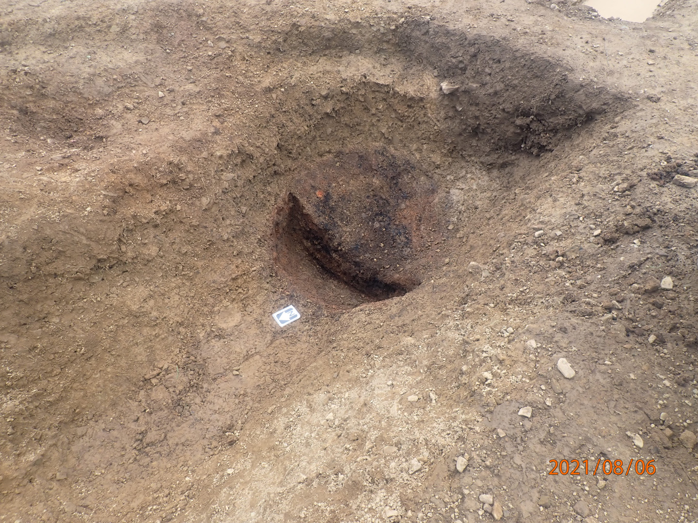
- (Area A) – Boundary ditch (027); (041) and a contemporaneous cereal drying kiln (034)
- (Area B) – Pit (032)
- (Area C) – Pit (042)
- (Area D) – Pit (039)
- (Area E) – Boundary ditch (044)
- Limekiln – Fragmentary remains of the northern wall; preserved in the modern field boundary.
The archaeological activity recorded at represents three main phases of activity, identified at three separate discreet locations at Gortnagross. A Middle Bronze Age date of 1412–1270 cal BC (3075±24 BP; SUERC-122423) was obtained from pit 042 in Area 4C. Pit 019 in Area 1 provided an Iron Age radiocarbon date of 166 cal BC-cal AD 2 (2077±24 BP; SUERC-1222424). Radiocarbon dating of the basal fill of pit 034 in Area 4A provided an Early Medieval date of cal AD 674-874 (1253±24 BP; SUERC-122422).
While there is no evidence for continuous habitation at any of the areas, nor any direct evidence to link activity in the different areas to each other, the results of the archaeological works at Gortnagross indicate land use in this area since at least the Bronze Age.
The programme of archaeological excavation was undertaken by Bruce Sutton in accordance with licence 21E0452 as issued by the Department of Housing, Local Government and Heritage in consultation with the National Museum of Ireland.
Specialist analysis
A total of fifteen soil samples were retrieved during the excavation of archaeological features in Gortnagross, six of which were selected for charred plant remains and anthracological analysis.
This included a charred cereal grain assemblage from a pit in Area 4A, indicating an arable economy based largely on oats.
Charcoal analysis from features in Areas 1, 4A and 4D show a variety of woodfuels used with a range of timber sizes suggesting a mixed fuel procurement strategy of felling trees and opportunistic gathering during different phases of activity.
A single artefact was recovered during the excavation; a sherd of white glazed, cream fabric post-medieval pottery (21E0452:028:001) was recovered from the lower fill (028) of a field boundary (027) in Area 4A.
A flint debitage fragment (21E0452:047:001) was recovered during processing of a sample from context 047, a non-archaeological tree-throw in Area 2. While this is not a diagnostic artefact from a secure archaeological context, it can be considered an indicator of prehistoric activity in this area.
Datin
Radiocarbon results demonstrate that activity dated to the following periods, in chronological order:
- A Middle Bronze Age date of 1412–1270 cal BC (3075±24 BP; SUERC-122423) was obtained from pit 042 in Area 4C
- Pit 019 in Area 1 provided an Iron Age radiocarbon date of 166 cal BC-cal AD 2 (2077±24 BP; SUERC-1222424)
- Radiocarbon dating of the basal fill of pit 034 in Area 4A provided an Early Medieval date of cal AD 674-874 (1253±24 BP; SUERC-122422)
Reference