2021:218 - KINSALE: 'The Garden of Paradise', Townplots, Cork
County: Cork
Site name: KINSALE: 'The Garden of Paradise', Townplots
Sites and Monuments Record No.: CO112-034001-
Licence number: 21E0496
Author: David Murphy
Author/Organisation Address: 3a Westpoint Trade Centre, Link Road, Ballincollig, Cork
Site type: Historic town
Period/Dating: Multi-period
ITM: E 563940m, N 550200m
Latitude, Longitude (decimal degrees): 51.703027, -8.521710
Archaeological testing of the site of a proposed private dwelling development at a property known as ‘The Garden of Paradise’ in Townplots, Kinsale, County Cork was undertaken over the course of a three-day period between 24 and 26 August 2021. The testing programme was undertaken at the pre-planning stage in order to inform an archaeological impact assessment of the site which will be submitted to Cork County Council as part of the overall planning application.
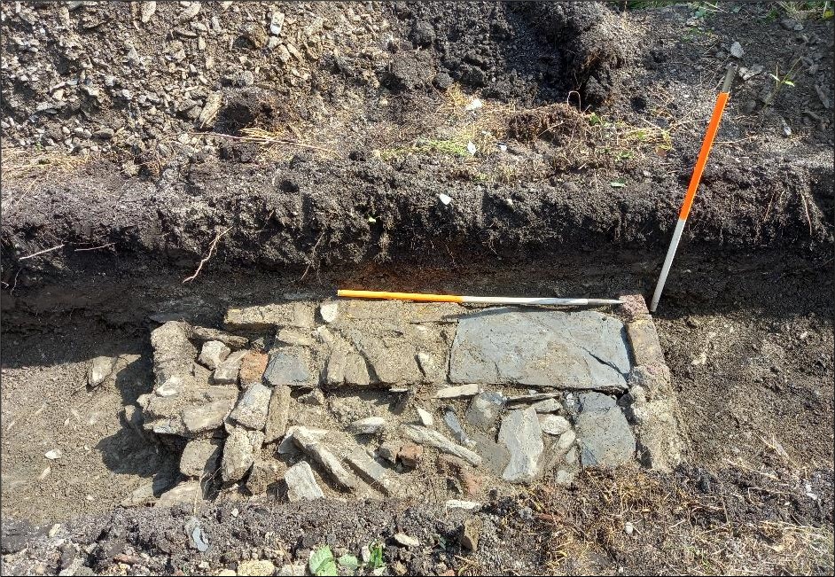
Three linear test trenches, comprising a total length of 50m, were excavated across the areas of the site which will be impacted should the proposed development proceed. Furthermore, a 2m² investigatory box cutting was excavated in the south-western corner of the site, at the angle of the southern boundary wall and a rectangular stone-built corner feature in order to investigate their relationship and to determine whether any extant medieval wall or structural elements survived at this location.
No evidence of any in-situ medieval archaeological remains was revealed in the excavated linear trenches or in the box cutting. The linear trenches revealed evidence of post-medieval garden-type activity in the form of low wall foundations, kerbing features and pathways, which were likely associated with a formal garden layout. Such features are depicted within the site on the detailed 1882 five foot to one mile scale Ordnance Survey map of Kinsale. A subsoil composed of sandy silt and fragmented shale was revealed within the linear trenches. The fragmented nature of the shale suggests that a degree of ground truncation may have been undertaken within the site at some point in the past. If such works were undertaken subsequent to the later medieval period, any archaeological remains from this period, or before, would likely have been truncated or removed.
Excavation of the investigatory box cutting in the south-western corner of the site revealed that both the southern boundary wall and the stone-built corner feature had been constructed upon the same infill material which had been deposited in the post-medieval period. The infill material contained frequent inclusions of post-medieval ceramic wares, including sherds of North Devon sgraffito ware and North Devon gravel tempered ware, indicating a construction date from the 17th century onwards for the southern boundary wall and corner feature. Consequently, it has been definitively demonstrated that the extant corner feature is unrelated to the medieval defences of the town, while the southern boundary wall post-dates the medieval period and is not related to the medieval town defences (CO112-034002-). Furthermore, no evidence of an internal fosse was revealed to the south of the southern boundary wall during the testing programme.