2021:087 - CORK: 48, 50 & 52 Barrack Street, Cork
County: Cork
Site name: CORK: 48, 50 & 52 Barrack Street
Sites and Monuments Record No.: CO074-034001-
Licence number: 21E0361
Author: David Murphy
Author/Organisation Address: 3a Westpoint Trade Centre, Link Road, Ballincollig, Cork
Site type: Historic town
Period/Dating: Multi-period
ITM: E 567066m, N 571314m
Latitude, Longitude (decimal degrees): 53.298121, -8.493912
Archaeological testing of the site of an approved Part 8 social housing development at Nos 48, 50 and 52 Barrack Street, Cork was undertaken on 28 and 29 June 2021 in order to comply with a condition to the grant of Part 8 approval. The testing was undertaken in the backyard area of No. 52 Barrack Street; this was the only area suitable for testing at this early phase of the development. A combined total of 56.5m of archaeological test trench was excavated across this area.
Significant modern disturbance in the form of dumped modern refuse and debris within an introduced soil matrix, as well as modern service routes, was encountered across T.2 and T.3. The depth of infill material ranged between 1m and 1.3m at the north-western end of these trenches to between 0.4m and 0.7m at their south-eastern ends. This reflects the natural rise in topography towards the south-east end of the site. The disturbed overburden overlay an orangish-brown sandy, clayey silt subsoil which contained occasional large natural limestones. There was no evidence of any archaeological activity revealed in either T.2 or T.3.
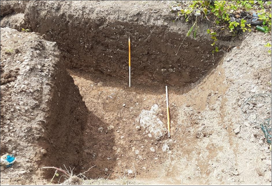
Within T.1, which was excavated across the south-western margin of the site, a significant depth of garden soil (between 1m and 1.2m in depth) was encountered. The garden soil, which underlay a thin layer of modern gravel, comprised a relatively sterile, mid-brown clayey silt which contained infrequent late 19th/early 20th-century ceramic sherds in its upper portions and occasional animal bone fragments throughout. Unlike the subsurface conditions noted in T.2 and T.3, there was no modern detritus contained within the garden soil in this area.
Probable medieval archaeological activity in the form of a linear cut feature and deposits of stone and soil which contained charcoal flecks, animal bone and a number of corroded metal objects was encountered at a depth of 1.5m below modern surface level at the north-western end of T.1. Most importantly, a portion of a probable strap handle from a green glazed medieval ceramic vessel was recovered from a mixed stone and soil deposit in this area. The probable medieval archaeological activity appeared to extend beyond the excavated extent of the trench to the north-west, north and east, but did not extend beyond the central portion of the excavated trench.
A further phase of archaeological testing has been recommended to reveal the exact nature and extent of the features uncovered during this testing programme.