2021:682 - KILVOYDAN, Corrofin, Clare
County: Clare
Site name: KILVOYDAN, Corrofin
Sites and Monuments Record No.: CL017-117
Licence number: 21E0500
Author: Kate Taylor, TVAS (Ireland) Ltd.
Author/Organisation Address: Ahish, Ballinruan, Crusheen, Co. Clare
Site type: Ringfort - rath, Enclosure and Pit
Period/Dating: Undetermined
ITM: E 528870m, N 689000m
Latitude, Longitude (decimal degrees): 52.947074, -9.058385
Archaeological test trenching was carried out on the site of a proposed cottage redevelopment that is close to the location of a levelled earthwork (CL017-117), likely to be a ringfort. The site is within the grounds of the former Corrofin Workhouse, most of which has been demolished.
Four test trenches were excavated, each 1.6m wide and with a total length of approximately 81.9m, giving an area of investigation of 133.7m2 . This gave a 5.1% coverage of the proposal site.
These trenches revealed probable enclosure ditches that presumably represent the sub-surface remains of the ringfort, in addition to a possible foundation cut for a workhouse wall, stone drains and 19th-century and modern dump material.
Trench 1, situated towards the southern end of the development area was positioned to target the southern extent of the projected alignment of ringfort CL017-117. A probable ditch was recorded, aligned from east-north-east to west-south-west and presumably representing the infilled ringfort. The ditch was visible for a length of 1.6m, was 1.63m wide and at least 0.47m deep. An investigative slot revealed a rounded break of slope at the top and steep concave sides, narrowing as they go down. The base was not observed. The fill was a compact mid-greyish brown clayey silt with abundant small sub-rounded limestone pieces.
The probable enclosure ditch was truncated by large cut features filled with laminated layers of 19th-century material (broken brick, limestone and mortar), possibly associated with the demolition of Corrofin workhouse. This rubble material extended across the trench, both to the north and south of the enclosure ditch. A large pit measuring up to 0.62m deep and containing modern refuse (metal, soft and hard plastics and fabric etc.) was noted at the southern end of the trench.
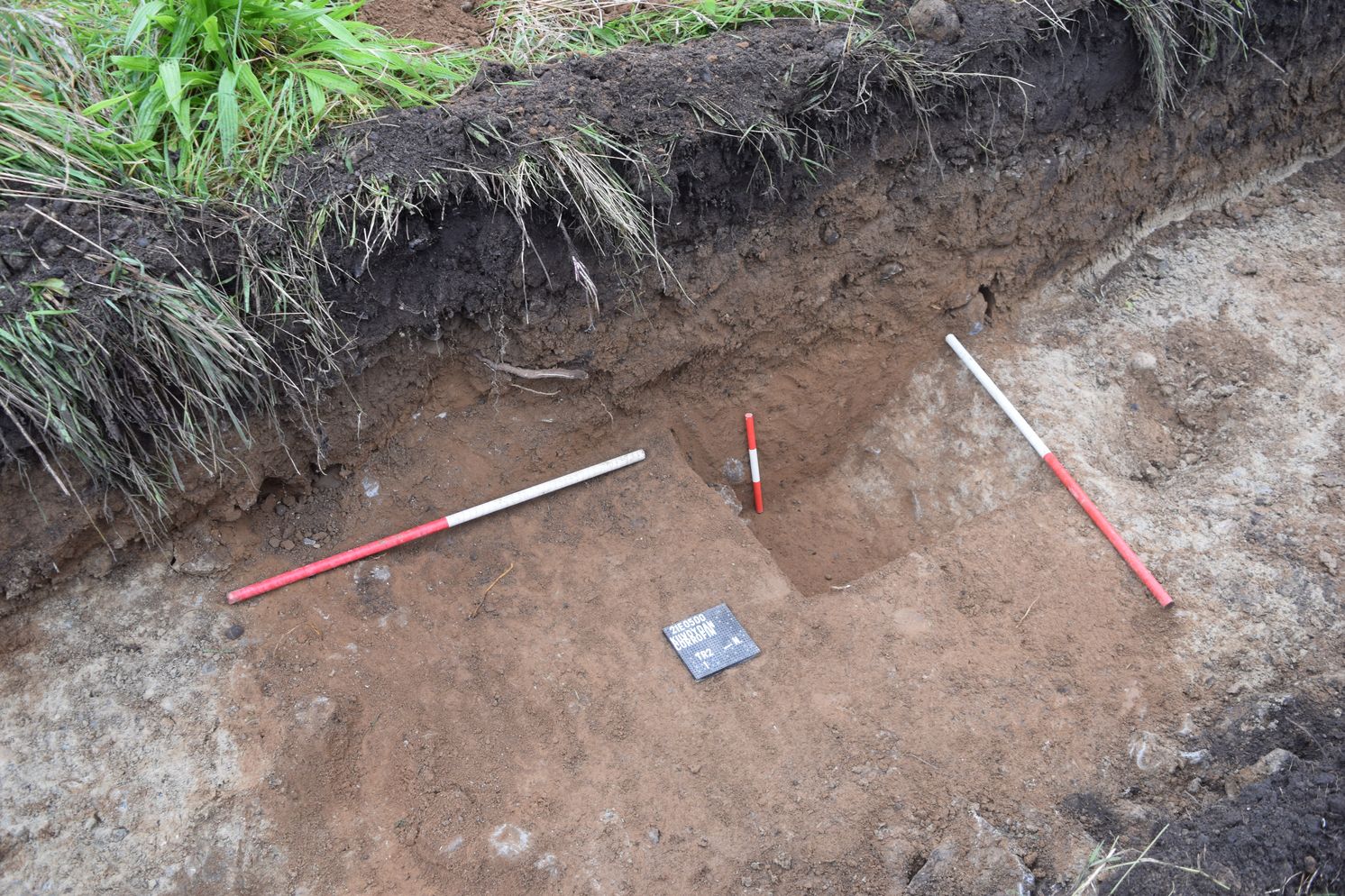
Trench 2 was positioned along the projected northern alignment of ringfort CL017-117 and the probable remains of the ditch were again noted. This probable ditch was aligned from east to west, was 1.9m wide and at least 0.5m deep. An investigative slot revealed a sharp break of slope at the top and steep concave sides. The base was not seen. The fill was a smooth and moderately compact mid-brownish orange clayey silt with rare small limestone pieces.
A second possible ditch was noted at the immediate southern end of the trench, which would be in the interior of the probable ringfort. Aligned from west-north-west to east-south-east, this feature was not as well defined as the enclosure ditch. Visible for a width of between 0.1m and 2.4m, much of this ditch lay beyond the extent of the trench. The fill was compact mid-greyish brown clayey silt.
Trench 3 was located to the north-east of Trench 2, positioned across the location of the proposed extension to the existing cottage and outside the projected circuit of the ringfort. This area of the proposed development had been subject to disturbance prior to test trenching, with topsoil previously removed and building refuse noted throughout. A possible wall foundation cut was recorded. Aligned from north to south, this foundation cut traversed the trench and was up to 2m wide. Filled with a moderately compact brown clayey silt, with abundant broken limestone pieces, this may be associated with one of the buildings of the Poor Union Workhouse noted on historic maps.
Trench 4 was at the north-eastern limits of the extrapolated ringfort circuit and was positioned to investigate the location of the proposed soakaway in the development plan. Modern disturbance was encountered along most of the trench and no sub-surface remains of the ringfort were observed.
No artefacts were recovered during test trenching.
It was recommended that an exclusion zone around the remains be established prior to the development proceeding and all groundworks associated with the proposed development be subject to archaeological monitoring.