2021:339 - BALLAGHALINE, Clare
County: Clare
Site name: BALLAGHALINE
Sites and Monuments Record No.: CL008A-010
Licence number: 15E0145
Author: Michael Lynch
Author/Organisation Address: Leana, Killinaboy, Co. Clare
Site type: Industrial site
Period/Dating: Prehistoric (12700 BC-AD 400)
ITM: E 506342m, N 696532m
Latitude, Longitude (decimal degrees): 53.011290, -9.395677
The monitoring of the clay layer beneath the storm beach at the mouth of the Aille River in Ballaghaline near Doolin, which has been ongoing since 2014, continued in 2021. This recording of areas of erosion where concentrations of shale flakes, axe rough-outs and hammer-stones were identified led to the excavation from 2015 to 2019 of Trenches 1 to 5 (see Excavations.ie 2015:143; 2017:206; 2018:324;2019:317). The excavations have shown that the knapping of shale axe roughouts as well as other tools was carried out across a large area of what is now a storm beach.
This material is similar to that recorded by M. Knowles at the end of the 19th century.
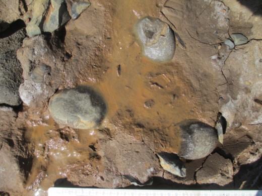
During April 2021 a section of the clay layer was exposed by storms and high seas at the eastern end of the monitoring area. This new area was to the north-east of the previous excavated areas which demonstrates that the erosion of the clay is an ongoing process. As before, the occurrence of archaeological material within the clay led to the excavation of two trenches: TR 6W and TR 6E.
Shale flakes, shale axe roughouts and hammerstones were recovered with many concentrated deposits of flakes. A notable occurrence in these two trenches was the higher than usual deposition of unworked shale axe blanks along with knapped flakes. Whilst most of the shale flakes are from the preparation of axe roughouts, some flakes represented the production of alternative tools.
Samples associated with some of the finds and suitable for radiocarbon dating were recovered. When dated, these should add to the Mesolithic chronology already being established on the site.
The licenced monitoring and collection of surface finds from the survey area continued during 2021.
This confirmed that the erosion of the clay layer beneath the storm beach is continuous and that archaeological material is still being uncovered by the sea. It is proposed to continue with monitoring and the collection of surface finds during 2022 with appropriate excavation when
suitable conditions arise.
Acknowledgements:
Thanks are due to the landowner, Mr. Cyril Nagle, for his permission to access and excavate the site and to the Burrenbeo Trust Conservation Volunteers for their essential contribution.
Thanks are also due to the NMS and NMI for the extensions of the licence for the excavation, monitoring and collection of surface finds on the site.
References
Knowles, M 1901, Kitchen Middens, Co. Clare. Journal of the Limerick Field Club 2, 35-42.
Lynch, M. 2017. The Later Mesolithic on the North-West Coast of Clare. Archaeology Ireland Vol. 31. No.4.