2021:492 - ISLANDMAGEE GAS STORAGE PROJECT, Antrim
County: Antrim
Site name: ISLANDMAGEE GAS STORAGE PROJECT
Sites and Monuments Record No.: N/A
Licence number: AE/21/108
Author: Connor Foster, John Cronin & Associates
Author/Organisation Address: Burnside, St. Oran's Road, Buncrana, Co. Donegal
Site type: No archaeology found
Period/Dating: N/A
ITM: E 342947m, N 401659m
Latitude, Longitude (decimal degrees): 54.822650, -5.713610
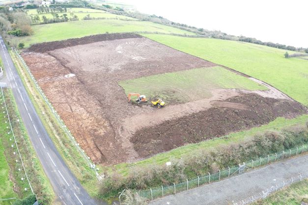
A programme of archaeological monitoring of topsoil stripping was carried out within the boundaries of the proposed gas storage facility at Ballylumford Road, Islandmagee, County Antrim over the course of two weeks between 8 and 19 November, 2021.
The topsoil consisted of light to dark brown silty clay measuring between 0.3m and 0.6m in depth. The underlaying natural subsoil was only visible at the north-east end of the field running parallel with the Ballylumford Road. The underlying natural consisted of a mottled light yellow to dark orange silty clay with frequent sub-angular stones.
The rest of the site was made up of redeposited construction rubble measuring between 0.4m and over 2m in depth. The site was previously used as a hardstand and dumping ground during development works associated with the nearby gas plant (a fact that wasn’t known when the excavation licence was applied for). Due to the volume and depth of construction fill, there was a very low potential of locating surviving archaeology.
Nothing of archaeological significance was identified during this work and no artefacts were found during a scan of the topsoil from the excavated area.