2020:193 - RAVENSWELL, Bray Commons (Co. Wicklow), Cork Great (Co. Dublin), Wicklow
County: Wicklow
Site name: RAVENSWELL, Bray Commons (Co. Wicklow), Cork Great (Co. Dublin)
Sites and Monuments Record No.: WI005-005--- / DU026-124----
Licence number: 20E0482
Author: Padraig Dunne, John Cronin & Associates
Author/Organisation Address: 3A Westpoint Trade Centre, Ballincollig, Co. Cork
Site type: Linear earthwork
Period/Dating: Post Medieval (AD 1600-AD 1750)
ITM: E 726504m, N 719501m
Latitude, Longitude (decimal degrees): 53.210858, -6.106064
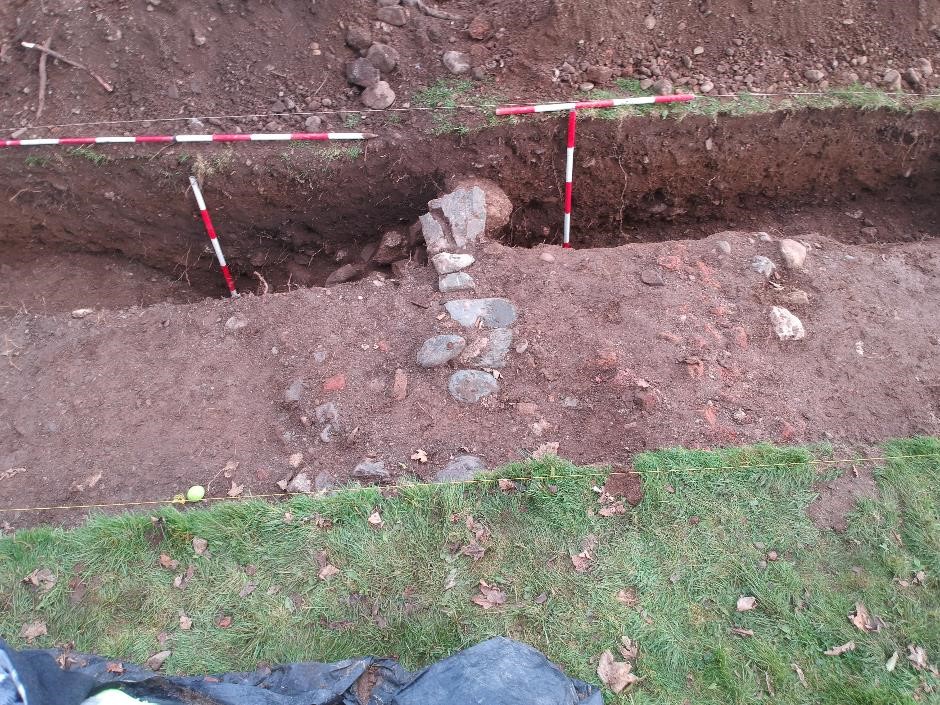
During archaeological testing of a proposed development site at Ravenswell and Bray Commons, County Wicklow and Cork Great, County Dublin, ten linear test trenches, totalling 650m in length, were excavated across the 7.3ha site. The testing programme sought to investigate a number of areas of limited archaeological potential which were identified during a recent geophysical survey (20R02014) undertaken within the subject lands, as well as the alignment of a recorded linear earthwork (WI005-005—/DU026-124—-), previously postulated to represent a portion of the ‘Pale’ ditch, which extends across the subject lands in a general east to west alignment. The licensed use of a metal-detector was incorporated into the test trenching investigations to assist in artefact retrieval (Detection Device Licence ref. 20R0179). No potential archaeological features or artefacts were uncovered in any of the excavated test trenches. Manual investigation of the linear earthwork revealed it to be a late 19th- or early 20th-century landscape feature and not a section of the ‘Pale’ ditch as had been previously postulated.
The stratigraphy encountered in both sections suggests that the landscape feature was formed by the demolition of the upper courses of a boundary wall. The rubble from this wall was primarily heaped on the northern face of the wall where the terrain slightly dips and was subsequently infilled to create a rampart to the elevated terrain to the south. In turn, the lower course of the wall could now function as a retaining wall allowing for additional dumped material to be spread out on top of the rampart to create a flat-topped earthwork. The ditch cut appears contemporary with the construction of the monument and was only present on the northern side of the wall. Likewise, its basal fills also contained late 19th-/early 20th-century glass and ceramic sherds. In summation, the archaeological evidence, in conjunction with the cartographic evidence and previous archaeological investigations, suggests that the linear earthwork was constructed in the late 19th early 20th century.

