2020:385 - ATHLONE: Athlone Town Wall, Westmeath
County: Westmeath
Site name: ATHLONE: Athlone Town Wall
Sites and Monuments Record No.: WM029-042020 & WM029-042022
Licence number: W000412
Author: Antoine Giacometti, Archaeology Plan
Author/Organisation Address: 32 Fitzwilliam Place Dublin 2
Site type: Historic town
Period/Dating: Multi-period
ITM: E 604156m, N 741506m
Latitude, Longitude (decimal degrees): 53.423650, -7.937472
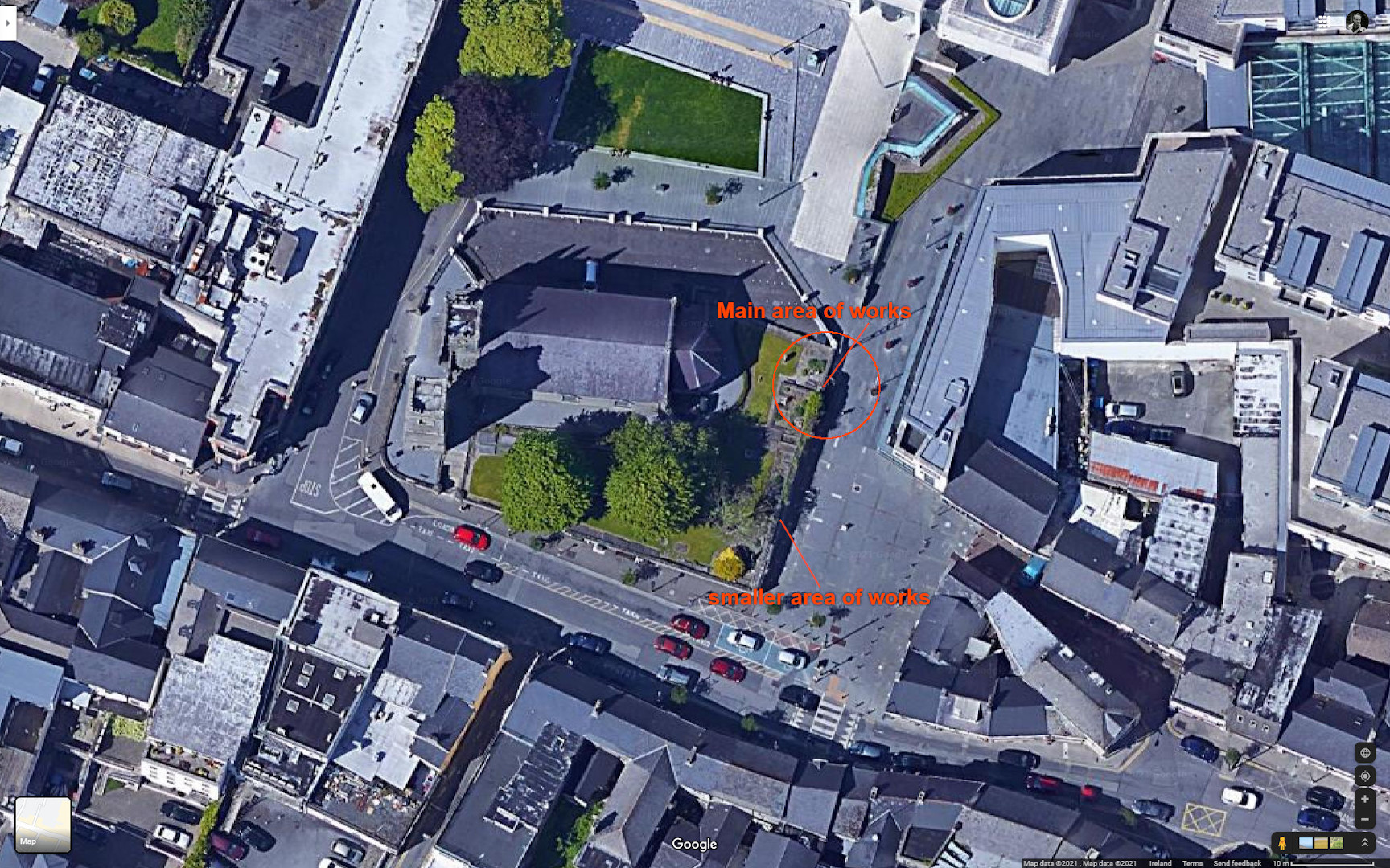
Archaeological monitoring was carried out in 2020 during restoration works to the Dublin Gate section of the Athlone Town Wall (WM029-042020). This section of wall also forms the western boundary of St Mary’s Church and Graveyard (WM029-042022). The Dublin Gate section of wall dates to the 17th century but may be constructed on the line of the 13th-century wall.
Two sections of the wall were restored. The largest area of works measured c. 8m in length (north-south) from the north-east corner of the graveyard. This included a collapsed and heavily overgrown segment of the Dublin Gate wall that showed heavy modifications in the past. Photographs from 2006 demonstrated the extent of the damage to the wall, and also provided a model for its reconstruction. Following vegetation removal, collapsed areas were rebuilt and, where necessary, new stone was sourced from a local quarry. Stainless steel dowels were used to tie the new part of the wall into the pre-existing parts. The top of the pre-existing wall behind the grave plot was repaired on the eastern side by re-bedding it with mortar following a clean-out of soil and loose material.
The smaller area of works in the south was a gap (c. 1m long, 150mm high and 150mm deep) at the base of the east-facing wall façade situated 8m from the southern end of the wall at Dublin Gate Street. Hand-excavation identified sterile sandy-clay behind the gap, suggestive of natural subsoil. A thin layer of mortar was present on the base of the gap, indicating that a stone or brick had been set directly onto the earth at some stage, but there was no masonry below the gap. No stone was present at the rear of the gap. The masonry wall was present directly over the gap and to the north of the gap, but to the south of the gap two courses of red brick ran in line with the gap and up to it, at the base of the wall.
Based on the archaeological evidence it appeared most likely that the visible lower course of masonry in this part of the wall represents the original lowermost or foundation course of the wall constructed directly over natural subsoil. This wall sloped down from the south, where the ground was originally higher than it is today, towards the north. Over time, as the ground was reduced in the south to level it, the natural subsoil below the wall was exposed and eroded, and was replaced with brick. The gap in 2020 represents a continuation of this process. It was considered that repairing the gap in limestone would make the wall harder to read in the future, as it would imply that the masonry wall had originally extended down to this level, whereas the archaeological evidence had suggested the opposite. As a result, it was decided to refill the gap in brick.