2020:586 - CASTLEGAL (4), Sligo
County: Sligo
Site name: CASTLEGAL (4)
Sites and Monuments Record No.: N/A
Licence number: E005283 (R00544) (also Ministerial Consent Ref. No. A079)
Author: James McKee, c/o Archaeological Management Solutions Ltd.
Author/Organisation Address: Fahy’s Road, Kilrush, Co. Clare
Site type: Enclosure
Period/Dating: Iron Age (800 BC-AD 339)
ITM: E 571840m, N 840731m
Latitude, Longitude (decimal degrees): 54.314540, -8.432775
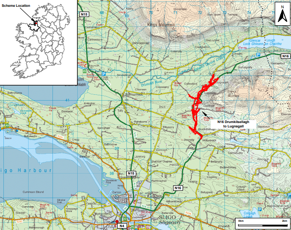
Stage (iii) Excavations were undertaken at Castlegal 4 as part of the N16 Lugatober (Drumkilsellagh to Lugnagall) Road Project, Co. Sligo. Castlegal 4 was discovered in the central section of the scheme in the townland of Castlegal during advance Stage (i) Test Excavations undertaken in 2020 by AMS (Dowling & McKee 2020; Registration Nos: E005188 and R00544; Ministerial Consent Ref.: A079).The onsite Stage (iii) Excavation Services at Castlegal 4 were undertaken between 27 November and 18 December 2020.
Castlegal 4 was located on an elevated position (c.121.5m OD) at the western end of a hill on the western slope of Cope’s Mountain. The ground dropped gently to the south and west and sharply to the north into the steep mouth of the Glencar Valley. The prominent location provided extensive views of the surrounding landscape towards the Ox Mountains to the south, Knocknarea, Sligo Bay, Drumcliff Estuary and Knocklane promontory fort (SL007-001001) to the west and King’s Mountain, Ben Bulben and the Glencar Valley to the north. It was strategically situated close to routeways to the north, south and east.
A group of possibly Early Neolithic features including slot trenches, pits, post-holes, stake-holes, fire pits and a curvilinear trench was identified. Carinated pottery sherds were recovered from a slot trench and a pit.
The predominant activity consisted of an Iron Age circular palisaded enclosure c.21m in diameter with an entrance at the south-west. The palisade consisted of a circular U-profiled trench with 196 post-sockets within the clay and stone-packing fill. It was truncated at three places by two relict field boundaries. An oak charcoal sample from one of the post-sockets provided a radiocarbon date of 360–173 cal. BC (UBA-44907).
A metalled surface led from the entrance through a pair of post-holes to an internal sub-circular post structure which comprised a c.6.5m-wide ring of six post-holes with a central fire pit. An access point to the post structure at the south was indicated by a metalled surface, post- and stake-holes. Burnt bone was present in two of the post-holes and a charred emmer wheat grain from one of the post-holes returned a radiocarbon date of 196–53 cal. BC (UBA-44832).
Other internal features comprised two post-holes, a line of four stake-holes and a fire pit. Structured deposition was suggested by the discovery of a broken rubbing stone, three possible saddle querns and burnt bone in the packing fill of the palisade. Frequent charcoal and scorched packing stones suggested that the site had been burnt.
Castlegal 4 may have served as a sanctuary for a local Iron Age community. It was situated within a local funerary landscape with five later prehistoric burial monuments located within 0.4km of the site. These include a ring barrow (SL009- 027), 80m to the east, an embanked barrow (SL009-030) 0.4km to the south-east and three ring ditches found during the project including Castlegal 2, 180m to the south-east, Castlegal 3, 190m to the south-south-east and Lugatober 3, 350m to the north.
References
Dowling, G. & McKee, J. 2020. N16 Lugatober (Drumkilsellagh to Lugnagall) Road Project Stage (i)a Test Excavation, Stage (i)f Townland Boundary Surveys and Stage (i)g Topographical Survey Report. Ministerial Consent Ref.: A079; Registration Nos.: E005188. Unpublished report by Archaeological Management Solutions Ltd on behalf of Sligo County Council.