2020:518 - COLLINSFOR (1), Sligo
County: Sligo
Site name: COLLINSFOR (1)
Sites and Monuments Record No.: N/A
Licence number: E005284 (R00544) (also Ministerial Consent Ref. No. A079)
Author: John Channing, c/o Archaeological Management Solutions Ltd.
Author/Organisation Address: Fahy’s Road, Kilrush, Co. Clare
Site type: Pit and Habitation site
Period/Dating: Prehistoric (12700 BC-AD 400)
ITM: E 572202m, N 841843m
Latitude, Longitude (decimal degrees): 54.324170, -8.436944
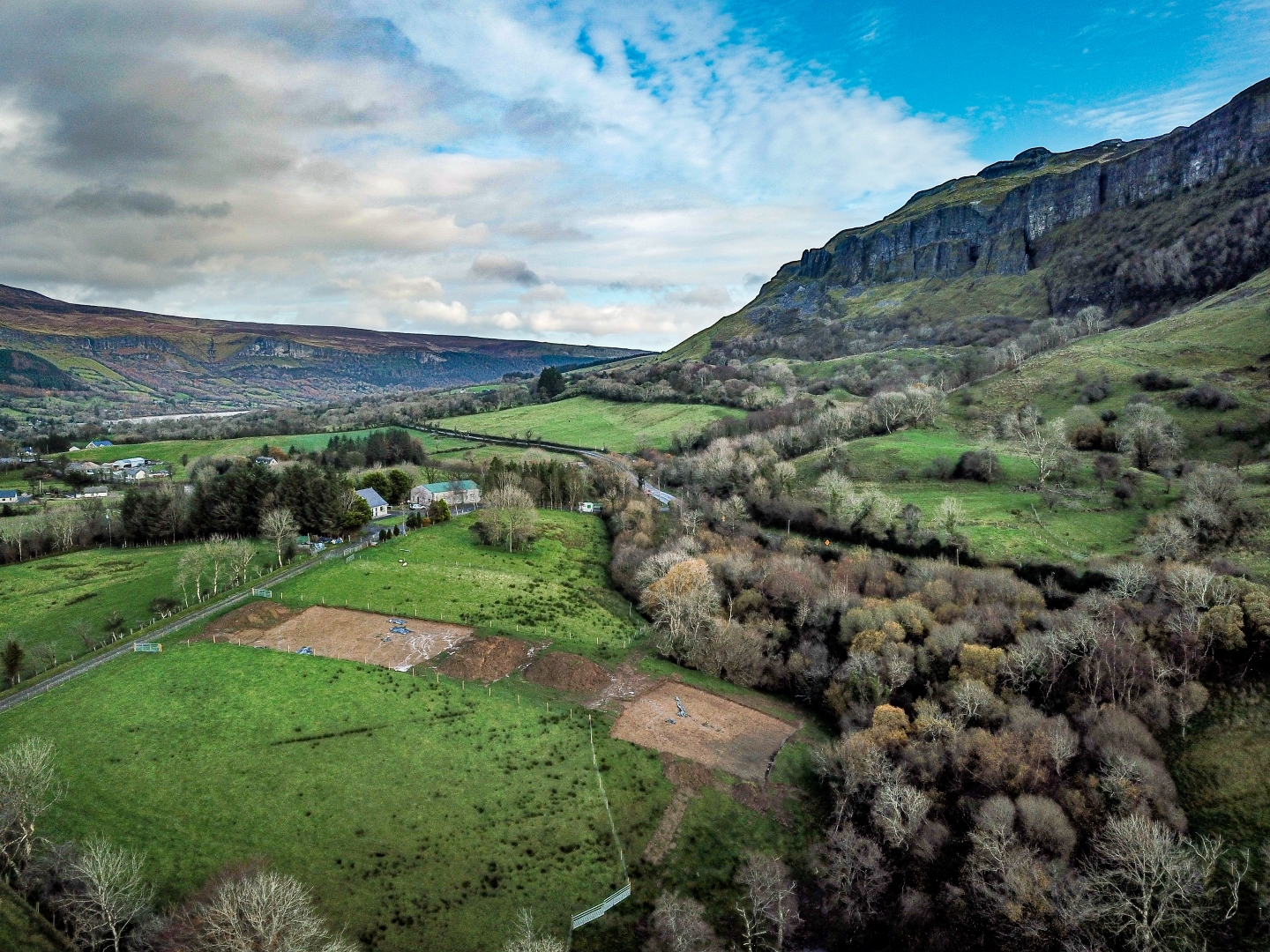
Stage (iii) Excavations were undertaken at Collinsford 1 as part of the N16. Lugatober (Drumkilsellagh to Lugnagall) Road Project, Co. Sligo. Collinsford 1 consisted of a series of pits and a metalled surface, as well as the remains of a possible structure and two potential charcoal-production pits. The site was identified during Stage (i)a Test Excavations undertaken in 2020 by AMS (Dowling and McKee 2020; Registration No.: E005188; Ministerial Consent Ref.: A079).
The on-site Stage (iii) Excavation Services at Collinsford 1 were conducted from 23 November to 11 December 2020.
Most of the excavated features were identified at the northern end of the site. They comprise a series of discrete pits, as well as a curvilinear feature and a metalled surface, and may relate to prehistoric settlement. The curvilinear or roughly ‘L-shaped’ feature was defined by a slot trench that measured some 2.8m (north–south) before it turned sharply to the south-west to
continue for a distance of approximately 1.8m. It was filled with a mixture of clay and loose angular stones, possible packing material, and contained two sherds of probable prehistoric pottery. It may be the remains of a possible small (rectangular?) structure. One of the pits contained several sherds of probable prehistoric pottery and some bone; this may be a cremation pit.
The two possible charcoal-production pits were identified on sloping terrain at the southern end of the site. They were of sub-oval and sub-rectangular form and a medieval date for them is possible.
Collinsford 1 is one of a number of archaeological sites identified in this area as part of the N16 Road Project. These include what may be an early Neolithic building at the site of Lugatober 4 and a series of pits, possible post-holes and hearths at Lugatober 5, about 230m and 120m to the south-west of Collinsford 1, respectively. The remains of a burnt spread were also recorded about 300m to the north-east, at the site of Lugnagall 1.
Reference
Dowling, G. & McKee, J. 2020. N16 Lugatober (Drumkilsellagh to Lugnagall) Road Project Stage (i)a Test Excavation, Stage (i)f Townland Boundary Surveys and Stage (i)g Topographical Survey Report. Ministerial Consent Ref.: A079.