2020:731 - TULLYLOYD (1), Roscommon
County: Roscommon
Site name: TULLYLOYD (1)
Sites and Monuments Record No.: N/A
Licence number: E5118
Author: Joe Nunan and Alan Healy, AMS
Author/Organisation Address: Fahy's Road, Kilrush, Clare
Site type: Burnt mound
Period/Dating: Prehistoric (12700 BC-AD 400)
ITM: E 588534m, N 786250m
Latitude, Longitude (decimal degrees): 53.825632, -8.174156
Tullyloyd 1 was excavated in advance of construction of the N5 Ballaghaderreen to Scramoge Road Project in County Roscommon by Archaeological Management Solutions (AMS) for Roscommon County Council (RCC) and Transport Infrastructure Ireland (TII). The site consisted of a burnt mound located in a low-lying field of pasture 0.3km northwest of Clooncullaan Loughs. It was identified during Stage (i)a Test Excavations, carried out by AMS under Ministerial Direction (Direction No. A077, Registration No. E5070) (Hardy 2021).
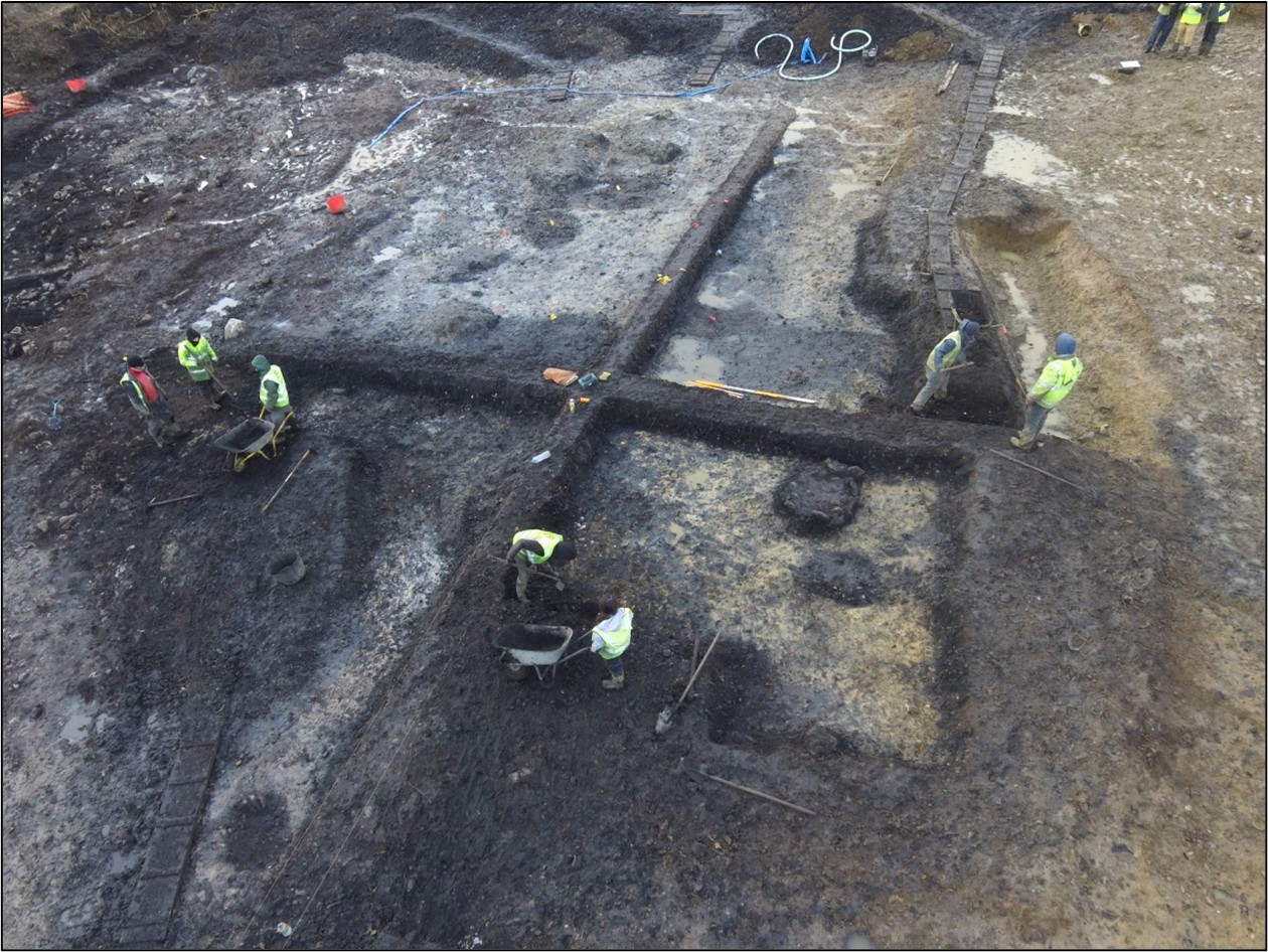
The site at Tullyloyd 1 comprised two main phases of activity: possible prehistoric activity in and around the burnt mound with later disturbance and a field boundary ditch cutting the north of the burnt mound.
The site of Tullyloyd 1 consisted of a large burnt mound that had been levelled and disturbed by past farming practices. The burnt mound sealed a complex of archaeological features including six troughs, pits, hearths, gullies, mounds of upcast material, post- and stake-holes. The burnt mound consisted mainly of compact grey–black burnt sandstone containing black silt and frequent charcoal inclusions. Five troughs contained structural elements in the form of stake-holes, which could have acted as supports for wicker linings or to secure bases. Four of the troughs and pits had inter-connecting gullies, which would have re-used water from one, to having a secondary use in another. This shows water management in action and utilising the water for potentially several different purposes.
Thirteen artefacts were found during the investigation. A total of 93 bulk soil, five bone, three wood, two snail shell, one charcoal and 25 stone samples (fourteen for potential lipid analysis) were retrieved from site for subsequent environmental analysis. Although presently undated, the burnt mound may relate to prehistoric subsistence and/or other specialised activities. The site may relate to the hilltop enclosure (RO022-054) a short distance to the northwest, although this is speculative.
Post-excavation works for Tullyloyd 1 will include in-depth historical and comparative research with the aim of further placing the burnt mound in its broader context.
This preliminary report summary was submitted on behalf of its authors.
Reference
Hardy, C. 2021. N5 Ballaghaderreen to Scramoge Road Project Stage (i)a, (i)b, (i)c Test Excavation, Stage (i)m Testing in Felled Forestry and Stage (i)f Townland Boundary Survey. Ministerial Direction No. A077, Registration No. E5070. Unpublished AMS report for TII and RCC.