2020:726 - CARTRONAGOR (2), Roscommon
County: Roscommon
Site name: CARTRONAGOR (2)
Sites and Monuments Record No.: N/A
Licence number: E5205
Author: Joe Nunan and Brigid Melloy, AMS
Author/Organisation Address: Fahy's Road, Kilrush, Clare
Site type: Structure
Period/Dating: Post Medieval (AD 1600-AD 1750)
ITM: E 582354m, N 787740m
Latitude, Longitude (decimal degrees): 53.838849, -8.268108
Cartronagor 2 was excavated in advance of construction of the N5 Ballaghaderreen to Scramoge Road Project in County Roscommon by Archaeological Management Solutions (AMS) for Roscommon County Council (RCC) and Transport Infrastructure Ireland (TII).
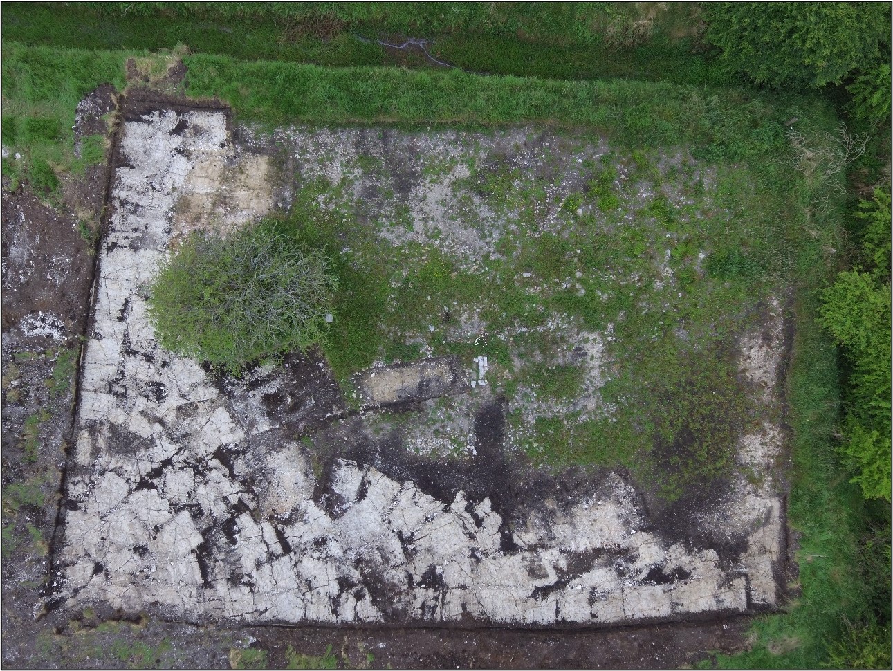
The subsurface remains of a vernacular structure and garden plot were identified during Stage (i)a Standard Test Excavations, carried out by AMS under Ministerial Direction (Direction No. A077, Registration No. E5070) (Hardy 2021). The site was indicated on the first-edition six-inch OS map (1838) and on the 25-inch OS map (1914) and was recorded in the Environmental Impact Assessment Report (EIAR) as CHC36 (Roughan & O’Donovan-AECOM 2017, 304).
The surviving remnants of the vernacular structure comprised an east–west-orientated arrangement of three discontinuous sections of wall, a collapse layer, a possible hearth or flag floor and an internal metalled surface. Externally the structure measured 9.4m (east–west) by 6.4m and internally it measured 9.2m (east–west) by 5.4m. A fourth discontinuous section of wall, multiple metalled surfaces, a garden plot, a field boundary and drain were also excavated to the south and southeast of the structure.
Post-medieval pottery, iron objects and glass sherds were found in association with the walls, metalled surfaces and garden plot and were dated to the nineteenth–twentieth centuries. Griffith’s Valuation (1857–58) suggests a Catherine Cassidy lived in the house in the mid-1800s but by the 1901/1911 censuses the site was occupied by Patrick Padien, his wife, Mary, and his son, Patrick (National Archives: Census of Ireland 1901/1911).
This summary report was submitted on behalf of its authors.
References
Griffith, R. J. 1857. General Valuation of Rateable Property in Ireland. Roscommon. Dublin: Alexander Thom & Sons.
Hardy, C. 2021. N5 Ballaghaderreen to Scramoge Road Project Stage (i)a, (i)b, (i)c Test Excavation, Stage (i)m Testing in Felled Forestry and Stage (i)f Townland Boundary Survey. Ministerial Direction No. A077, Registration No. E5070. Unpublished AMS report for TII and RCC.
National Archives: Census of Ireland 1901/1911. Available at: http://www.census.nationalarchives.ie/ [Accessed December 2, 2021].
Roughan & O’Donovan-AECOM. 2017. N5 Ballaghaderreen to Scramoge Road Project Environmental Impact Assessment Report. TII and Roscommon National Road Design Office. Available at: http://www.roscommoncoco.ie/en/Services/Roads/Publications-and-Information/N5-Ballaghaderreen-to-Scramoge-Road-Project/Environmental-Impact-Assessment-Report/Volume-2B-EIAR-Chapter-11-19/00-EIAR.pdf. [Accessed 18 November 2021].