2020:709 - PEAK (2), Roscommon
County: Roscommon
Site name: PEAK (2)
Sites and Monuments Record No.: N/A
Licence number: E005236
Author: Siobhan McNamara, Brigid Melloy and Conn Herriott, Archaeological Management Solutions (AMS)
Author/Organisation Address: Fahy’s Road, Kilrush, Co. Clare
Site type: Burnt spread and Pit
Period/Dating: Prehistoric (12700 BC-AD 400)
ITM: E 576940m, N 788000m
Latitude, Longitude (decimal degrees): 53.840973, -8.350384
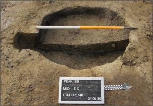
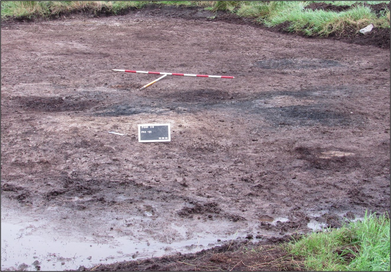
Peak 2 was excavated in advance of construction of the N5 Ballaghaderreen to Scramoge Road Project in County Roscommon by Archaeological Management Solutions (AMS) for Roscommon County Council (RCC) and Transport Infrastructure Ireland (TII). Located in a wet, boggy field approximately 2.3km east of Bellanagare, the site was unsuitable for geophysical survey and was initially identified during Stage (i)c Test Excavations, carried out by AMS under Ministerial Direction (Direction No. A077, Registration No. E5070; Hardy 2021). Peak 2 consisted of a burnt spread, associated pits, gullies and stakeholes, as well as several charcoal-production and metalworking pits, and two post-medieval animal burials.
The on-site works of the Stage (iii) Excavation and Post-excavation Assessment Services at Peak 2 were undertaken over ten days between 27 August and 9 October 2020.
Peak 2 comprised two areas of excavation, Areas A and B, approximately 25m apart. The archaeological remains included at least three phases of activity. In Area A a burnt spread covered a series of connected pits and gullies as well as several potentially associated stakehole structures. Samples of alder charcoal from the basal fills of two separate pits in this area both returned Middle Bronze Age dates: 1416–1280 cal. BC (UBA-48912, 3083±22BP) and 1397–1225 cal. BC (UBA-48913, 3048±21BP), respectively. In Area B there were two charcoal-production pits, a furnace pit and two postholes. A sample of oak charcoal from the basal fill of one of the charcoal-production pits returned an Early Iron Age date: 760–478 cal. BC (UBA-48915, 2470±21BP). A hazel charcoal sample from the furnace pit fill returned a Middle Iron Age date: 399–231 cal. BC (UBA-48914, 2284±21BP). The findings in Area B represent a rare example in Ireland of an Iron Age furnace with associated charcoal-production pits. In Area A there were two post-medieval or modern animal burials pits containing semi-articulated bovine skeletons. A cow tibia from one of the pits produced a post-medieval/modern radiocarbon date: cal. AD 1666–1950 (UBA-44908, 153±29BP).
The artefact assemblage includes a flint bipolar core, three flint and chert flakes and a flint flake used as an ad hoc cutting tool. An unworked quartzite pebble which was also found during the investigations. The slag from the furnace pit in Area B has a vertical flow structure and incorporates hollows left by timber fragments, while samples from the clay lining of this pit incorporate a vitrified clay surface. Animal bones were recovered from the burnt spread and associated features represent at least one adult and one immature cow, as well as calcined bones and a burnt bone from a medium-sized animal. The charred wood remains from this area are dominated by hazel, blackthorn/cherry and alder, while ash, oak, willow, spindle, pomaceous fruitwood and birch were also recorded from the burnt spread and associated features. Oak dominates the charcoal samples from all contexts in Area B, indicating the deliberate selection of this wood for metalworking and charcoal production. The charred wood remains from the post-medieval/modern animal burials in Area A are dominated by alder and hazel, with ash, blackthorn/cherry, oak, willow and pomaceous fruitwood also identified.
Sampled archaeobotanical remains include former waterlogged seeds of docks, grass, buttercups and brambles—indicative of scrubland, grassland and hedgerows in a locality characterised by damp land, the effects of anthropogenic disturbance and human activity. In line with this, insect remains from Area B represent species which live in water and marshlands, as well as in grass litter, woodland, dung, decaying litter and foul organic matter.
References
Hardy, C. 2021. N5 Ballaghaderreen to Scramoge Road Project Stage (i)a, (i)b, (i)c Test Excavation, Stage (i)m Testing in Felled Forestry and Stage (i)f Townland Boundary Survey. Ministerial Direction No. A077, Registration No. E5070. Unpublished AMS report for TII and RCC.


