2022:159 - VESNOY (1), Roscommon
County: Roscommon
Site name: VESNOY (1)
Sites and Monuments Record No.: N/A
Licence number: A077; E5092
Author: Eve Campbell, Archaeological Management Solutions
Author/Organisation Address: Fahy's Road, Kilrush, Co. Clare
Site type: Burnt spread and Charcoal-making site
Period/Dating: Multi-period
ITM: E 594377m, N 781515m
Latitude, Longitude (decimal degrees): 53.783179, -8.085321
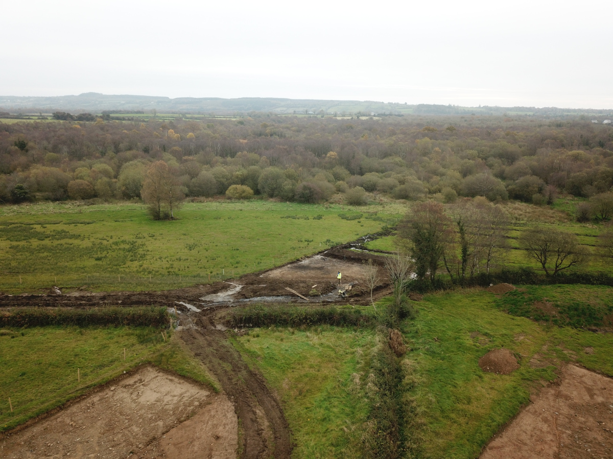
Vesnoy 1 was excavated in advance of construction of the N5 Ballaghaderreen to Scramoge Road Project in County Roscommon by Archaeological Management Solutions (AMS) for Roscommon County Council (RCC) and Transport Infrastructure Ireland (TII). It consisted of a burnt spread and a charcoal-production pit. The site also encompassed a pitfield identified by Steve Davis during LiDAR analysis (Davis 2015).
Geophysical survey (magnetometry and apparent electrical resistivity) was carried out at the site in 2015 (Bonsall & Gimson 2016). The magnetometry survey identified pitfield features and potential industrial remains. The apparent electrical resistivity survey identified pitfield pits, two possible walls, a possible stone feature and an area of potentially imported soil (ibid., 24–25). Test-trenching at the site in 2015 by Archer Heritage Planning Ltd confirmed the presence of a sequence of pitfield pits and determined that the potential industrial remains identified in the geophysical survey were non-archaeological (O’Connell 2016, 11, 22).
During Stage (ii) Phase 1 (July 2019) five cuttings were opened at the site by Gerry Mullins (AMS). A charcoal-production pit (Cutting 4) was identified in addition to five pitfield pits (Cuttings 2, 3, and 4). Two of the pits were investigated by GSI geologist Dr Robert Meehan in July 2019. A burnt spread was identified by Eve Campbell (AMS) during Stage (i) stripping at Vesnoy (Area 10) on 29 August 2019; the area opened around the spread was designated Cutting 6.
The burnt spread was shallow and had been significantly ploughed out. It had an extent of 5.7m by 5.3m and was 0.2m deep. A fragmented cow tooth was found at its northern end (Appendix 4). The burnt spread partially concealed a single trough, which was orientated northwest–southeast and was oval in plan. The trough was 2.35m long, 0.9m wide, 0.27m deep and contained a single fill of firm mid-brownish grey silty sand with frequent charcoal and burnt stone inclusions. A sample of alder charcoal from this fill returned an Early–Middle Bronze Age date of 1881–1645 cal. BC (UBA-47779; 3452±28BP). Two irregular cuts—1.5–2.7m long, 0.59–1.2m wide, 0.2–0.4m deep—were located to the immediate east of the trough and were interpreted as tree throws. A fragment of a possible cow tooth was recovered from the fill of one of these tree throws.
A small oval charcoal-production pit was identified with Cutting 4. It was orientated east–west and measured 2.5m long, 1.4m wide and 0.15m deep. The pit had two fills: a basal fill of soft mid blackish grey silty clay with charcoal chunks and medium-sized rounded stones and an upper fill of soft mid-greyish brown silty clay with moderate inclusions of charcoal and small sub-angular stones. The natural around the pit had been oxidised during the charcoal-production process. A sample of pomaceous fruitwood charcoal from the basal fill returned an early medieval date of cal. AD 897–1031 (UBA-47778; 1054±28BP).
Two pitfield pits were also investigated in Cutting 4 and Cutting 3, respectively. One was orientated northeast–southwest and was 2.36m wide, 0.92m deep and c.14.5m long. It contained a single sterile fill. The other began to collapse shortly after the cutting was opened and it was not possible to fully record the feature.
Two artefacts were recovered during the investigation: a flint flake and a ceramic teapot lid. The flint flake will be retained for the national collection. Charred wood remains from the fill of the trough, the burnt spread and charcoal-production pit consisted of hazel, birch, ash, pomaceous fruitwood and blackthorn/cherry.
References
Bonsall, J. & Gimson, H. 2016. Geophysical Survey Report, N5 Ballaghaderreen-Scramoge Road Development. Unpublished report prepared by Earthsound Archaeological Geophysics Ltd on behalf of RCC.
Davis, S. 2015. N5 Strokestown-Ballaghaderreen corridor: LiDAR Assessment. Unpublished report prepared by UCD School of Archaeology for RCC and TII.
O’Connell, A. 2016. N5 Ballaghaderreen-Scramoge Road Development, Archaeological Consultancy Services Contract, Stage (i) Services Area AH05; Lavally and Vesnoy, Co. Roscommon, Licence No. 15E0589. Unpublished report by Archer Heritage Planning Ltd for RCC.