2020:772 - TURLAGHNAMADDY (2), Roscommon
County: Roscommon
Site name: TURLAGHNAMADDY (2)
Sites and Monuments Record No.: N/A
Licence number: Registration No. E5181, Ministerial Direction No. A077
Author: John Channing, c/o Archaeological Management Solutions Ltd.
Author/Organisation Address: Fahy’s Road, Kilrush, Co. Clare
Site type: Burnt spread
Period/Dating: Bronze Age (2200 BC-801 BC)
ITM: E 571753m, N 791503m
Latitude, Longitude (decimal degrees): 53.872195, -8.429518
Turlaghnamaddy 2 was excavated in advance of construction of the N5 Ballaghaderreen to Scramoge Road Project in County Roscommon by Archaeological Management Solutions (AMS) for Roscommon County Council (RCC) and Transport Infrastructure Ireland (TII). The excavation included two square cuttings centred around a burnt mound and a burnt spread that were identified during Stage (i)m Test Excavations in Felled Forestry, carried out by AMS (Ministerial Direction No. A077, Registration No. E5070; Hardy 2021).
The full extent of the burnt mound was located within the southern cutting. This was sub-oval and measured 15m by 7m in plan and 0.4m deep and consisted of a substantial deposit of desiccated and heat-shattered stone in a charcoal-stained matrix of fine silt and grit with frequent (80%) small to medium-sized sub-angular stones. No underlying or associated troughs, pits or other archaeological features were found.
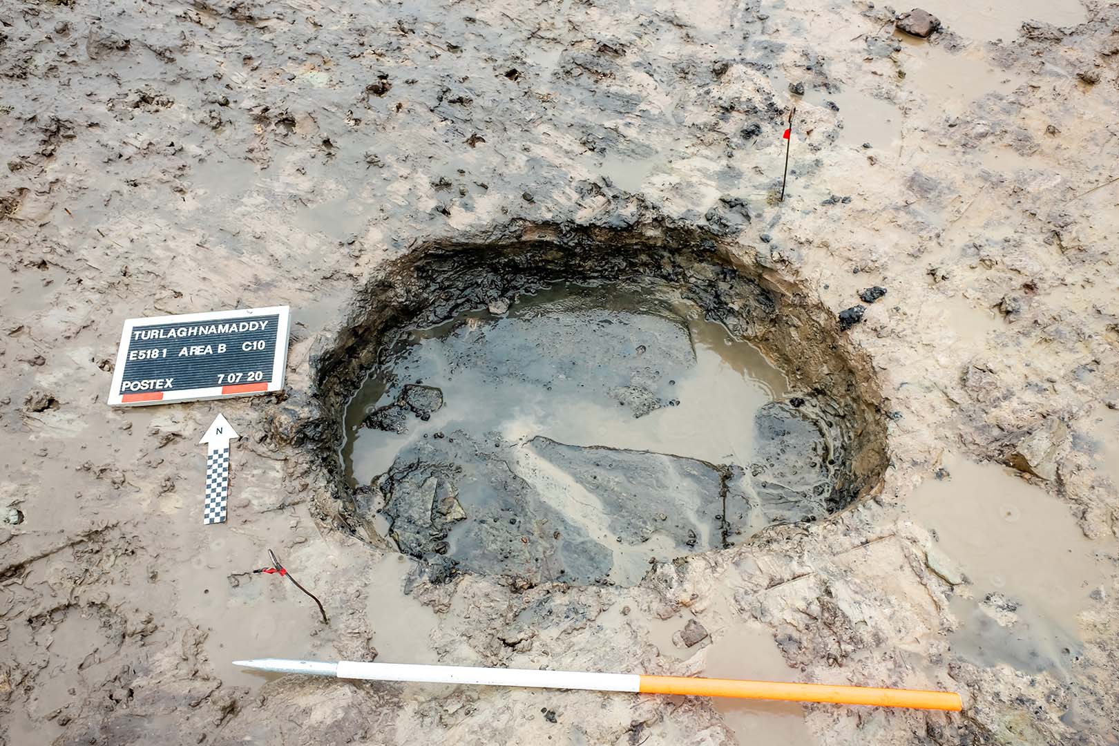
Approximately 10m north of the burnt mound, within the northern cutting, was a sub-circular burnt spread (7.1m by 5m in plan and 0.2m deep). This overlay a sub-oval pit/trough (1.18m by 0.8m in plan and 0.26m deep) with vertical sides and a flat base that naturally infilled with water during the investigation. The base was lined with sandstone slabs, each c.0.6m thick, that sat on a thin layer of silt. A sample of alder charcoal from the fill of the trough returned an Early Bronze Age date of 2135–1932 cal. BC (UBA-47763; 3647±28BP).
Post-medieval and modern agricultural features were also recorded at Turlaghnamaddy 2 including a series of northeast–southwest furrows which truncated both the burnt mound and burnt spread, as well as two drains which ultimately fed into an open drain immediately south of the site. These modern drains are likely associated with the recent conifer plantations and disturbed by tree-harvesting activity.
No artefacts were found during the investigation. Charred wood remains from the fill of the trough consisted of hazel, ash, alder, willow and pomaceous fruitwood.
Reference
Hardy, C. 2021. N5 Ballaghaderreen to Scramoge Road Project Stage (i)a, (i)b, (i)c Test Excavation, Stage (i)m Testing in Felled Forestry and Stage (i)f Townland Boundary Survey. Ministerial Direction No. A077, Registration No. E5070. Unpublished AMS report for TII and RCC.