2020:770 - DUNGAR (1), Roscommon
County: Roscommon
Site name: DUNGAR (1)
Sites and Monuments Record No.: N/A
Licence number: Registration No. E5151, Ministerial Direction No. A077
Author: John Channing, c/o Archaeological Management Solutions Ltd.
Author/Organisation Address: Fahy’s Road, Kilrush, Co. Clare
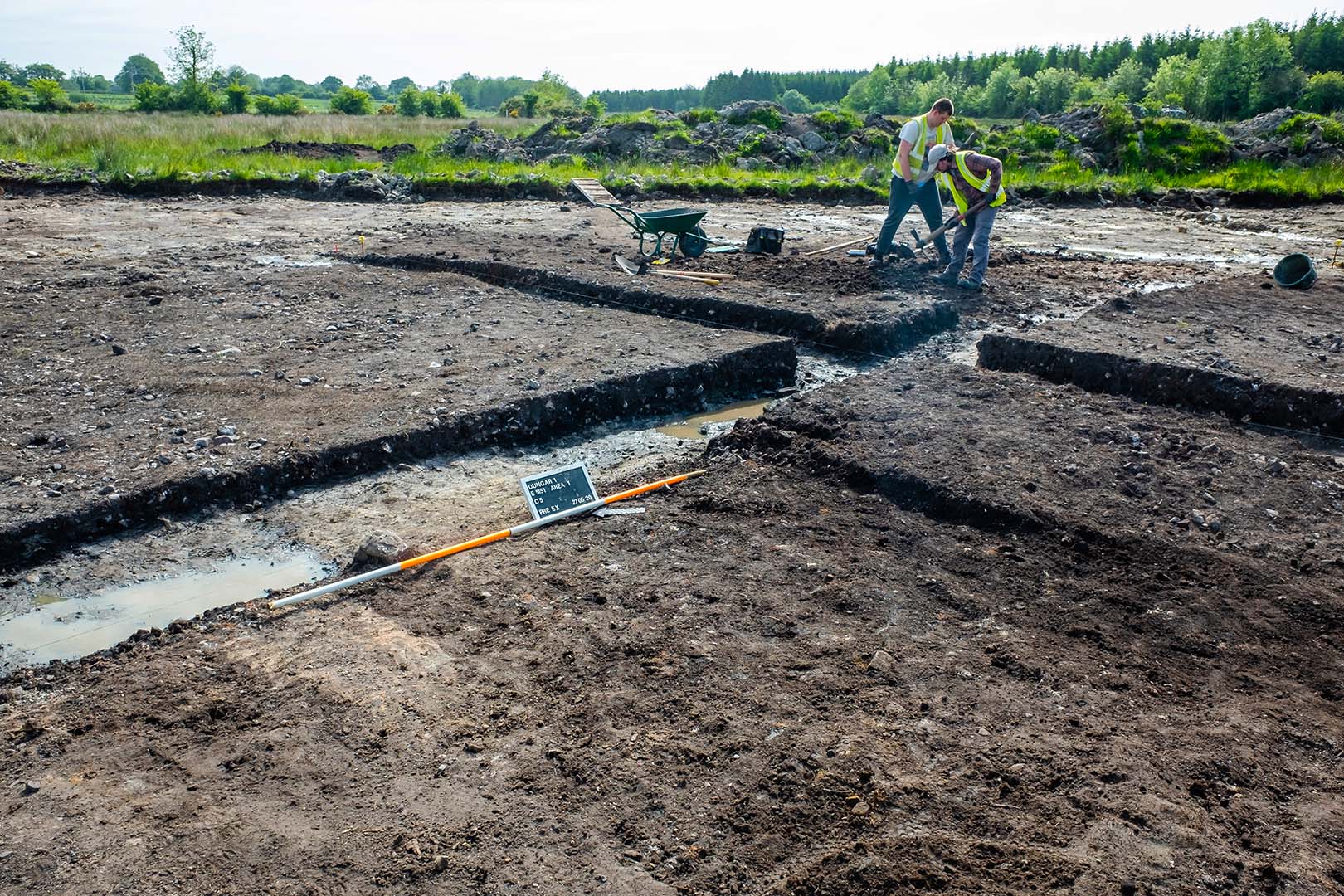
Site type: Burnt spread and Pit
Period/Dating: Chalcolithic (2500 BC-2201 BC)
ITM: E 571855m, N 791399m
Latitude, Longitude (decimal degrees): 53.871266, -8.427957
Dungar 1 was excavated in advance of construction of the N5 Ballaghaderreen to Scramoge Road Project in County Roscommon by Archaeological Management Solutions (AMS) for Roscommon County Council (RCC) and Transport Infrastructure Ireland (TII). The site consisted of two burnt spreads located in two areas within boggy terrain adjacent to felled forestry. It was identified during Stage (i)a Test Excavations, carried out by AMS under Ministerial Direction (Direction No. A077, Registration No. E5070; Hardy 2021).
Excavations in Area 1 revealed a burnt mound of moderately compacted, charcoal-rich silty clay and frequent heat-shattered stone. This was ovoid in plan, 14.6m long (northwest–southeast) by 14.2m wide and averaged 0.28m deep, and sealed a total of four pits or troughs, arranged in two groups and ranging in size and shape.
A pair of troughs was located centrally under the burnt mound. The larger of the two was sub-rectangular in plan, 2.4m long, 1.3m wide, 0.37m deep and contained a basal fill of pale grey silty clay with charcoal flecks, 0.05–0.07m deep and an upper fill of dark charcoal-stained matrix of fine silt and grit with abundant angular heat-shattered red, yellow and grey sandstone. The second trough was sub-rectangular in plan, 1.9m long, 1.4m wide, 0.46m deep and contained a basal fill of pale grey silty clay with charcoal flecks, 0.06m deep, and an upper fill of dark charcoal-rich soil with frequent angular heat-shattered red, yellow and grey sandstone. A sample of alder charcoal from the upper fill of the second trough returned a Chalcolithic/Early Bronze Age date of 2271–2030 cal. BC (UBA-47751; 3726±31BP).
Two pits were located under the northern extent of the spread: a roughly kidney-shaped pit, 1.2m long, 1m wide, 0.18m deep, and a smaller sub-oval pit, 0.7m long, 0.72m wide, 0.17m deep. Both contained a single fill of dark brown charcoal-rich fine silt and grit with frequent angular heat-shattered sandstone together with unburnt stone.
Area 2 was located 65m to the southeast, and comprised a smaller, kidney-shaped burnt mound measuring 10m long (north–south), 7.1m wide, 0.1m deep, and it sealed two pits or troughs. The sub-circular trough was 1.2m long, 1.1m wide, 0.28m deep, and contained a basal fill of red, yellow and grey angular sandstone in a charcoal-stained silt and gritty soil and an upper fill of dark brown charcoal-stained silty clay and occasional burnt stone. A sample of alder charcoal from its basal fill (C.21) returned a Late Neolithic/Chalcolithic date of 2622–2467 cal. BC (UBA-47752; 4020±31BP).
A sub-circular pit was located 0.48m to the west of the trough and measured 1.27m long, 1.2m wide, 0.57m deep. It contained a basal fill of dark brown charcoal-stained silt and grit with abundant angular heat-shattered red, yellow and grey sandstone, 0.47m deep, and an upper fill of dark brown charcoal-stained (increasing towards the base) silty clay, with occasional inclusions of heat-shattered sandstone, 0.1m deep. Organic residue (lipid) analysis from a sample of stone from its basal fill suggests the presence of vegetation-derived organic matter of a woody origin, possibly roots found in soil.
A series of parallel cultivation furrows, 0.3m wide and 0.05m deep, orientated southwest–northeast, cut across both Areas 1 and 2, truncating the upper portions of both burnt mounds. The furrows were rounded in profile and base and contained a mix of topsoil and redeposited subsoil fill.
Nineteen artefacts, including a flint or chert flake, nineteenth-century ceramic pottery sherds and fragments of an eighteenth-century tobacco pipe were identified during the investigation. Charcoal from Dungar 1 comprised alder, willow, hazel, ash, oak, pomaceous fruitwood and blackthorn/cherry.
References
Hardy, C. 2021. N5 Ballaghaderreen to Scramoge Road Project Stage (i)a, (i)b, (i)c Test Excavation, Stage (i)m Testing in Felled Forestry and Stage (i)f Townland Boundary Survey. Ministerial Direction No. A077, Registration No. E5070. Unpublished AMS report for TII and RCC.