2020:766 - CARTRONAGOR (8), Roscommon
County: Roscommon
Site name: CARTRONAGOR (8)
Sites and Monuments Record No.: N/A
Licence number: Registration No. E5203, Ministerial Direction No. A077
Author: John Channing, c/o Archaeological Management Solutions Ltd.
Author/Organisation Address: Fahy’s Road, Kilrush, Co. Clare
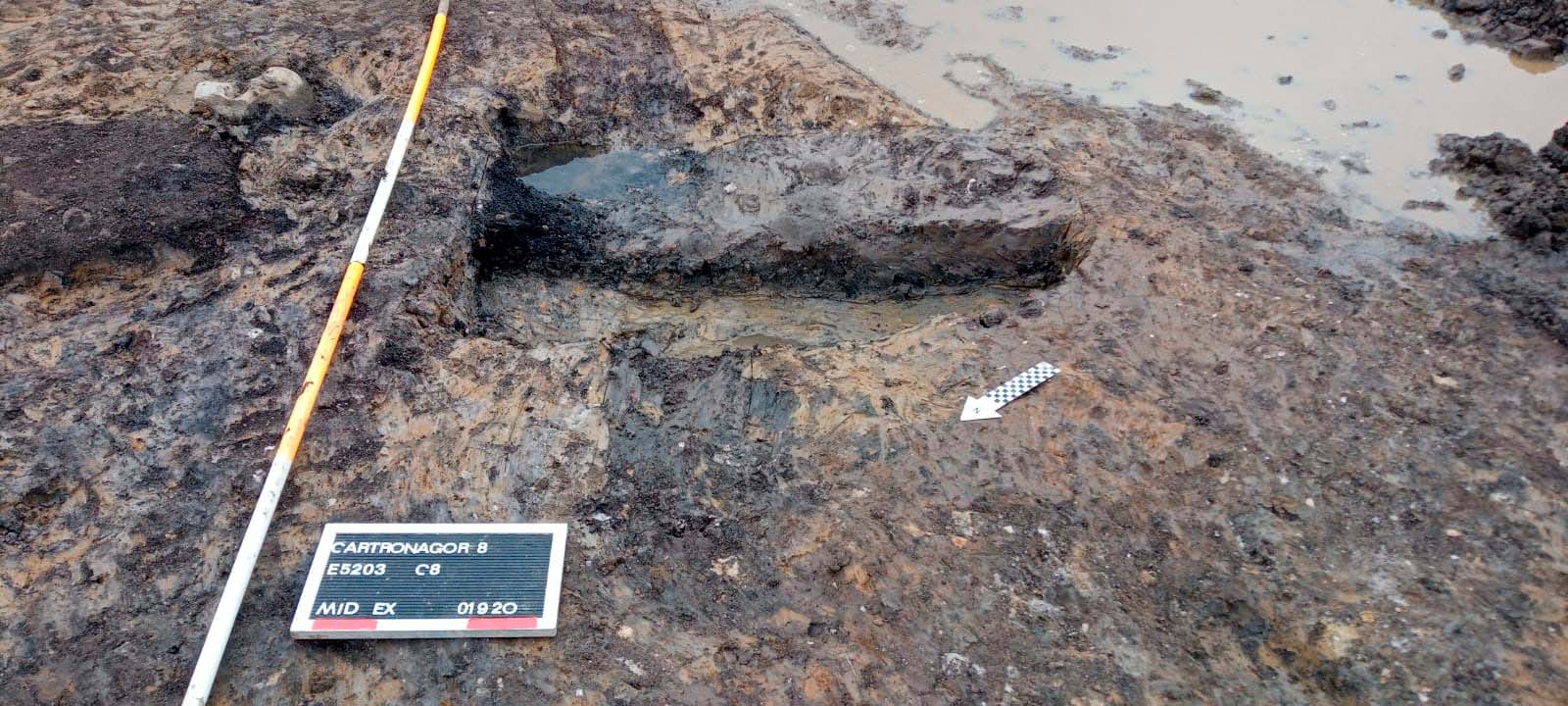
Site type: Burnt spread and Pit
Period/Dating: Bronze Age (2200 BC-801 BC)
ITM: E 582870m, N 787718m
Latitude, Longitude (decimal degrees): 53.838668, -8.260267
Cartronagor 8 was excavated in advance of construction of the N5 Ballaghaderreen to Scramoge Road Project in County Roscommon by Archaeological Management Solutions (AMS) for Roscommon County Council (RCC) and Transport Infrastructure Ireland (TII). The site consisted of a burnt spread and trough located in boggy terrain in felled forestry. It was identified during Stage (i)m Test Excavations, carried out by AMS under Ministerial Direction (Direction No. A077, Registration No. E5070; Hardy 2021).
The on-site works of the Stage (iii) Excavation and Post-excavation Assessment Services at Cartronagor 8 were undertaken from 31 August 2020–4 September 2020.
The burnt spread was sub-circular in plan and measured 4.4m long by 3.9m wide and was 0.04m deep. It consisted of a charcoal-stained dark greyish-black sandy silt containing heat-shattered sandstone and charcoal flecks. A trough was located under the south-western portion of the burnt spread. It possessed a sharp break of slope at surface and base giving an irregular, flat-bottomed, U-shaped profile. It was sub-rectangular in plan and measured 1.35m in length, 0.8m wide and 0.26m deep. There was no evidence of any lining, and it contained two fills. The basal fill averaged 0.12m in depth and comprised a dark brownish-black sandy silt that was charcoal rich with inclusions of heat-discoloured and shattered sandstone. A sample of hazel charcoal from the basal fill of the trough returned a Middle Bronze Age date of 1675–1504 cal. BC (UBA-47770; 3311±33BP). The upper fill averaged 0.12m in depth and consisted of a firm yellowish-grey sandy clay, which was plastic when wet, with inclusions of charcoal flecks and occasional small stones. The remnants of a parallel set of agricultural furrows truncated the burnt spread and trough on an approximate northwest–southeast line. The furrows were faint and only partially survived. They had gently sloping sides, concave bases and measured over 5m long, 0.3m wide and 0.04–0.1m deep.
No artefacts were found during the investigation. Charcoal from the trough consisted of hazel, ash and blackthorn/cherry, while charcoal from the burnt mound consisted exclusively of hazel.
Reference
Hardy, C. 2021. N5 Ballaghaderreen to Scramoge Road Project Stage (i)a, (i)b, (i)c Test Excavation, Stage (i)m Testing in Felled Forestry and Stage (i)f Townland Boundary Survey. Ministerial Direction No. A077, Registration No. E5070. Unpublished AMS report for TII and RCC.