2020:761 - BUMLIN (2), Roscommon
County: Roscommon
Site name: BUMLIN (2)
Sites and Monuments Record No.: N/A
Licence number: E5209
Author: Lydia Cagney, Bridget Melloy and Kevin Kearney, AMS
Author/Organisation Address: Fahy's Road, Kilrush, Clare
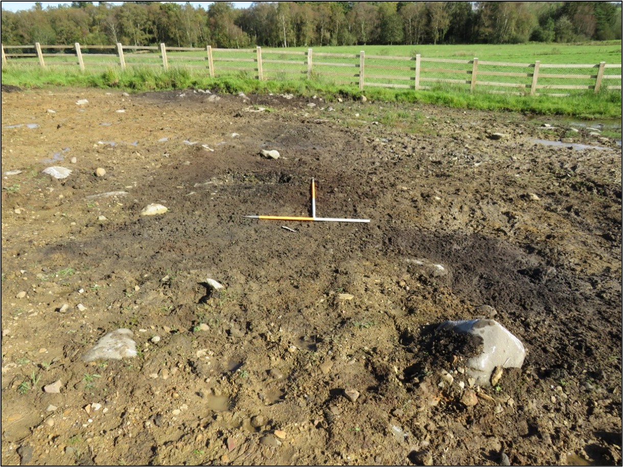
Site type: Burnt spread and Pit
Period/Dating: Medieval (AD 400-AD 1600)
ITM: E 595562m, N 780117m
Latitude, Longitude (decimal degrees): 53.770627, -8.067320
Bumlin 2 was excavated in advance of construction of the N5 Ballaghaderreen to Scramoge Road Project in County Roscommon by Archaeological Management Solutions (AMS) for Roscommon County Council (RCC) and Transport Infrastructure Ireland (TII). It was identified during Stage (i)a Standard Test Excavations, carried out by AMS under Ministerial Direction (Direction No. A077, Registration No. E5070; Hardy 2021).
The excavation at Bumlin 2 revealed three burnt spreads and three pits, two of which were sealed beneath the burnt spread material. Part of one burnt spread extended beyond the Compulsory Purchase Order, to the northeast of the site. The exposed portion was sub-rectangular in plan (6.5m long, 4m wide, and 0.3m deep) and comprised loosely compacted dark brownish-black clayey silt and charcoal with heat-affected stone and natural large stones and boulders. Three small fragments of indeterminate calcined bone were identified within the burnt spread material. The burnt spread sealed a large sub-rectangular pit (1.7m long, 1.6m wide, and 0.25m deep) filled with firmly compacted dark brownish-black sandy silt with frequent heat-affected grey limestone inclusions. A sample of pomaceous fruitwood charcoal returned an early medieval date of cal. AD 994–1152 (UBA-47775; 994±23BP). Four indeterminate fragments of calcined bone were also recovered from within the fill of the pit.
The second and third burnt spreads were located to the southwest. The northernmost was sub-rectangular in plan (1.7m long, 2m wide, and 0.1m deep) and comprised loosely compacted dark-brownish-black clayey silt and charcoal with heat-affected stones and large unburnt stones and sealed another pit. It was circular in plan (1m in diameter and 0.2m deep) and filled with firmly compacted sandy silt and large stones.
The other spread was sub-oval in plan (4.5m long, 3.1m wide, and 0.06m deep) and comprised loosely compacted dark brownish-black sandy silt and charcoal with heat-affected and heat-shattered red sandstone.
The unsealed pit was located to the south of the spreads. It was almost circular in plan (1.46m long, 1.44m wide, and 0.4m deep) and was filled with softly compacted mid-brown clayey silt containing infrequent heat-shattered red sandstone and grey limestone inclusions. A sample of hazel charcoal from its single fill returned an early medieval date of cal. AD 1042–1212 (UBA-47775; 911±22BP; Appendix 7).
No artefacts were found during the investigation. Charcoal consisted of hazel, ash, pomaceous fruitwood, blackthorn/cherry and elder, while non-wood macro remains consisted of low frequencies of hedgerow species, brambles, docks and nightshade which appeared to have once been waterlogged and subsequently became dried out.
This reports summary was submitted on behalf of its authors.
Reference
Hardy, C. 2021. N5 Ballaghaderreen to Scramoge Road Project Stage (i)a, (i)b, (i)c Test Excavation, Stage (i)m Testing in Felled Forestry and Stage (i)f Townland Boundary Survey. Ministerial Direction No. A077, Registration No. E5070. Unpublished AMS report for TII and RCC.