2020:759 - CLOONRADOON (2), Roscommon
County: Roscommon
Site name: CLOONRADOON (2)
Sites and Monuments Record No.: N/A
Licence number: E005198
Author: Lydia Cagney, Conn Herriott and Kevin Kearney, AMS
Author/Organisation Address: Fahy's Road, Kilrush, Clare
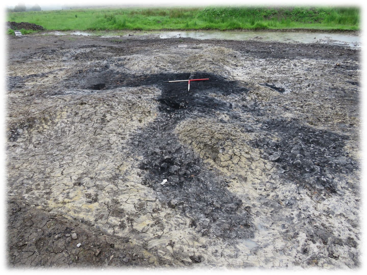
Site type: Burnt mound
Period/Dating: Bronze Age (2200 BC-801 BC)
ITM: E 595118m, N 780662m
Latitude, Longitude (decimal degrees): 53.775521, -8.074064
Cloonradoon 2 consisted of a burnt mound and underlying features discovered in pastureland approximately 1.8km east of Strokestown in advance of construction of the N5 Ballaghaderreen to Scramoge Road Project in County Roscommon by Archaeological Management Solutions (AMS) for Roscommon County Council (RCC) and Transport Infrastructure Ireland (TII). It was identified during Stage (i)a Standard Test Excavations, carried out by AMS (Ministerial Direction No. A077, Registration No. E5070; Hardy 2021).
The on-site Stage (iii) Excavation Services at Cloonradoon 2 were undertaken by AMS between 9 July and 26 August 2020.
The burnt mound was a maximum of 14.9m by 14.3m in plan and 0.56m deep. A sample of hazel charcoal from the base of the burnt mound returned a Late Bronze Age date of 1219–1020 cal. BC (UBA-47749; 2932±25BP). Under its western side, a sub-oval trough (2.02m by 1.56m in plan and 0.29m deep) and a sub-rectangular trough (1.88m by 1.54m in plan and 0.3m deep) were located on either side of a spread of upcast subsoil. Organic residue (lipid) analysis from a sample of stone from the sub-oval trough suggests the presence of vegetation-derived organic matter of a woody origin, possibly roots found in soil.
The sub-rectangular trough and the upcast were truncated by a third trough (2.37m by 1.34m in plan and 0.4m deep) providing evidence for some sequential activity. A sample of ash charcoal from the recut trough returned a Late Bronze Age date of 971–809 cal. BC (UBA-47750; 2734±33BP). The upcast was also cut by two channels that may have directed overflow water away from the working area or, conversely, directed run-off water into the troughs.
Two pits were located under the eastern side of the burnt mound. The first pit was sub-oval in plan (0.57m by 0.37m and 0.34m deep) and the second was irregularly shaped (1.18m by 0.56m in plan and 0.3m deep).
Two sherds of post-medieval pottery were recovered from the topsoil during the investigation. Charcoal from the burnt mound, troughs and pits comprised alder, hazel, ash, oak, elm, pomaceous fruitwood and blackthorn/cherry.
Reference
Hardy, C. 2021. N5 Ballaghaderreen to Scramoge Road Project Stage (i)a, (i)b, (i)c Test Excavation, Stage (i)m Testing in Felled Forestry and Stage (i)f Townland Boundary Survey. Ministerial Direction No. A077, Registration No. E5070. Unpublished AMS report for TII and RCC.