2020:757 - TULLEN (1), Roscommon
County: Roscommon
Site name: TULLEN (1)
Sites and Monuments Record No.: N/A
Licence number: E005140
Author: Lydia Cagney, Breana McCulloch and Kevin Kearney, AMS
Author/Organisation Address: Fahy's Road, Kilrush, Clare
Site type: Burnt mound
Period/Dating: Multi-period
ITM: E 592558m, N 783638m
Latitude, Longitude (decimal degrees): 53.802234, -8.112973
Tullen 1 comprised two burnt mounds overlying troughs, pits and other associated features. The site was discovered in pastureland approximately 2km northwest of Strokestown, in advance of construction of the N5 Ballaghaderreen to Scramoge Road Project in County Roscommon by Archaeological Management Solutions (AMS) for Roscommon County Council (RCC) and Transport Infrastructure Ireland (TII). It was identified during Stage (i)a Test Excavations, carried out by AMS under Ministerial Direction (Direction No. A077, Registration No. E5070; Hardy 2021).
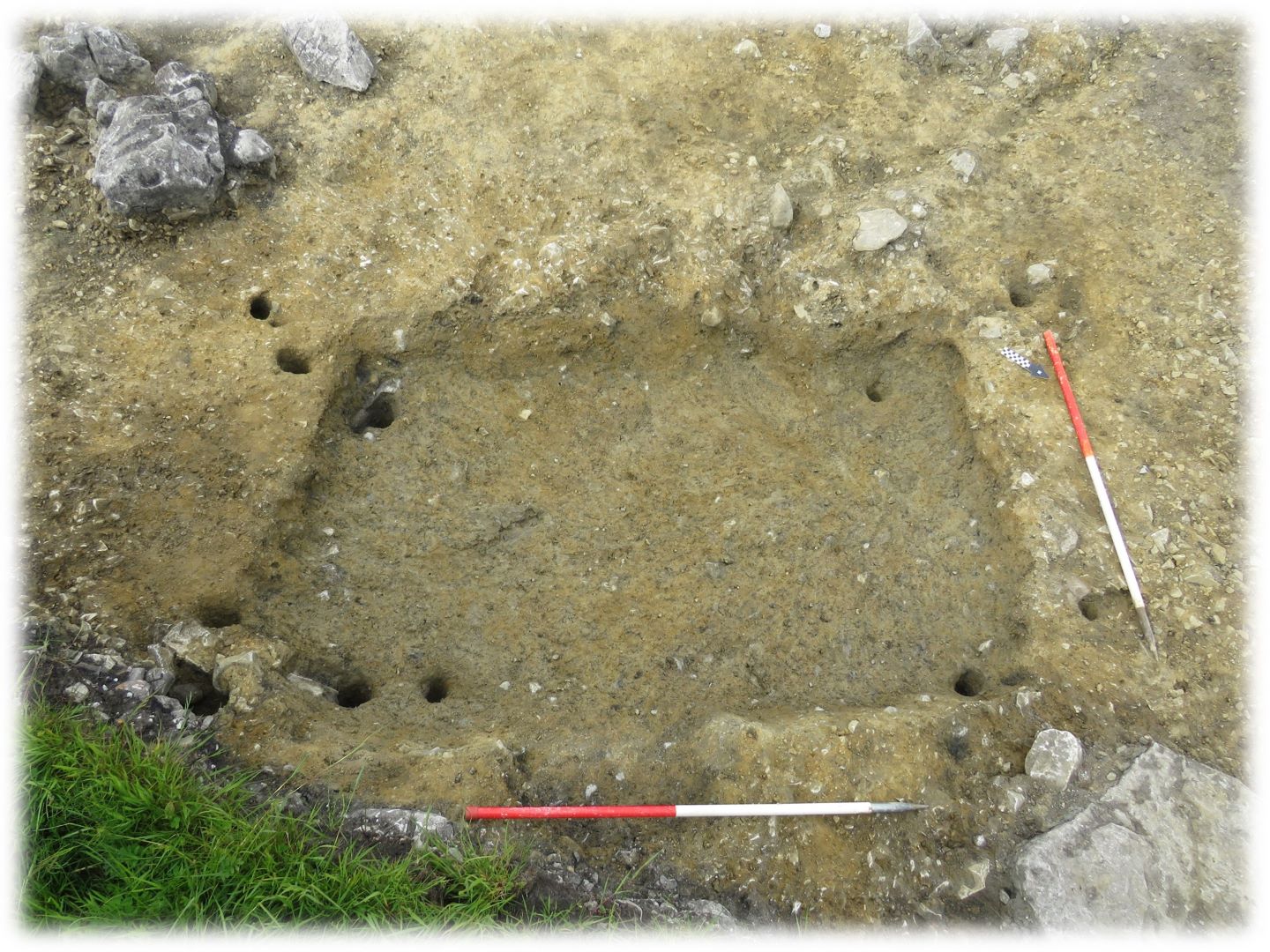
The on-site Stage (iii) Excavation Services at Tullen 1 were undertaken by AMS between 24 February and 22 May 2020. The northernmost burnt mound was fully exposed within the excavation area. It measured 25m (north-east/south-west) by 18.4m and was a maximum of 0.25m deep and was truncated by a large modern drain that extended the length of the site. One sub-rectangular trough, two pits and one spread were underlying the north-eastern segment of the burnt mound. The trough measured 2.2m by 1.9m in plan and was 0.22m deep; three post- and four stake-holes recorded along its inner corners suggested the trough was lined. Three cattle teeth, four horse teeth and a fragment of bone from a large mammal were recovered from its fill. A sample of ash charcoal from the fill of one of the post-holes returned a Late Bronze Age date of 825–778 cal. BC (UBA-47756; 2630±26BP).
A large pit was situated 0.9m southwest of the trough and measured 3.7m by 2.6m in plan and was 0.5m deep. It may have functioned as a well and a possible metalled surface along its gentle south-western slope could indicate a working surface or entryway. A sample of blackthorn/cherry charcoal in its basal fill returned a Late Bronze Age date of 1104–906 cal. BC (UBA-47755; 2831; 2831±26BP). Fragments of indeterminate calcined bone, seven calcined bones from a medium-sized animal such as sheep/goat or pig and calcined bone from a large-sized animal such as cow or horse were also recovered from its fills. Prolonged use or re-use of the site is suggested by the sub-circular re-cut of this pit. A light structure may have been used as indicated by the eight stake-holes recorded along its southern and eastern edges. A sample of hazel charcoal from the fill of the recut returned a Late Bronze Age/Early Iron Age date of 775–543 cal. BC (UBA-47754; 2505±26BP).
The western segment of the burnt mound overlay three pits and three spreads in close proximity to one another. The largest pit measured 1.94m by 1.7m in plan and was 0.72m deep and may have been used to collect water for nearby pyrolithic activity. Seventy-two fragments of indeterminate calcined bone, six calcined bones from a medium-sized animal such as sheep/goat or pig and a calcined bone from a large-sized animal such as cow or horse were recovered from its fill.
The second burnt mound was located at the south-eastern extent of the site and extended beyond the limit of excavation. It measured 16.2m by 8.6m in plan and was 0.15m deep and was truncated by a curvilinear boundary ditch. Fragments of indeterminate calcined animal bone were recovered from within the burnt mound material. One trough and eleven stake-holes were underlying the burnt mound while one post-hole was found beyond its western extent. The sub-rectangular trough measured 2.2m by 1.4m in plan and 0.2m deep. Five stake-holes along its inner corners suggest the trough was lined while six stake-holes along the outer edges may be evidence for a windbreak. The basal fill of the trough contained fragments of indeterminate calcined animal bone and a sample of hazel charcoal returned a Late Bronze Age/Early Iron Age date of 787–545 cal. BC (UBA-47757; 2520±25BP).
Post-medieval and modern agricultural features were also recorded at Tullen 1, including one field boundary ditch, two stone drains and eight furrows. The upper layers of the burnt mounds had been flattened and spread by agricultural activity, covering over some of the earlier agricultural phases (i.e. furrows) that cut underlying archaeological remains.
Six artefacts were recovered from the topsoil during the investigation, including two post-medieval pottery sherds, two undecorated clay pipe stems, an iron sickle and a flint flake. The charred wood remains comprised hazel, ash, oak, elm, blackthorn/cherry and pomaceous fruitwood.
The burnt spread is suggested to have a prehistoric date and may be associated with the burnt mounds recorded at Tullen 2 (Registration No. E5142; Cagney et al. 2022), c.230m southeast.
This report summary was submitted on behalf of its authors.
References
Cagney, L. McCulloch, B. and Kearney, K. 2022. N5 Ballaghaderreen to Scramoge Road Project Stage (iv) Final Report: Tullen 2. Unpublished report prepared by AMS on behalf of TII and RCC.
Hardy, C. 2021. N5 Ballaghaderreen to Scramoge Road Project Stage (i)a, (i)b, (i)c Test Excavation, Stage (i)m Testing in Felled Forestry and Stage (i)f Townland Boundary Survey. Ministerial Direction No. A077, Registration No. E5070. Unpublished AMS report for TII and RCC.

