2020:755 - BUMLIN (4), Roscommon
County: Roscommon
Site name: BUMLIN (4)
Sites and Monuments Record No.: N/A
Licence number: E5215
Author: Lydia Cagney, Breana McCulloch and Kevin Kearney, AMS
Author/Organisation Address: Fahy's Road, Kilrush, Clare
Site type: Burnt spread
Period/Dating: Bronze Age (2200 BC-801 BC)
ITM: E 595328m, N 780408m
Latitude, Longitude (decimal degrees): 53.773240, -8.070874
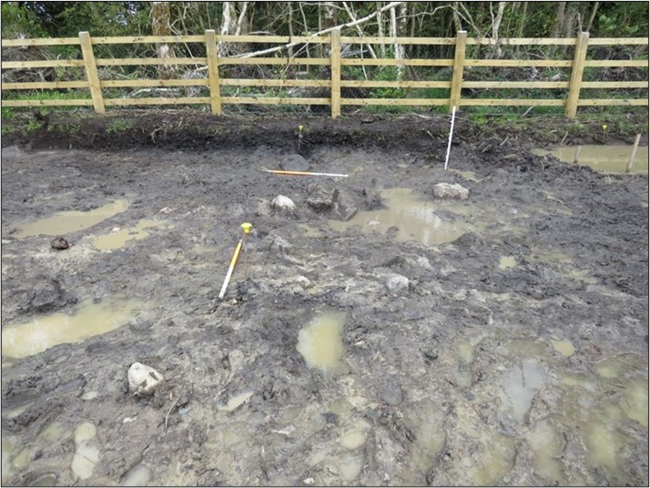
Bumlin 4 comprised a single burnt spread discovered in a felled forestry area that was excavated in advance of construction of the N5 Ballaghaderreen to Scramoge Road Project in County Roscommon by Archaeological Management Solutions (AMS) for Roscommon County Council (RCC) and Transport Infrastructure Ireland (TII). It was identified during Stage (i)m Test Excavations carried out by AMS under Ministerial Direction (Direction No. A077, Registration No. E5070; Hardy 2021).
The on-site Stage (iii) Excavation Services at Bumlin 4 were undertaken by AMS between 18–30 September 2020. The burnt spread comprised loosely compacted, charcoal-rich peaty sandy silt with frequent heat-shattered stone. It was irregular in plan and measured a maximum of 8.18m (north-west/south-east) by 5.21m and averaged 0.2m deep. No pits or troughs were recorded; however, the full extent of the site is unknown as it extended beyond the north-eastern limit of excavation. It is possible that in-situ features associated with this burnt spread are located outside of the area of excavation.
Charred wood macro-remains from the burnt spread consisted of oak, birch, ash, pomaceous fruitwood, hazel, elm and alder. A sample of hazel charcoal returned an Early Bronze Age date of 2134–1775 cal. BC (UBA-47428; 3599±49BP).
No artefacts were found during the investigation.
This report summary was submitted on behalf of its authors.
Reference
Hardy, C. 2021. N5 Ballaghaderreen to Scramoge Road Project Stage (i)a, (i)b, (i)c Test Excavation, Stage (i)m Testing in Felled Forestry and Stage (i)f Townland Boundary Survey. Ministerial Direction No. A077, Registration No. E5070. Unpublished AMS report for TII and RCC.

