2020:754 - BUMLIN (3), Roscommon
County: Roscommon
Site name: BUMLIN (3)
Sites and Monuments Record No.: N/A
Licence number: E005210
Author: Lydia Cagney, Alan Healy and Kevin Kearney, AMS
Author/Organisation Address: Fahy's Road, Kilrush, Clare
Site type: Charcoal-making site and Field boundary
Period/Dating: Medieval (AD 400-AD 1600)
ITM: E 595377m, N 780339m
Latitude, Longitude (decimal degrees): 53.772621, -8.070130
Bumlin 3 was excavated in advance of construction of the N5 Ballaghaderreen to Scramoge Road Project in County Roscommon by Archaeological Management Solutions (AMS) for Roscommon County Council (RCC) and Transport Infrastructure Ireland (TII). It was identified during Stage (i)m Test Excavations in Felled Forestry, carried out by AMS under Ministerial Direction (Direction No. A077, Registration No. E5070; Hardy 2021).
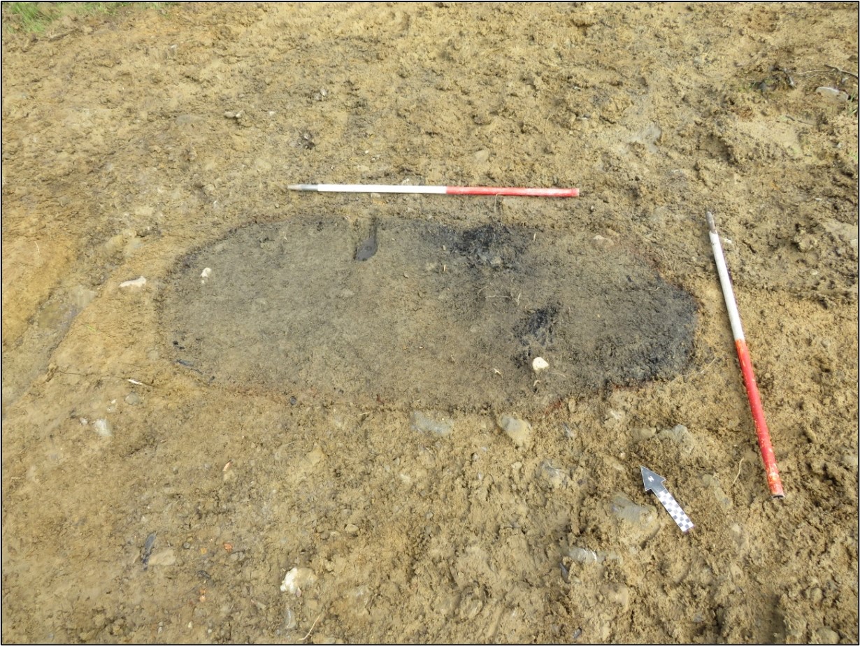
The excavation revealed a northwest–southeast orientated ditch/drain and a charcoal-production pit. The ditch/drain contained a single fill that was cut by the charcoal-production pit. This pit was sub-oval in plan and was orientated northwest–southeast. It was 1.78m long, 0.78m wide, 0.16m deep and contained two fills. The basal fill comprised softly compacted dark black silty clay containing frequent large pieces of charcoal. The upper fill was a softly compacted mid-brownish grey silty clay containing medium–large sub-angular and sub-rounded stones.
Charred wood macro-remains from the basal fill of the pit consisted exclusively of oak, a sample of which dated to the medieval period, cal. AD 1038–1213 (UBA-47427; 914±35BP). A rath (RO029-033—), located only c.90m to the south, was likely occupied at the time the pit was in use. The charcoal was likely produced for metalworking. Metalworking furnaces that have yet to be dated were found at Bumlin 5 c.100m to the northwest (Cagney & Healy 2022). The linear feature must pre-date the charcoal-production pit, but investigation revealed no evidence for its precise chronology. Its sterile fill, shallow depth and linear nature suggest it functioned to divide/demarcate agricultural land or as a drain.
This report summary was submitted on behalf of its authors.
References
Cagney, L. & Healy, A. 2022. N5 Ballaghaderreen to Scramoge Road Project Stage (iii) Post-Excavation Assessment Report: Bumlin 5. E5216. Unpublished AMS report for RCC and TII.
Hardy, C. 2021. N5 Ballaghaderreen to Scramoge Road Project Stage (i)a, (i)b, (i)c Test Excavation, Stage (i)m Testing in Felled Forestry and Stage (i)f Townland Boundary Survey. Ministerial Direction No. A077, Registration No. E5070. Unpublished AMS report for TII and RCC.