2020:753 - SCRAMOGE (2), Roscommon
County: Roscommon
Site name: SCRAMOGE (2)
Sites and Monuments Record No.: N/A
Licence number: E005169
Author: Gerry Mullins and Brigid Melloy, AMS
Author/Organisation Address: Fahy's Road, Kilrush, Clare
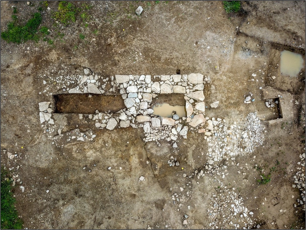
Site type: Structure and Field boundary
Period/Dating: Modern (AD 1750-AD 2000)
ITM: E 595763m, N 779835m
Latitude, Longitude (decimal degrees): 53.768095, -8.064267
Scramoge 2 was one of 24 post-medieval vernacular structures excavated as part of the Stage (iii) works in advance of construction of the N5 Ballaghaderreen to Scramoge Road Project in County Roscommon by Archaeological Management Solutions (AMS) for Roscommon County Council (RCC) and Transport Infrastructure Ireland (TII).
The nineteenth-century building was one of two depicted at the site on the six-inch Ordnance Survey (OS) map (1838), but it had disappeared by publication of the 25-inch OS map (1892). It was recorded in the Environmental Impact Assessment Report as CHC70 (Roughan & O’Donovan-AECOM 2017, 140). The subsurface remains of the vernacular structure were subsequently identified during Stage (i)a Standard Test Excavations, carried out by AMS under Ministerial Direction (Direction No. A077, Registration No. E5070) (Hardy 2021).
The building was c.7.4m by c.4m west-northwest–east-southeast. It had a rough stone and cobbled floor and is interpreted as a byre or outbuilding. It was part of a pre-Famine settlement arranged along the former east-bound main road into Strokestown. The settlement, including the structure excavated at Scramoge 2, was destroyed sometime between the surveying of the 1838 and the 1892 OS maps, although the residents were likely among the 187 people from Scramoge who were evicted in 1848 (Browne 1848).
Thirteen artefacts including a copper-alloy thimble, a coin, clay pipe, two iron pins, glass, a flint blade and a quern fragment were retrieved from the excavation. These have been analysed by the relevant specialists and dated generally to the eighteenth/nineteenth century, although the flint blade is of a Late Mesolithic date. Only this blade, found in the cobbled floor, may have been directly associated with the building. It may represent a folkloric artefact, possibly used in folk medicine or as a deposition of an apotropaic object.
This report summary was submitted on behalf of its authors.
References
Browne, G.J.P. 1848. ‘The Mahon Evictions’ in The Freeman’s Journal, [online] 26 April 1848, v.81, pp.2–3. Available at: The British Newspaper Archive https://www.britishnewspaperarchive.co.uk/viewer/BL/0000056/18480429/001/0001 [16 December 2022].
Hardy, C. 2021. N5 Ballaghaderreen to Scramoge Road Project Stage (i)a, (i)b, (i)c Test Excavation, Stage (i)m Testing in Felled Forestry and Stage (i)f Townland Boundary Survey. Ministerial Direction No. A077, Registration No. E5070. Unpublished AMS report for TII and RCC.
Roughan & O’Donovan-AECOM. 2017. N5 Ballaghaderreen to Scramoge Road Project Environmental Impact Assessment Report. TII and Roscommon National Road Design Office. Available at: http://www.roscommoncoco.ie/en/Services/Roads/Publications-and-Information/N5-Ballaghaderreen-to-Scramoge-Road-Project/Environmental-Impact-Assessment-Report/Volume-2B-EIAR-Chapter-11-19/00-EIAR.pdf. [Accessed 24 November 2021].