2020:752 - KILDALLOGE (6), Roscommon
County: Roscommon
Site name: KILDALLOGE (6)
Sites and Monuments Record No.: N/A
Licence number: E005225
Author: Gerry Mullins and Brigid Melloy, AMS
Author/Organisation Address: Fahy's Road, Kilrush, Clare
Site type: House - vernacular house
Period/Dating: Modern (AD 1750-AD 2000)
ITM: E 593159m, N 781551m
Latitude, Longitude (decimal degrees): 53.783487, -8.103803
Kildalloge 6 was excavated in advance of construction of the N5 Ballaghaderreen to Scramoge Road Project in County Roscommon by Archaeological Management Solutions (AMS) for Roscommon County Council (RCC) and Transport Infrastructure Ireland (TII). The subsurface remains of an eighteenth–nineteenth-century house were identified during Stage (i)a Standard Test Excavations, carried out by AMS under Ministerial Direction (Direction No. A077, Registration No. E5070) (Hardy 2021).
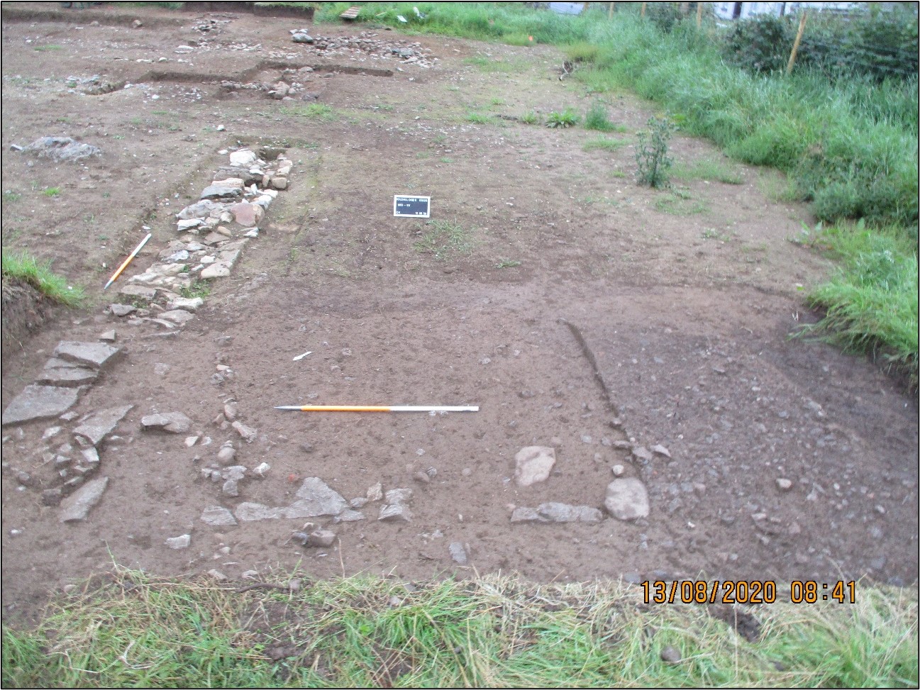
The site consisted of a demolished eighteenth–nineteenth-century house depicted on the six-inch Ordnance Survey (OS) map (1838) but not on the 25-inch OS map (1914). The structure was recorded in the Environmental Impact Assessment Report (EIAR) as Structure 2 of CHC58 (Roughan & O’Donovan-AECOM 2017, 323).
The demolished house comprised the partial remains of stone walls, cobbled surfaces, spreads of rubble from structure demolition and a stone-lined drain. The building was c.17m long and orientated north–south. It was built from mortared stone walls set into a shallow foundation trench. No evidence for an entrance or a hearth survived. An area of cobbling flanked the south wall of the building. A French drain was identified to the southeast of the house, although it may post-date the structure.
According to historical documentation, the structure at Kildalloge 6 was a pre-Famine dwelling, the inhabitants of which were likely evicted during the 1848 Mahon mass eviction. The townland was noted in rental records as having a substantial populace in the pre-Famine period, but by the surveying of the 25-inch OS map the dwelling had disappeared and the area around it was reforested. This likely occurred as part of the expansion and renovation of the Strokestown Estate in the post-Famine period.
A total of 67 artefacts were recovered during the investigation, which have been analysed by the relevant specialists and determined to date generally to the mid–late nineteenth century, reflecting the historical occupation. These artefacts included a glass rosary bead, four glass sherds, 23 post-medieval pottery sherds, four clay tobacco pipe stems and 35 metal objects. A selection of these has been recommended for retention for museum accession. The remainder will, subject to the approval of the NMI, be disposed of.
This report summary was submitted on behalf of its authors.
References
Hardy, C. 2021. N5 Ballaghaderreen to Scramoge Road Project Stage (i)a, (i)b, (i)c Test Excavation, Stage (i)m Testing in Felled Forestry and Stage (i)f Townland Boundary Survey. Ministerial Direction No. A077, Registration No. E5070. Unpublished AMS report for TII and RCC.
Roughan & O’Donovan-AECOM. 2017. N5 Ballaghaderreen to Scramoge Road Project Environmental Impact Assessment Report. TII and Roscommon National Road Design Office. Available at: http://www.roscommoncoco.ie/en/Services/Roads/Publications-and-Information/N5-Ballaghaderreen-to-Scramoge-Road-Project/Environmental-Impact-Assessment-Report/Volume-2B-EIAR-Chapter-11-19/00-EIAR.pdf. [Accessed 24 November 2021].