2020:749 - KILDALLOGE (5), Roscommon
County: Roscommon
Site name: KILDALLOGE (5)
Sites and Monuments Record No.: N/A
Licence number: E5141
Author: Gerry Mullins and Brigid Melloy, AMS
Author/Organisation Address: Fahy's Road, Kilrush, Clare
Site type: House - vernacular house
Period/Dating: Modern (AD 1750-AD 2000)
ITM: E 593246m, N 781548m
Latitude, Longitude (decimal degrees): 53.783462, -8.102483
Kildalloge 5 was excavated in advance of construction of the N5 Ballaghaderreen to Scramoge Road Project in County Roscommon by Archaeological Management Solutions (AMS) for Roscommon County Council (RCC) and Transport Infrastructure Ireland (TII).
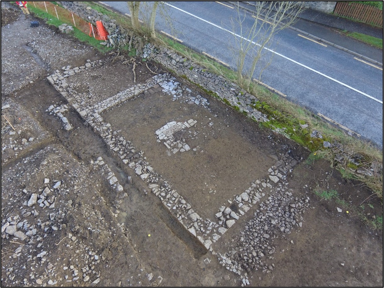
The site consisted of a vernacular structure marked on the first-edition six-inch Ordnance Survey (OS) map (1838) and recorded in the Environmental Impact Assessment Report as CHC59 (Roughan & O’Donovan-AECOM 2017, 325). The structure was not depicted on the 25-inch OS map (1914). However, a local resident recalled that the building was inhabited up until 80 years ago. Stage (i) testing confirmed that the site consisted of remains consistent with the foundation of a vernacular structure (Hardy 2021).
The excavation revealed the outline of two east–west-aligned buildings, one of which abutted the other. The earlier building was 8.93m by 5.2m in plan and a drain in its floor suggests it may have functioned as a byre dwelling. It also contained the trace of an internal division and a hearth. The later building was 5.2m by 3.9m in plan and its floor was cobbled.
A total of 159 artefacts were uncovered at the site, comprising assemblages of clay pipe fragments, metal artefacts, pottery and glass and a single incomplete leather shoe. The artefacts range in date from the late eighteenth to the early twentieth centuries.
References to the townland are found in historical records and censuses, but no direct connection can be made between the named families and the dwelling itself. The structure at Kildalloge 5 was a pre-Famine structure that was demolished in the post-Famine period as part of the land reorganisation in the Strokestown demesne.
This report was submitted on behalf of its authors.
References
Hardy, C. 2021. N5 Ballaghaderreen to Scramoge Road Project Stage (i)a, (i)b, (i)c Test Excavation, Stage (i)m Testing in Felled Forestry and Stage (i)f Townland Boundary Survey. Ministerial Direction No.: A077, Registration No.: E5070. Unpublished AMS report for RCC and TII.
Roughan & O’Donovan-AECOM. 2017. N5 Ballaghaderreen to Scramoge Road Project Environmental Impact Assessment Report. TII and Roscommon National Road Design Office. Available at: http://www.roscommoncoco.ie/en/Services/Roads/Publications-and-Information/N5-Ballaghaderreen-to-Scramoge-Road-Project/Environmental-Impact-Assessment-Report/Volume-2B-EIAR-Chapter-11-19/00-EIAR.pdf. [Accessed 29 January 2021].