2020:747 - KILDALLOGE (2), Roscommon
County: Roscommon
Site name: KILDALLOGE (2)
Sites and Monuments Record No.: N/A
Licence number: E005224
Author: Gerry Mullins and Brigid Melloy, AMS
Author/Organisation Address: Fahy's Road, Kilrush, Clare
Site type: House - vernacular house
Period/Dating: Modern (AD 1750-AD 2000)
ITM: E 593562m, N 781864m
Latitude, Longitude (decimal degrees): 53.786305, -8.097695
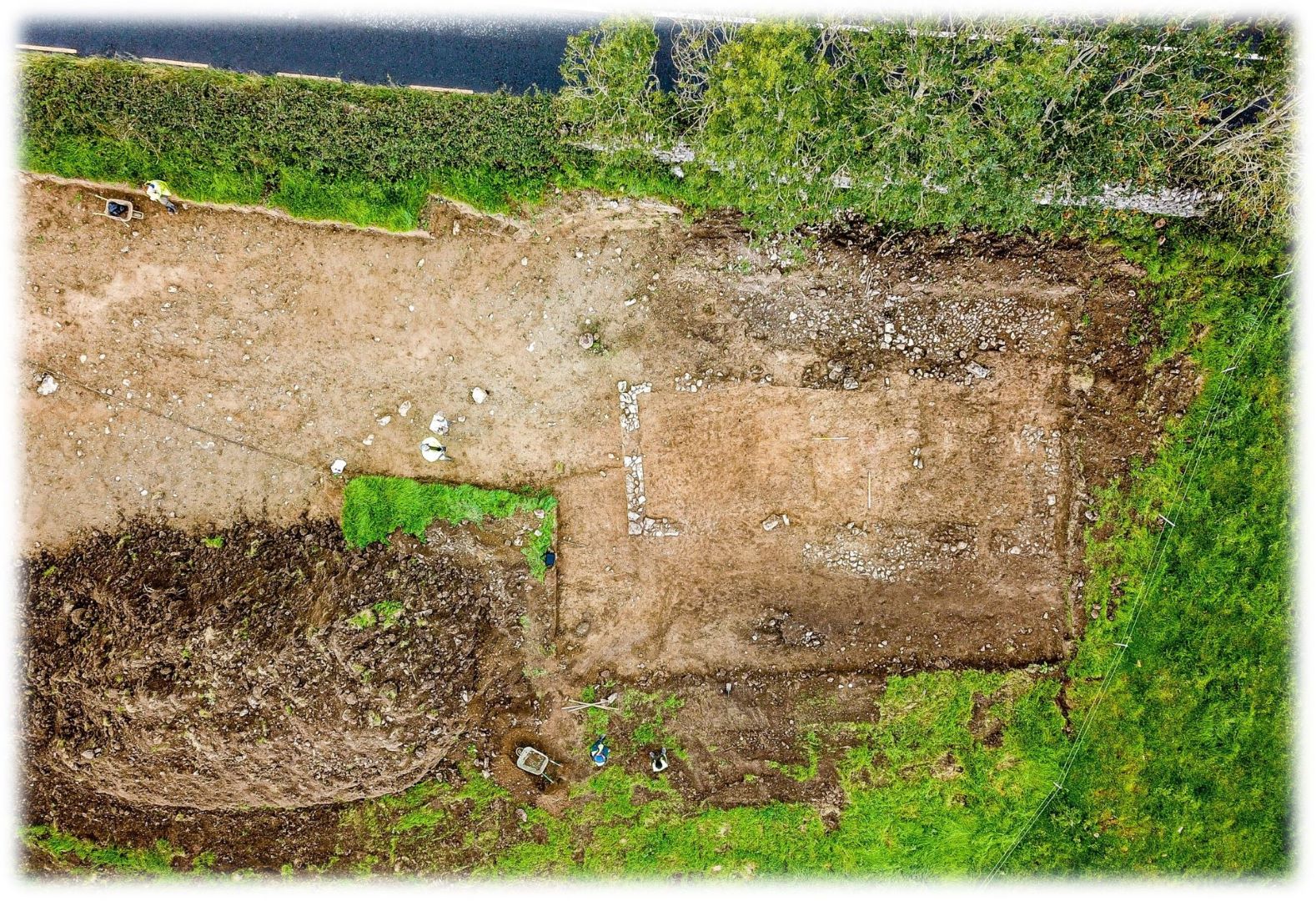
Kildalloge 2 was excavated in advance of construction of the N5 Ballaghaderreen to Scramoge Road Project in County Roscommon by Archaeological Management Solutions (AMS) for Roscommon County Council (RCC) and Transport Infrastructure Ireland (TII). The site consisted of a vernacular structure and cobbled surfaces. The structure was initially identified as one of eight roadside structures marked on the first-edition six-inch Ordnance Survey (OS) map (1838) in this area and recorded in the Environmental Impact Assessment Report as CHC61 (Roughan & O’Donovan-AECOM 2017, 325). The cobbled surface, initially interpreted as a road, was located during Stage (i)a Standard Test Excavations carried out by Archaeological Management Solutions (AMS) under Ministerial Direction (No. A077, Registration No. E5070) (Hardy 2021). The structure was later discovered during topsoil stripping of the area associated with stage (ii) Pre-Excavation Services. It was near the location on which such a structure was marked on the first-edition six-inch OS map (1838). It is not indicated on the 25-inch OS map (1914) and was therefore likely removed before 1914.
The archaeological excavations uncovered the remains of a vernacular structure and cobbled surfaces. The structure was rectangular with angular corners and measured 12.6m by 4.9m in plan. It was orientated north-east/south-west, had a clay floor and was divided internally into two rooms. Evidence of a possible hearth was located c.1.5m southwest of the internal wall. No artefacts were found during the course of the excavation. The cobbled surfaces were located northwest of the structure and are likely the remains of a yard to the front of the building as indicated on the first-edition six-inch OS map.
This report was submitted on behalf of its authors.
References
Hardy, C. 2021. N5 Ballaghaderreen to Scramoge Road Project Stage (i)a, (i)b, (i)c Test Excavation, Stage (i)m Testing in Felled Forestry and Stage (i)f Townland Boundary Survey. Ministerial Direction No. A077, Registration No. E5070. Unpublished AMS report for TII and RCC.
Roughan & O’Donovan-AECOM. 2017. N5 Ballaghaderreen to Scramoge Road Project Environmental Impact Assessment Report. TII and Roscommon National Road Design Office. Available at: http://www.roscommoncoco.ie/en/Services/Roads/Publications-and-Information/N5-Ballaghaderreen-to-Scramoge-Road-Project/Environmental-Impact-Assessment-Report/Volume-2B-EIAR-Chapter-11-19/00-EIAR.pdf. [Accessed 29 January 2021].