2020:743 - CREGGA (3), Roscommon
County: Roscommon
Site name: CREGGA (3)
Sites and Monuments Record No.: N/A
Licence number: A077 E5173
Author: Eve Campbell, Archaeological Management Solutions
Author/Organisation Address: Fahy's Road, Kilrush, Co. Clare
Site type: Road - road/trackway
Period/Dating: Modern (AD 1750-AD 2000)
ITM: E 590611m, N 785821m
Latitude, Longitude (decimal degrees): 53.821819, -8.142595
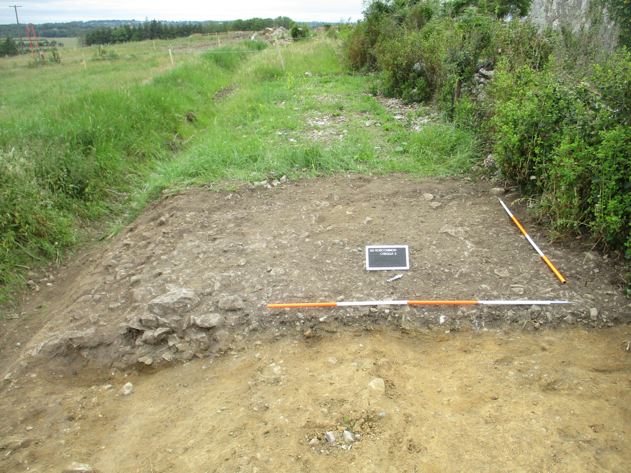
Cregga 3 was excavated in advance of construction of the N5 Ballaghaderreen to Scramoge Road Project in County Roscommon by Archaeological Management Solutions (AMS) for Roscommon County Council and Transport Infrastructure Ireland. The site consisted of a section of relict roadway initially shown on the Roscommon Grand Jury Map (1817) and subsequently on the six-inch and 25-inch OS maps (1838; 1914). It was noted in the EIAR as a “significant feature of the local landscape” (Roughan & O’Donovan-AECOM 2017, Chapter 14, 14). The subsurface remains of the feature were subsequently revealed during Stage (i)a Standard Test Excavations carried out by AMS under Ministerial Direction No. A077 (Registration No. E5070; Hardy 2021).
At Cregga 3, a single cutting measuring 4.8m by 5.9m south-west/north-east was excavated with the aim of investigating the form and composition of the road. The excavation showed that the road lay under a thin covering of topsoil and was built directly on the subsoil. The road surface itself was 4.9m wide and 0.06–0.32m deep. It was composed of a deposit of small to medium angular limestone cobbles and gravel (ranging in size from 0.04m x 0.02m to 0.32m x 0.2m) in a matrix of mid-greyish brown silty clay. It was thickest at the downslope (south-western) side, where larger stones had been used to build up a level surface. The road had a distinct camber on its south-western side.
The road section at Cregga 3 is part of a historic roadway running north-west/south-east across the western slopes of Cregga Hill. The road runs for a total of c.1.68km, branching off the R368 Elphin–Strokestown road in the south of Lugboy townland, and re-joining it at a crossroads to the south of Cregga townland.
The first-edition six-inch map (1838) is the first detailed depiction of the road. The map indicated that by 1838 the road had been bypassed by a slightly larger road that skirted around the base of Cregga Hill, rather than traversing its slopes. Despite being bypassed by a more convenient road around the base of the hill, the “old line” at Cregga persisted as a local routeway. The 25-inch OS map (1914) and revised six-inch map (1914) both show the road, marking it as a footpath for most of its course. The route went out of use at some time in the twentieth century, being incorporated into the adjoining improved pasture fields.
References
First-edition six-inch OS map 1838. Available at: https://webapps.geohive.ie/
First-edition 25-inch OS map 1914. Available at: https://webapps.geohive.ie/
Hardy, C. 2021. N5 Ballaghaderreen to Scramoge Road Project Stage (i)a, (i)b, (i)c Test Excavation, Stage (i)m Testing in Felled Forestry & Stage (i)f Townland Boundary Survey. Ministerial Direction No. A077, Registration No. E5070. Unpublished AMS report for RCC and TII.
Roughan & O’Donovan-AECOM. 2017. N5 Ballaghaderreen to Scramoge Road Project Environmental Impact Assessment Report. TII and Roscommon National Road Design Office. Available at: http://www.roscommoncoco.ie/