2020:742 - CREGGA (2), Roscommon
County: Roscommon
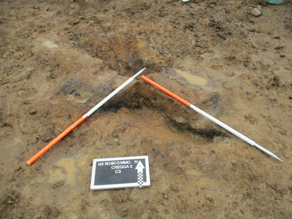
Site name: CREGGA (2)
Sites and Monuments Record No.: N/A
Licence number: A077 E5172
Author: Eve Campbell, Archaeological Management Solutions
Author/Organisation Address: Fahy's Road, Kilrush, Co. Clare
Site type: Pit
Period/Dating: Multi-period
ITM: E 591113m, N 785411m
Latitude, Longitude (decimal degrees): 53.818143, -8.134960
Cregga 2 was excavated in advance of construction of the N5 Ballaghaderreen to Scramoge Road Project in County Roscommon by Archaeological Management Solutions (AMS) for Roscommon County Council (RCC) and Transport Infrastructure Ireland (TII). The site consisted of a charcoal-rich oblong pit, a small pit containing burnt bone, and a gully relating to post-medieval agricultural activities. The site lay in pasture fields on the southern slopes of Cregga Hill. It was initially identified during Stage (i)a Standard Test Excavations carried out by AMS under Ministerial Direction (Direction No. A077, Registration No. E5070; Hardy 2021).
The charcoal-rich pit had an oblong-shaped cut, was orientated northwest to southeast, and measured 1.73m long, 0.85m wide and 0.26m deep. The pit had two fills; the lower fill contained an abundance of oak charcoal, while the upper fill was derived from the backfilling of the pit. A sample of oak charcoal from the basal fill of the oblong pit was dated to the Later Neolithic period, cal. 2881–2632 BC (UBA-46762; 4167±27BP).
A second smaller pit was located 3.8m to the southeast. It was irregular in plan, 0.4m long, 0.3m wide, 0.12m deep and abutted a small boulder embedded in the subsoil. The pit had a single fill which contained burnt bone, charcoal flecks, charred seeds, and burnt clay. The majority of the burnt bone was too fragmented to be identified to species, but four fragments were from a medium-sized animal, probably a sheep. A sample of willow charcoal from the small pit was dated to the Middle Bronze Age, cal. 1496–1284 BC (UBA-46761; 3124±38BP).
The third feature identified within the excavation area was a gully relating to agricultural activities, which extended from the north-west corner of the cutting and ran southeast for c.7.9m. It was up to 2.1m wide and 0.22m deep. This gully is coaxial with a series of historic cultivation ridges clearly visible on LiDAR imagery and is likely to be a subsurface expression of these ridges.
No artefacts were found during the investigations.
Reference
Hardy, C. 2021. N5 Ballaghaderreen to Scramoge Road Project Stage (i)a, (i)b, (i)c Test Excavation, Stage (i)m Testing in Felled Forestry and Stage (i)f Townland Boundary Survey. Ministerial Direction No. A077, Registration No. E5070. Unpublished AMS report for TII and RCC.