2020:740 - CORSKEAGH (2), Roscommon
County: Roscommon
Site name: CORSKEAGH (2)
Sites and Monuments Record No.: N/A
Licence number: A077 E5186
Author: Eve Campbell, Archaeological Management Solutions
Author/Organisation Address: Fahy's Road, Kilrush, Co. Clare
Site type: House - 19th century
Period/Dating: Modern (AD 1750-AD 2000)
ITM: E 572379m, N 790548m
Latitude, Longitude (decimal degrees): 53.863647, -8.419913
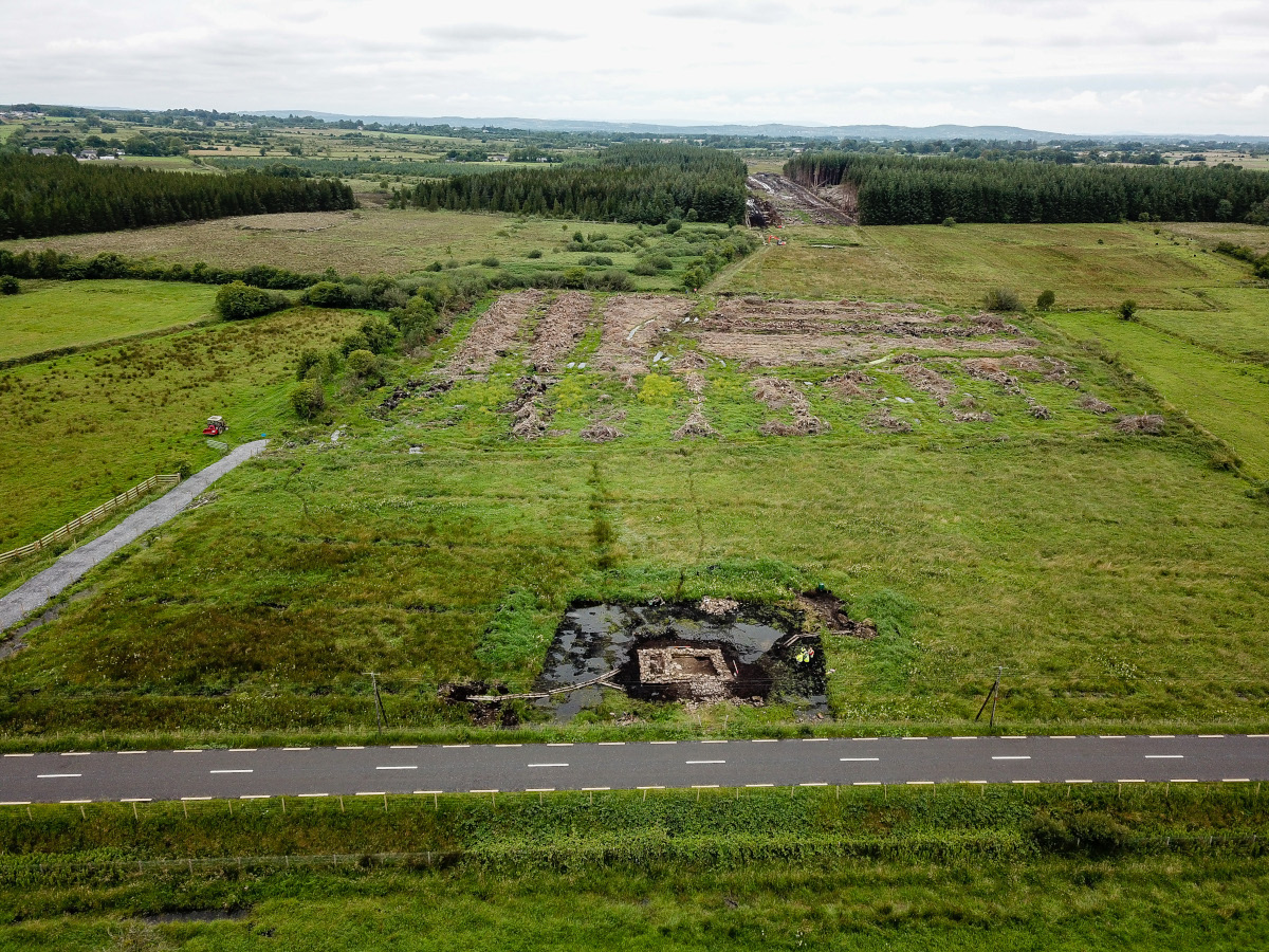
Corskeagh 2 was excavated in advance of construction of the N5 Ballaghaderreen to Scramoge Road Project in County Roscommon by Archaeological Management Solutions (AMS) for Roscommon County Council (RCC) and Transport Infrastructure Ireland (TII). The subsurface remains of a vernacular structure were identified during Stage (i)a Standard Test Excavations carried out by AMS under Ministerial Direction (Direction No. A077, Registration No. E5070) (Hardy 2021). The structure was recorded in the Environmental Impact Assessment Report as CHC13 (Roughan & O’Donovan-AECOM 2017, 140).
Excavation at Corskeagh 2 uncovered the remains of a small sub-rectangular dwelling, 7.65–8m by 5.10–5.30m northeast–southwest. The building was divided into two rooms: the smaller room (Room 1) occupied the southwestern third of the building; it was 3.46m northwest–southeast and 1.36–1.44m southwest–northeast and had a stone and clay floor. The larger room (Room 2) occupied the northeastern two-thirds of the building; it was 3.4–3.45m northwest–southeast and 3.58–4.08m southwest–northeast and had a clay floor. The rooms were divided by an internal wall (C.4) with a hearth in its northeast side facing into Room 2. An external doorway was located in the northeast end of the southeast wall entering Room 2; a second probable external doorway was located midway along the southwest wall. There was no evidence for an internal door between Rooms 1 and 2. A sample of mortar indicated the use of lime mortar in the dwelling’s construction.
A total of 1,246 artefacts were found during the investigation. Most of the assemblage dates to the nineteenth century, with some artefacts extending occupation into the twentieth century. This matches with historical records which suggests that the site was occupied from at least the early nineteenth century, when the dwelling appeared on the first-edition six-inch Ordnance Survey (OS) map (1838), to the early twentieth century, as the dwelling was still extant on the 25-inch OS map (1914). Griffith’s Valuation (1857–58) recorded a Mary Burke as occupying the dwelling, leasing from the Rt. Hon. and Rev. Lord John De Freyne of Frenchpark Demesne. No direct link could be made between later Corskeagh residents recorded by the censuses and the dwelling at Corskeagh 2.
Among the artefacts recovered were four objects of worked bone, 36 metal objects, 140 clay tobacco pipe fragments, 1,054 sherds of post-medieval pottery, 328 pieces of post-medieval glass, one brick, a glass crucifix and two ceramic buttons. Of interest in the artefact assemblage is a bone crochet hook, a rare find in an archaeological context, which offers a glimpse into nineteenth-century Irish crochet lace-making, a cottage industry that likely helped the residents of Corskeagh 2 supplement their income. This supplement may have allowed the residents access to the imported goods found in the remainder of the assemblage, including English refined wares and a possible American glass crucifix candlestick. The remainder of the artefact assemblage indicated an active household engaged in agricultural work along with the possible lace-making.
References
Hardy, C. 2021. N5 Ballaghaderreen to Scramoge Road Project Stage (i)a, (i)b, (i)c Test Excavation, Stage (i)m Testing in Felled Forestry and Stage (i)f Townland Boundary Survey. Ministerial Direction No. A077, Registration No. E5070. Unpublished AMS report for TII and RCC.
Roughan & O’Donovan-AECOM. 2017. N5 Ballaghaderreen to Scramoge Road Project Environmental Impact Assessment Report. TII and Roscommon National Road Design Office. Available at: http://www.roscommoncoco.ie/en/Services/Roads/Publications-and-Information/N5-Ballaghaderreen-to-Scramoge-Road-Project/Environmental-Impact-Assessment-Report/Volume-2B-EIAR-Chapter-11-19/00-EIAR.pdf. [Accessed 24 November 2021].