2020:739 - Corskeagh 1, Roscommon
County: Roscommon
Site name: Corskeagh 1
Sites and Monuments Record No.: N/A
Licence number: A077; E5185
Author: Eve Campbell
Author/Organisation Address: Archaeological Management Solutions, Fahy's Road, Kilrush, Co. Clare
Site type: Burnt spread
Period/Dating: Bronze Age (2200 BC-801 BC)
ITM: E 572228m, N 790858m
Latitude, Longitude (decimal degrees): 53.866424, -8.422237
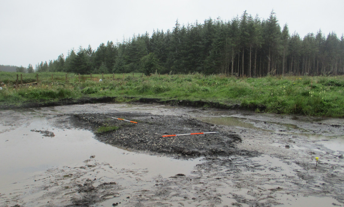
Corskeagh 1 was excavated in advance of construction of the N5 Ballaghaderreen to Scramoge Road Project in County Roscommon by Archaeological Management Solutions (AMS) for Roscommon County Council (RCC) and Transport Infrastructure Ireland (TII). The site consisted of a burnt spread located in a low-lying field of damp pasture (79m OD), south of a conifer plantation, c.340m northwest of the R361 Frenchpark to Castlerea Road. It was initially identified during Stage (i)a Test Excavations, carried out by AMS under Ministerial Direction (Direction No. A077, Registration No. E5070; Hardy 2021). The Environmental Impact Assessment Report recorded three fulachtaí fia (RO015-060001-, RO0105-060002- & RO015-060003-) clustered together c.500m south of Corskeagh 1 outside the road corridor (Roughan & O’Donovan-AECOM 2017).
A single cutting was opened at the site, measuring c.21.5 by c.15m (329m2). The archaeological remains consisted of a burnt spread sealing a wood-lined trough, a brushwood-lined pit and an unlined pit. The burnt spread was sub-oval in plan (10m x 4.5m), orientated east to west, and up to 0.18m deep. It comprised a dark brownish-black deposit of burnt red and yellow sandstone and charcoal in a matrix of sandy peat. The trough was irregular in plan and measured 1.7m by 1.4m; it was up to 0.16m deep. It had a timber lining consisting of three poorly preserved unconverted ash, alder and oak roundwoods set parallel to each other across the width of the cut. A sample of waterlogged alder from the trough lining returned an Early Bronze Age date of 2132–1899 cal. BC (UBA-47429; 3635±30). This timber lining was covered by a single fill of soft, dark reddish-brown peat with frequent inclusions of charcoal and medium-sized angular stones.
On the north-west side, the trough cut a small sub-circular brushwood-lined pit with a single fill of soft, dark brown peat with frequent charcoal and occasional hazelnut shells. A second pit was located 2.3m to the northeast of the trough, measuring 1.36m by 1.3m and up to 0.15m deep. It contained three fills: a basal fill (0.65m x 0.5m x 0.04m) of moderately compact sandy silt with frequent inclusions of heat-shattered stone and charcoal; a secondary fill (0.8m x 0.58m x 0.03m) of loose, light brown sand with inclusions of heat-shattered stone; and an upper fill (1.36m x 1.3m x 0.15m) of mottled blackish brown silty sand with frequent burnt stone and occasional charcoal.
No artefacts were found during the investigations on site. Charred wood remains from the burnt spread and fill of the unlined pit consisted of ash, hazel, oak, birch, pomaceous fruitwood and alder. Organic residue (lipid) analysis from a sample of stone from the fill of the unlined pit suggests the presence of vegetation-derived organic matter of a woody origin, possibly roots found in soil.
References
Hardy, C. 2021. N5 Ballaghaderreen to Scramoge Road Project Stage (i)a, (i)b, (i)c Test Excavation, Stage (i)m Testing in Felled Forestry and Stage (i)f Townland Boundary Survey. Ministerial Direction No. A077, Registration No. E5070. Unpublished AMS report for TII and RCC.
Roughan & O’Donovan-AECOM. 2017. N5 Ballaghaderreen to Scramoge Road Project Environmental Impact Assessment Report. Roscommon: TII and Roscommon National Road Design Office. Available at: http://www.roscommoncoco.ie/en/Services/Roads/Publications-and-Information/N5-Ballaghaderreen-to-Scramoge-Road-Project/Environmental-Impact-Assessment-Report/Volume-2B-EIAR-Chapter-11-19/00-EIAR.pdf [Accessed: 29 January 2021]