2020:735 - LEGGATINTY (8), Roscommon
County: Roscommon
Site name: LEGGATINTY (8)
Sites and Monuments Record No.: N/A
Licence number: E5246
Author: Brian O'Hara and Kevin Kearney, AMS
Author/Organisation Address: Fahy's Road, Kilrush, Clare
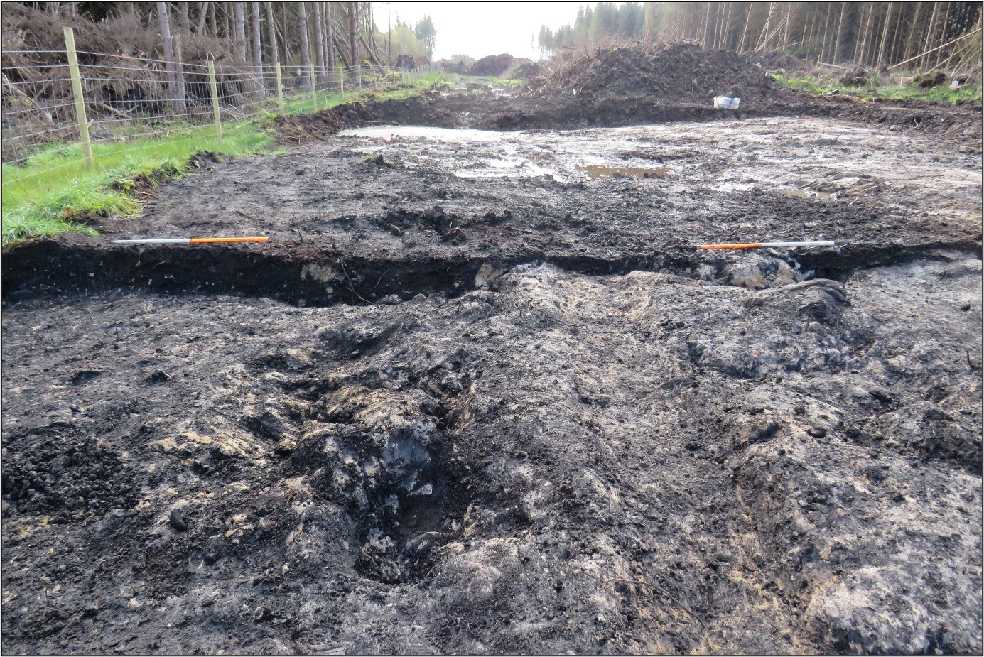
Site type: Burnt spread
Period/Dating: Bronze Age (2200 BC-801 BC)
ITM: E 572652m, N 790075m
Latitude, Longitude (decimal degrees): 53.859411, -8.415721
Leggatinty 8 was excavated in advance of construction of the N5 Ballaghaderreen to Scramoge Road Project in County Roscommon by Archaeological Management Solutions (AMS) for Roscommon County Council and Transport Infrastructure Ireland. The site consisted of a burnt spread located in boggy terrain in felled forestry. It was identified during Stage (i) Test Excavations, carried out by AMS under Ministerial Direction (Direction No. A077, Registration No. E5070; Hardy 2021).
The on-site works Stage (iii) Excavation and Post-excavation Assessment Services were undertaken between 14 and 23 October 2020.
The burnt spread consisted of a layer of moderately compacted, charcoal-rich silty clay and frequent heat-shattered stone 11.71m long, 6.89m wide and 0.15–0.46m deep. The spread extended outside of the road-take and it is likely that associated cut features, such as pits and troughs, are located there. A layer of mid-brown peat with frequent inclusions of wood fragments, 1.62m long, 1.22m wide and 0.09–0.14m deep, lay on top of the spread and a north–south-orientated drain, 0.57m wide and 0.1–0.16m deep, traversed the excavation area and cut the surface of the burnt spread.
No artefacts were found during the investigation. Palaeoenvironmental analysis of the burnt spread identified charred wood macro-remains of alder, hazel, oak, pomaceous fruitwood and willow. A sample of willow charcoal returned a Middle to Late Bronze Age date of 1264–1055 cal. BC (UBA-46770; 2963±24BP). Another burnt spread—Leggatinty 7 (O’Hara 2022)—c.70m to the south was also excavated as part of the same scheme; that site has yet to be dated.
This report summary was submitted on behalf of its authors.
References
Hardy, C. 2021. N5 Ballaghaderreen to Scramoge Road Project Stage (i)a, (i)b, (i)c Test Excavation, Stage (i)m Testing in Felled Forestry and Stage (i)f Townland Boundary Survey. Ministerial Direction No. A077, Registration No. E5070. Unpublished AMS report for TII and RCC.
O’Hara, B. 2022. N5 Ballaghaderreen to Scramoge Road Project Stage (iii) Post-Excavation Assessment Report: Leggatinty 7 E5247. Unpublished report prepared by AMS on behalf of TII and RCC.