2020:734 - LEGGATINTY (6), Roscommon
County: Roscommon
Site name: LEGGATINTY (6)
Sites and Monuments Record No.: N/A
Licence number: E5248
Author: Brian O'Hara and Brigid Melloy, AMS
Author/Organisation Address: Fahy's Road, Kilrush, Clare
Site type: House - 19th/20th century
Period/Dating: Modern (AD 1750-AD 2000)
ITM: E 572787m, N 789711m
Latitude, Longitude (decimal degrees): 53.856147, -8.413637
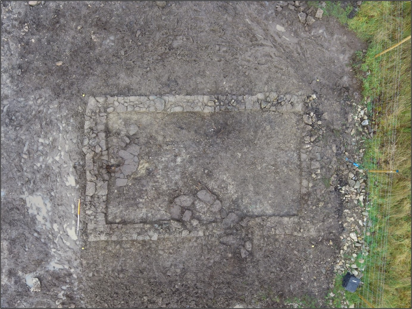
Leggatinty 6 was excavated in advance of construction of the N5 Ballaghaderreen to Scramoge Road Project in County Roscommon by Archaeological Management Solutions (AMS) for Roscommon County Council and Transport Infrastructure Ireland. The remains were discovered during Stage (i)a Standard Test Excavations, carried out by AMS under Ministerial Direction (Direction No. A077, Registration No. E5070; Hardy 2021). The site consisted of a vernacular structure marked on the first-edition 25-inch OS map (1914), but not on the first-edition six-inch OS map (1838).
The excavation revealed a rectangular south-west/north-east-orientated structure measuring 7.6m by 4.7m externally. Originally, it had opposing doorways in its longer walls; however, the north-western one was blocked up during the life of the building. There were remnants of a flagstone floor extending inside the building from the south-eastern entrance and against the interior of the south-west wall. A charcoal-rich deposit on the flagstones against the south-west wall is likely the remnants of a hearth. Sixteen sherds of post-medieval pottery, five sherds of glass and eleven metal objects were recovered from the topsoil over the foundations of the structure. These have been dated to the 19th–20th centuries.
The Books of Survey and Distribution for Roscommon (Simington 1949) list the townland as being owned first by Cormuck Mc Dermot in 1641 and then William Davis 1670, whose family still owned the townland by the time of Griffith’s Valuation (1857–58). It was described as bog land, with no associated buildings. By 1901, there were 40 private dwellings in Leggatinty, however, it is not possible to directly link any of these buildings to the structure excavated at Leggatinty 6.
This report summary was submitted on behalf of its authors.
References
Griffith, R. J. 1857. General Valuation of Rateable Property in Ireland. Roscommon. Dublin: Alexander Thom & Sons.
Hardy, C. 2021. N5 Ballaghaderreen to Scramoge Road Project Stage (i)a, (i)b, (i)c Test Excavation, Stage (i)m Testing in Felled Forestry & Stage (i)f Townland Boundary Survey. Ministerial Direction No. A077, Registration No. E5070. Unpublished AMS report for RCC and TII.
Simington, R. C. (1949) Books of Survey and Distribution being abstracts of various surveys and instruments of title 1636–1703 vol. i county of Roscommon with maps c. 1636 of the baronies of Athlone and Moycarnan and of parishes in Ballintober (4 vols 1949–67) [Accessed December 2, 2021]. Available from: https://www.irishmanuscripts.ie/product/books-of-survey-and-distribution-being-abstracts-of-various-surveys-and-instruments-of-title-1636-1703-vol-i-county-of-roscommon-with-maps-c-1636-of-the-baronies-of-athlone-and-moycarnan-and/