2020:615 - CARTRONAGOR (7), Roscommon
County: Roscommon
Site name: CARTRONAGOR (7)
Sites and Monuments Record No.: N/A
Licence number: Registration No. E5202, Ministerial Direction No. A077
Author: John Channing
Author/Organisation Address: c/o Archaeological Management Solutions Ltd, Fahy’s Road, Kilrush, Co. Clare
Site type: Burnt spread and Pit
Period/Dating: Chalcolithic (2500 BC-2201 BC)
ITM: E 582823m, N 787648m
Latitude, Longitude (decimal degrees): 53.838038, -8.260977
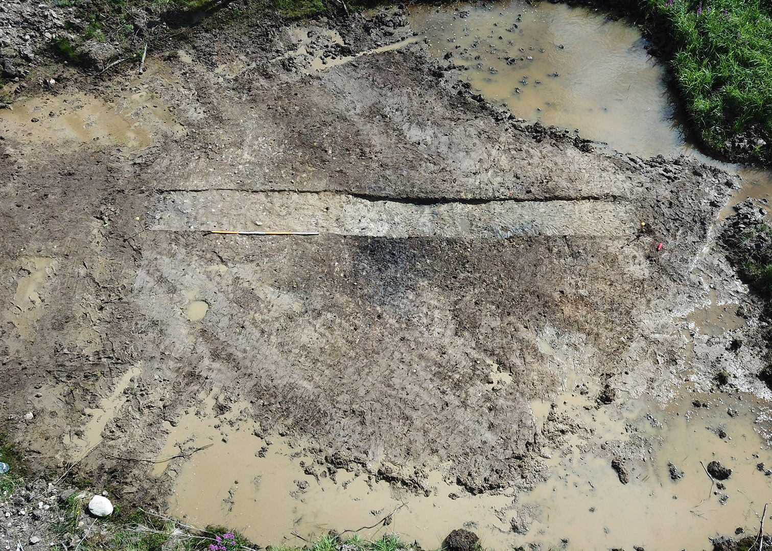
Cartronagor 7 was excavated in advance of construction of the N5 Ballaghaderreen to Scramoge Road Project in County Roscommon for Roscommon County Council (RCC) and Transport Infrastructure Ireland (TII). The site consisted of a burnt spread and trough located in boggy terrain in felled forestry. It was identified during Stage (i)m Test Excavations, carried out by AMS under Ministerial Direction (Direction No. A077, Registration No. E5070) (Hardy 2021).
The burnt spread consisted of a layer of charcoal-rich dark greyish-black silty sand containing frequent heat-shattered sandstone. It was sub-rectangular in plan, 6.9m long by 5.57m wide and averaged 0.1m deep. A trough was located under the southern portion of the burnt spread. It possessed a sharp break of slope at surface and medium at base giving a rounded flat-bottomed, bucked-shaped profile and was sub-oval in plan; it measured 1.1m in length, 0.75m wide and 0.26m deep. There was no evidence for any lining. It contained two fills. The lower fill averaged 0.08m in depth and comprised dark grey sandy silt that was charcoal rich with inclusions of heat-discoloured and shattered sandstone. A sample of hazel charcoal from this fill was dated to the Late Neolithic/Chalcolithic period (2574–2347 cal. BC). The upper fill averaged 0.18m in depth and consisted of mixed greyish-black sandy silt with charcoal flecks and greater than 80% of its volume comprised angular heat-shattered sandstone similar to that in in the burnt spread.
The remnants of a parallel set of agricultural furrows ran over the burnt spread on an approximate west–east line. The furrows were faint and often barely visible. They had gently sloping sides, concave bases and measured over 5m long, 0.3m wide and 0.04–0.1m deep. Their fills were indistinguishable from the topsoil (C.1) and were largely disturbed by the forestry.
No artefacts were found during the investigation. Palaeo-environmental analysis identified oak, ash and hazel as the principal charred wood remains in the basal fill of the trough, while both oak and ash were also recorded from the burnt spread.
Reference
Hardy, C. 2021. N5 Ballaghaderreen to Scramoge Road Project Stage (i)a, (i)b, (i)c Test Excavation, Stage (i)m Testing in Felled Forestry and Stage (i)f Townland Boundary Survey. Ministerial Direction No. A077, Registration No. E5070. Unpublished AMS report for TII and RCC.