2020:610 - CARRTRONAGOR (6), Roscommon
County: Roscommon
Site name: CARRTRONAGOR (6)
Sites and Monuments Record No.: N/A
Licence number: Registration No. E5201, Ministerial Direction No. A077
Author: John Channing, c/o Archaeological Management Solutions Ltd.
Author/Organisation Address: Fahy’s Road, Kilrush, Co. Clare
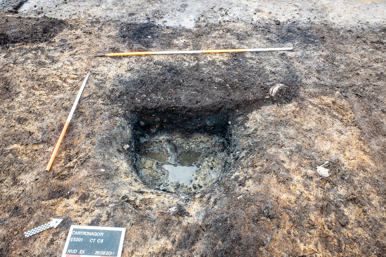
Site type: Burnt spread and trough
Period/Dating: Bronze Age (2200 BC-801 BC)
ITM: E 582916m, N 787703m
Latitude, Longitude (decimal degrees): 53.838535, -8.259567
Cartronagor 6 was excavated in advance of construction of the N5 Ballaghaderreen to Scramoge Road Project in County Roscommon by Archaeological Management Solutions (AMS) for Roscommon County Council (RCC) and Transport Infrastructure Ireland (TII). The site consisted of a burnt spread located in boggy terrain in felled forestry. It was identified during Stage (i)m Test Excavations, carried out by AMS under Ministerial Direction (Direction No. A077, Registration No. E5070; Hardy 2021).
The on-site works of the Stage (iii) Excavation and Post-excavation Assessment Services at Cartronagor 6 were undertaken from 25–28 August 2020. The mitigation strategy of the Stage (iii) services aimed to preserve by record all significant archaeological features and deposits at the site. The archaeological remains consisted of a burnt spread overlying a trough.
The spread consisted of dark charcoal-rich black silty sand and heat-shattered sandstone. The spread measured 10m long, 10m wide and 0.05–0.1m deep. A sample of ash charcoal from the spread returned an Early Bronze Age date of 2201–2028 cal. BC (UBA-47771; 3716±29BP). A flint end scraper (E5201:1) and two sherds and two fragments of a Middle Bronze Age domestic pot (E5201:6–8) were recovered from within the burnt spread.
The trough was located under the north-east sector of the burnt spread; it was sub-oval in plan, 1.5–1.7m long, 1.2m wide, 0.45m deep and contained a single fill of angular heat-shattered red, yellow and grey sandstone, and dark brown, black sandy silt with charcoal staining and flecks. Three flint flakes and a flint blade (E5201:2–5) were recovered from the lower part of the trough.
Charred wood remains from the trough and spread were identified as a mixture of oak and ash.
Reference
Hardy, C. 2021. N5 Ballaghaderreen to Scramoge Road Project Stage (i)a, (i)b, (i)c Test Excavation, Stage (i)m Testing in Felled Forestry and Stage (i)f Townland Boundary Survey. Ministerial Direction No. A077, Registration No. E5070. Unpublished AMS report for TII and RCC.