2020:404 - GARRYNPHORT (1), Roscommon
NMI Burial Excavation Records
County: Roscommon
Site name: GARRYNPHORT (1)
Sites and Monuments Record No.: N/A
Licence number: E005147
Author: Ger Dowling, Archaeological Management Solutions
Author/Organisation Address: Unit 1, Hector Street Mills, Kilrush, Co. Clare
Site type: Burnt spread
Period/Dating: Prehistoric (12700 BC-AD 400)
ITM: E 578747m, N 787379m
Latitude, Longitude (decimal degrees): 53.835470, -8.322885
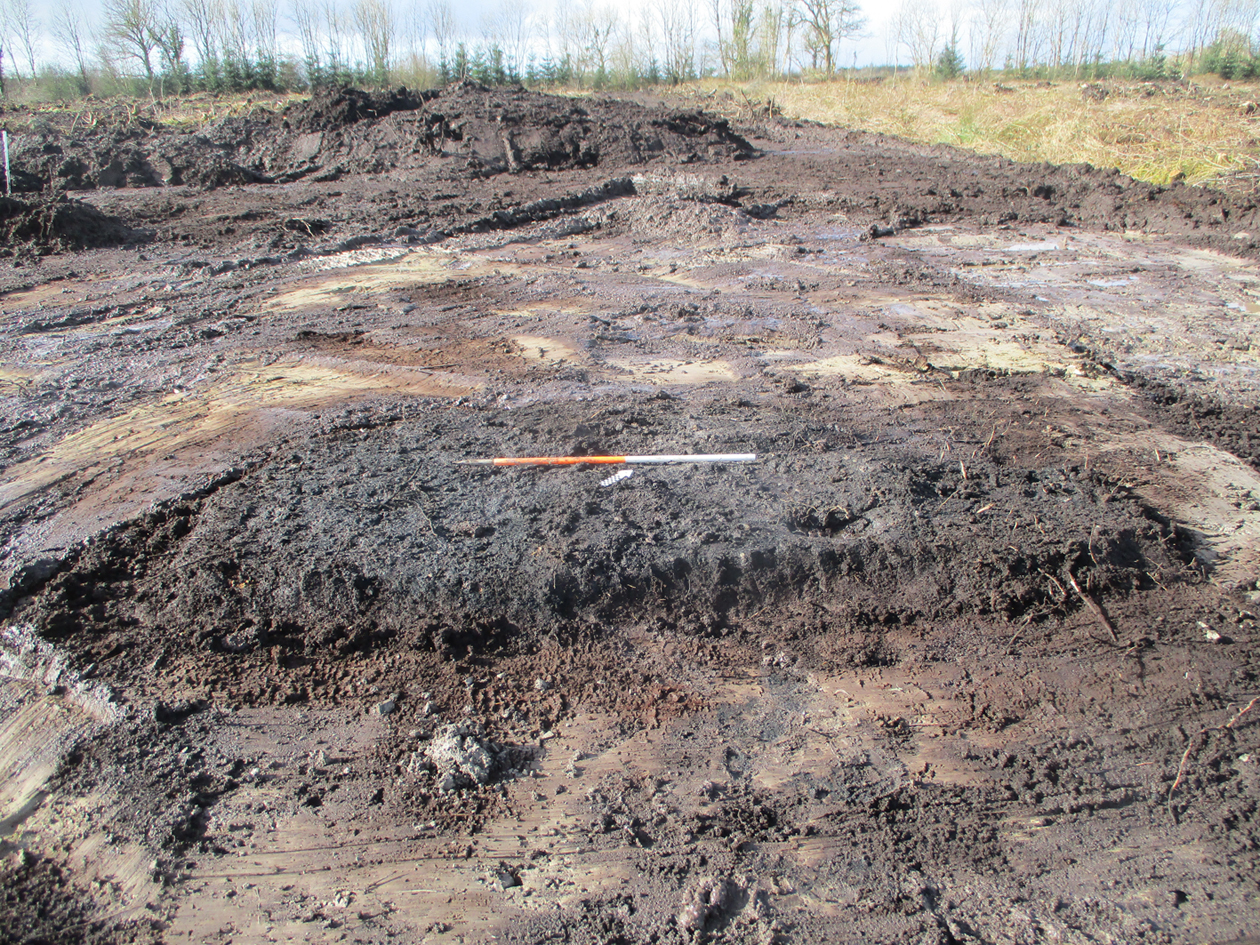
Garrynphort 1 was excavated in advance of construction of the N5 Ballaghaderreen to Scramoge Road Project in County Roscommon by Archaeological Management Solutions (AMS) for Roscommon County Council (RCC) and Transport Infrastructure Ireland (TII). The site consisted of a burnt spread located in boggy terrain in felled forestry. It was identified during Stage (i)m Test Excavations, carried out by AMS under Ministerial Direction (Direction No. A077, Registration No. E5070; Hardy 2021). The on-site works of the Stage (iii) Excavation and Post-excavation Assessment Services at Garrynphort 1 were undertaken on 16 March 2020. The burnt spread consisted of a layer of moderately compacted, charcoal-rich silty clay and frequent heat-shattered stone. It was roughly rectangular in plan and measured 3.44m long (northwest–southeast) by 2.25m wide (northeast–southwest). It was 0.2m in average depth. No artefacts were found during the investigation. Palaeo-environmental analysis of the burnt spread identified charred wood macro-remains as ash, oak, pomaceous fruitwood, hazel and alder. A sample of hazel charcoal was dated to the Early Bronze Age, 2202–2035 cal. BC (UBA-46763, 3730±24BP). The archaeological feature at Garrynphort 1 dates to the Early Bronze Age and relates to prehistoric subsistence and/or other specialised activities.
References
Hardy, C. 2021. N5 Ballaghaderreen to Scramoge Road Project Stage (i)a, (i)b, (i)c Test Excavation, Stage (i)m Testing in Felled Forestry and Stage (i)f Townland Boundary Survey. Ministerial Direction No. A077, Registration No. E5070. Unpublished AMS report for TII and RCC.