2020:625 - BETAGHSTOWN: R150 Bettystown–Laytown Link (750m), Meath
County: Meath
Site name: BETAGHSTOWN: R150 Bettystown–Laytown Link (750m)
Sites and Monuments Record No.: N/A
Licence number: 19E0582
Author: Niall Roycroft
Author/Organisation Address: c/o Meath County Council
Site type: Field system
Period/Dating: Modern (AD 1750-AD 2000)
ITM: E 715576m, N 772895m
Latitude, Longitude (decimal degrees): 53.692963, -6.249973
Archaeological testing took place along the proposed R150 Bettystown-Laytown Link (750m), Co. Meath, on behalf of Meath County Council. The project area is 3.9ha of which 1.72ha is green field. This green field area has been reduced from a previous estimate of 2.3ha by numerous very large field drainage ditches (usually 5m wide) and several areas of soil dumping (including Area 7) and a previous construction compound (Area 5). Present ground level was 7.2m OD at the northern end and 6.5–6.9m OD in the middle and southern ends.
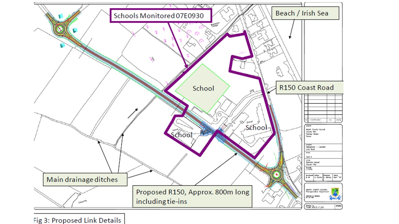
Archaeological testing comprised six areas in the townlands of Betaghstown and Ninch. This phase of testing follows an Archaeological Impact Assessment in July 2014 and archaeological monitoring (licence 07E0930) of a schools’ construction project which included a middle area of the proposed road. Test trenching determined that this whole zone had been subject to regular inundations from the sea (as seen by sea shells) throughout prehistory. Later, the area seems to have been more water meadow, being flooded by standing fresh water at certain times of the year and with excellent grass grazing at others.
Cutting the flood deposit was an irregularly shaped pit filled with fire-cracked stones, blackened soil and some seashell fragments (possibly food waste). Due to the limited extent of the pit, this feature was fully excavated under this Licence. This is probably an opportunistic cooking pit from herders using this area of water meadow for grazing animals. Modern ploughing had removed any contemporary ground surface.
An erased post-medieval field ditch in line with a ditch on the 1837 OS and a series of field drains were also located in Area 6. The area is shown partitioned into fields on the 1837 OS, but it seems likely that the first serious ploughing occurred after the R150 coast road was constructed in the mid-19th century. All the datable topsoil finds were mid- to late 19th and 20th century.
Of the available area of 17,202 sqm (Areas 1–6), the total area trial trenched was 1,685sq m which amounts to 9.8%. The works were subsequently monitored during groundworks for construction.

