2020:513 - CLONBRIN, Ballyroan, Laois
County: Laois
Site name: CLONBRIN, Ballyroan
Sites and Monuments Record No.: N/A
Licence number: 20E0188
Author: Seán Shanahan & Marion Sutton, Shanarc Archaeology Ltd.
Author/Organisation Address: Unit 39a, Hebron Business PArk, Hebron Road, Kilkenny
Site type: Burnt spread
Period/Dating: Prehistoric (12700 BC-AD 400)
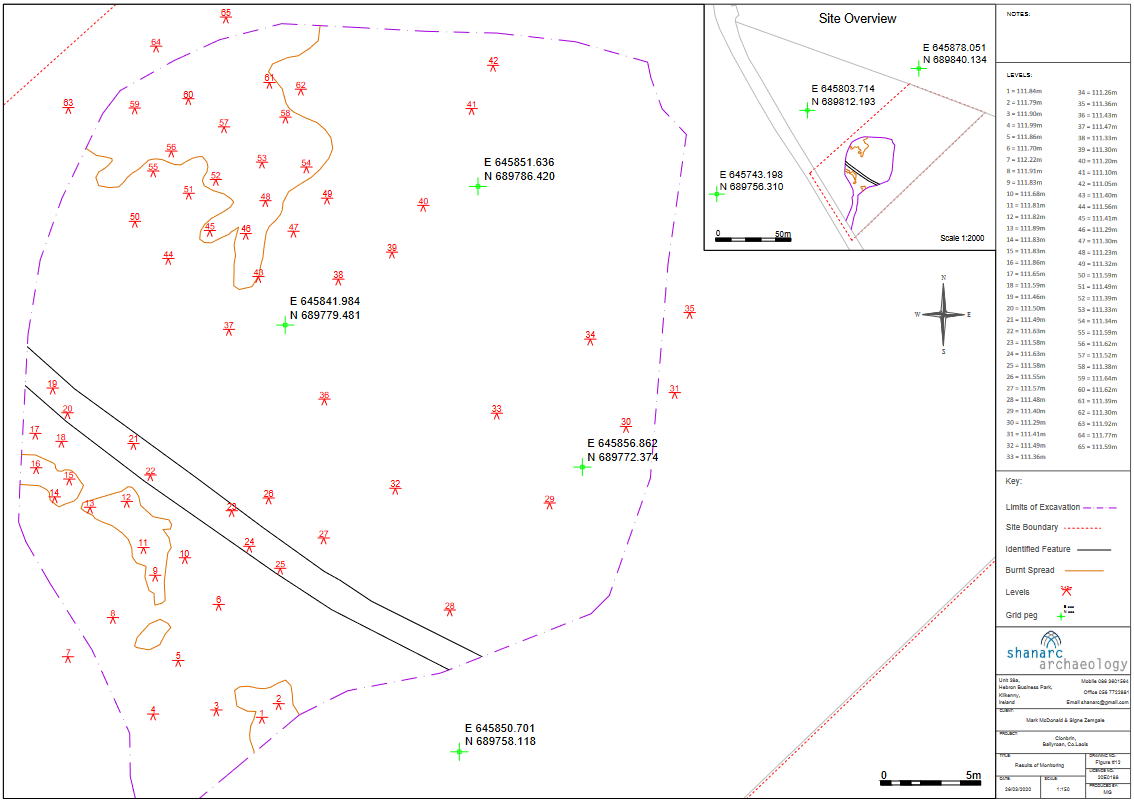
ITM: E 645853m, N 689789m
Latitude, Longitude (decimal degrees): 52.956919, -7.317577
Archaeological monitoring was carried out on 19-20 March 2020 on a greenfield site at Clonbrin, Ballyroan, Co. Laois, relating to the planned construction of a dwelling house and garage (Planning Ref: 18/775).
The development site had a moderate gradient sloping from the north-west towards the south-east and there were marshy areas. The stratigraphy comprised a sod layer and mid-brown silty clay topsoil (0.2-0.4m) that directly overlay a compact, yellow/cream silty clay subsoil. Evidence of modern plough furrows, generally orientated north-east/south-west, was noted cutting into the subsoil layer and the archaeological features.
A large linear cut was also noted in the southern area of the site. This appears to be an old field boundary indicated on the 1st edition OS map but had been removed by the time 2nd edition OS map was surveyed. In addition, a number of deposits/features with charcoal-rich material containing a moderate amount of heat-shattered stone were identified along the south-west boundary of the development footprint. The nature of the burnt spread deposits suggested a possible burnt mound or fulacht fiadh but the deposits were not that expansive and were isolated in small pockets (possibly pit features), the largest measuring 18m north-south by 15m. No finds were found in association with the features.