2020:540 - KILKENNY CITY: Abbey Quarter, Gardens Td, Kilkenny
County: Kilkenny
Site name: KILKENNY CITY: Abbey Quarter, Gardens Td
Sites and Monuments Record No.: KK019-026
Licence number: C000853, E004950
Author: Richard Clutterbuck, Archaeological Management Solutions
Author/Organisation Address: Fahy’s Road, Kilrush, Co. Clare. V15 C780
Site type: Historic town
Period/Dating: Multi-period
ITM: E 650507m, N 656370m
Latitude, Longitude (decimal degrees): 52.656165, -7.253481
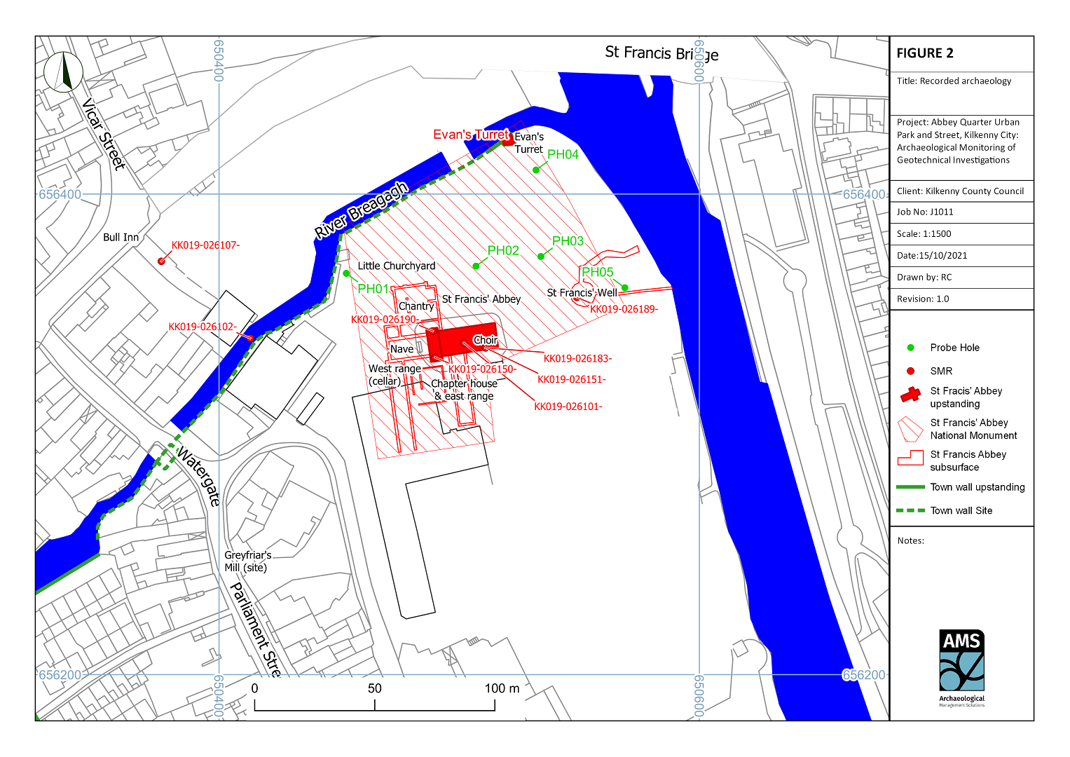
Kilkenny County Council (KCC) is developing the Urban Park and Street as part of the Abbey Quarter Masterplan in Kilkenny City. The development area is located within the Zone of Archaeological Potential for Kilkenny City (RMP KK019-026—-), adjacent to St Francis’ Abbey, which is a Recorded Monument (RMP KK019-026101) and a national monument (Reference No. 72), and the city wall for Kilkenny, also a national monument under the National Policy on Town Defences.
The works area bounds the River Breagagh to the north, the River Nore to the east, St Francis’ Abbey to the south and the Mayfair library development to the west. The area is covered with concrete surfaces and the footprints of demolished brewery buildings associated with the former Diageo/Smithwick’s Brewery. To facilitate the design of the public realm, geotechnical investigations were carried out in the form of five probe holes at various locations. Ministerial Consent was granted to monitor these works (C853/E4950; 23 December 2019).
AMS carried out archaeological monitoring of the geotechnical investigations in January 2020. Five bore or probe holes were made, each 0.2m in diameter. Nothing of archaeological significance was encountered.