2020:110 - KELLYSTOWN, RAVENSDALE AND BOGGANSTOWN, Kildare
County: Kildare
Site name: KELLYSTOWN, RAVENSDALE AND BOGGANSTOWN
Sites and Monuments Record No.: N/A
Licence number: 20E0149
Author: Siobhan Deery, Courtney Deery Heritage Consultancy
Author/Organisation Address: Lynwood House, Ballinteer Road, Dublin 16
Site type: Quarry
Period/Dating: Modern (AD 1750-AD 2000)
ITM: E 698347m, N 738839m
Latitude, Longitude (decimal degrees): 53.390544, -6.521448
Archaeological monitoring of 23 site investigation trial pits was carried out in advance of the construction of a 220kV Substation in Kellystown, Co. Kildare, and associated infrastructure of a 220kV cable route running from the Maynooth/Woodward line in Co. Meath.
No archaeological sites, finds or features were identified within the test pits opened.
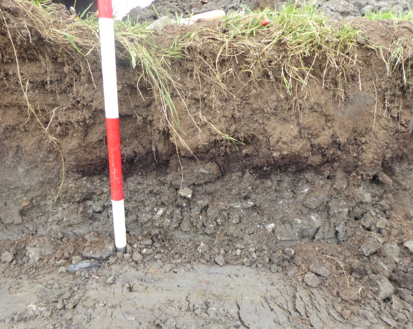
Some features of cultural heritage interest were, however, observed. In the townland of Ravensdale Demesne the presence of 19th–20th-century pottery in the ploughzone of the fields suggests evidence for manuring in the fields within the demesne (it was not seen in Kellystown or Bogganstown). Also in Ravensdale, field drainage was managed by either substantial stone French drains which could be seen in profile in the field ditches (none of these were identified in the test trenches) or Victorian clay tile land drains (egg-shaped in profile) laid on a bed of slate.
Limekilns were a common feature in the Irish rural countryside in the 18th-20th century. The limekiln in Bogganstown shown on the 1836 1st Edition OS map is no longer present but the waste from the process appears to have been spread out into the field and covered with topsoil as indicated in TP3. The limestone was quarried from the immediate area as shown in the OS mapping. Quicklime would have been used on agricultural land to improve the quality of the land by breaking up heavy clay soil, neutralising highly acidic soil or ‘sweetening’ the grass for livestock.
Archaeological monitoring of earth-moving works during construction was recommended.