2020:464 - N86, Dingle to Annascaul/Gortabreoge to Camp Road Improvement Scheme, Kerry
County: Kerry
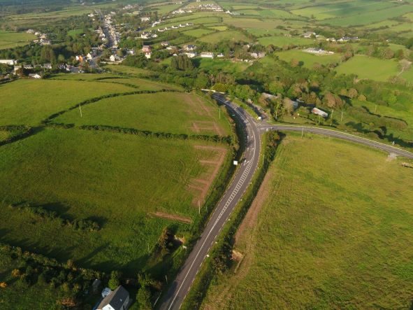
Site name: N86, Dingle to Annascaul/Gortabreoge to Camp Road Improvement Scheme
Sites and Monuments Record No.: KE044-105, KE044-105001
Licence number: E005145
Author: Tony Bartlett, Archaeological Management Solutions Ltd.
Author/Organisation Address: Fahy’s Road, Kilrush, Co. Clare
Site type: Excavation - miscellaneous
Period/Dating: Multi-period
ITM: E 457450m, N 601245m
Latitude, Longitude (decimal degrees): 52.144641, -10.082834
Stage (i) Test Excavations and Stage (i)f Townland Boundary Surveys were carried out on lands acquired for construction of the N86 Ballynasare Lower to Annascaul and Doonore North to Ballygarret Road Improvement Scheme, extending from Ballynasare Lower townland to Mountoven townland, in Co. Kerry. The test excavations were carried out under Ministerial Direction Number A070 and Registration Numbers E005145 (Test Excavations) and R000526 (Metal Detection).
Townland boundary survey:
Six townland boundaries intersect the route of the N86 Road Improvement Scheme. Two of these were subject to a Type A townland boundary survey, while four were subject to a Type B survey which included machine-excavated trenches. No suitable dating material was available from the Type B survey investigations. The streams which marked townland boundaries TD02 and TD03 were also the subject of a Stage (i)d Underwater Survey (Registration Numbers R00529 & S00135).
Standard test excavations:
The total area available for test excavations and monitoring was approximately 21.54 greenfield hectares. The scheme was divided into eight (8) Contract Testing Areas (Area 1–Area 8) and further subdivided by field into 51 areas (Field 1–Field 51) for recording purposes. The total linear metres excavated was 10,118m, representing a 12% sample of the area available for test excavations. During the test trenching, sixteen sites of archaeological potential were found: Baile na Saor Íochtarach 1, Gortacurraun 1, Gortacurraun 2, Gortacurraun 3, Gortacurraun 4, Gortacurraun 5, Farrannacarriga 1, Farrannacarriga 2, Farrannacarriga 3, Farrannacarriga 4, Gurteen North 1, Gurteen North 2, Gurteen North 3, Ballinclare 1, Scrallaghbeg 1 and Gurteen 1. The majority of the sites point to evidence for an archaeological landscape spanning from the Bronze Age and possibly earlier, through to the early medieval period. Post-medieval/modern activity was also identified along the scheme.
Baile na Saor Íochtarach 1 comprised a portion of the bank and ditch of ringfort KE044-105 (ARCH07) that extends beyond the CPO to the north, as well as a series of nine linear field ditches that may represent an early medieval field system associated with the ringfort. Ten pits, two stake-holes and one post-hole were also identified. Gortacurraun 1 consisted of four pits and three stake-holes.
Gortacurraun 2 comprised a series of thirteen linear field ditches that may be indicative of an early medieval field system associated with ringfort KE044-106 (ARCH08) which exists outside the CPO to the north. Eighteen pits, fourteen post-holes, six stake-holes, a hearth and a charcoal-production pit were also revealed, and two possible post-built structures were identified in the layout of post-holes, pits and hearth.
Gortacurraun 3 consisted of three ditches representing a possible early medieval field system, ten pits, two post-holes, two stake-holes, a charcoal spread and a possible cremation pit. Gortacurraun 4 comprised a small burnt spread at the limit of the CPO, four pits, three post-holes and a single stake-hole.
Gortacurraun 5 consisted of nine pits, three post-holes, two charcoal-production pits and a single stake-hole. Farrannacarriga 1 comprised a charcoal-production pit and four pits.
Farrannacarriga 2 consisted of a burnt spread. Farrannacarriga 3 comprised a charcoal-production pit, five pits, two post-holes and a hearth.
Farrannacarriga 4 consisted of a single charcoal-production pit.
Gurteen North 1 comprised a single charcoal-production pit. Gurteen North 2 consisted of three pits, a possible curvilinear ditch and a possible charcoal-production pit. Gurteen North 3 comprised ten pits, a charcoal-production pit, one post-hole, two stake-holes and a possible curvilinear ditch. Three linear ditches were also revealed, representing a possible medieval field system.
Ballinclare 1 consisted of a burnt mound.
Scrallaghbeg 1 comprised two charcoal-production pits. Gurteen 1 consisted of a burnt mound with associated trough.
No objects of archaeological interest were identified during metal detecting, and the only finds were modern (e.g., iron nails, barbed wire and undiagnostic pieces of metal). Artefacts recovered from identified archaeological sites during the testing works included a sherd of medieval pottery, a saddle quern fragment and a piece of possibly worked quartz crystal from Baile na Saor Íochtarach 1, a fragment of a polished stone axehead from Gortacurraun 1, and a flat stone object with aperture from
Gortacurraun 2. But by far the most remarkable artefact recovered was from Gurteen North 3, where a well-preserved Late Bronze Age leaf-shaped sword (Class 4) was discovered. Other finds from testing include two stone grinder-pounders, two clay-pipe bowls and a sherd of post-medieval pottery.
Road construction works will result in the total removal of the sixteen sites. Therefore, the sites as defined by the Stage (i) Test Excavations are recommended for Stage (ii) pre-excavation preparatory work and full excavation and preservation by record as part of the Stage (iii) excavation works.