2020:331 - GORTANAHANEBOY EAST (1), Kerry
County: Kerry
Site name: GORTANAHANEBOY EAST (1)
Sites and Monuments Record No.: N/A
Licence number: 20E0072
Author: Tony Bartlett, Archaeological Management Solutions Ltd.
Author/Organisation Address: Fahy’s Road, Kilrush, Co. Clare
Site type: Burnt mound
Period/Dating: Bronze Age (2200 BC-801 BC)
ITM: E 511886m, N 591732m
Latitude, Longitude (decimal degrees): 52.070515, -9.285279
Stage (iii) Excavation was carried out between 4 and 7 August 2020 at the site of Gortanahaneboy East 1 in advance of construction of the N72 Stagmount Bends Road Improvement Scheme, Co. Kerry. The work was carried out under Licence Numbers 20E0072 (Excavation) and 20R0020 (Metal Detection), on behalf of Kerry County Council. The site was discovered in the east of the scheme during advance Stage (i) Test Excavations undertaken in 2019 by AMS.
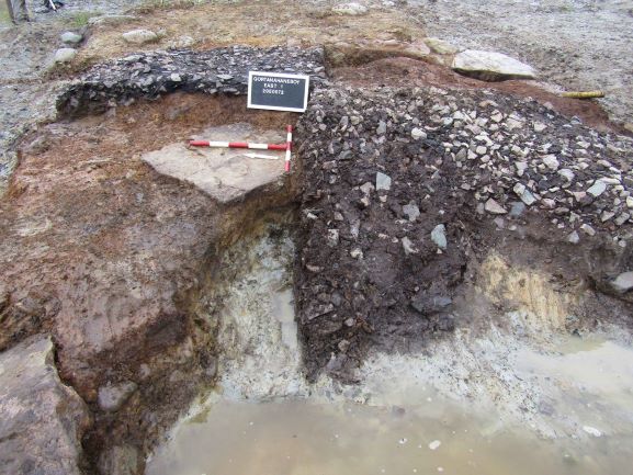
The site consisted of a burnt mound and associated trough, a palaeochannel and a series of modern agricultural field drains. The burnt mound was situated on slightly elevated ground immediately adjacent to the palaeochannel. It consisted of a single deposit of heat-shattered sandstone in a charcoal-enriched dark blackish-brown sandy silt matrix. It was sub-oval in plan, measured 3.65m by 2.7m and had a maximum thickness of 0.24m. The mound appeared to have been disturbed in past agricultural land reclamation processes and was consequently levelled over a small, truncated trough. This trough was sub-rectangular in plan and measured 1.18m by 0.88m by 0.3m in depth and contained a single fill. The palaeochannel measured 25.5m in length within the excavation area, by 5m in width by 0.68m in depth, and contained six fills.
No artefacts were recovered. In the absence of absolute dating, given the nature of the site type, it would not be unreasonable to suggest a possible Bronze Age date for the archaeology at Gortanahaneboy East 1.
Post-excavation analysis is ongoing and it is hoped that specialist reports, including radiocarbon dating and comparative research, will further enhance our understanding of the site.

