2020:330 - BRACKAHARAGH (1), Kerry
County: Kerry
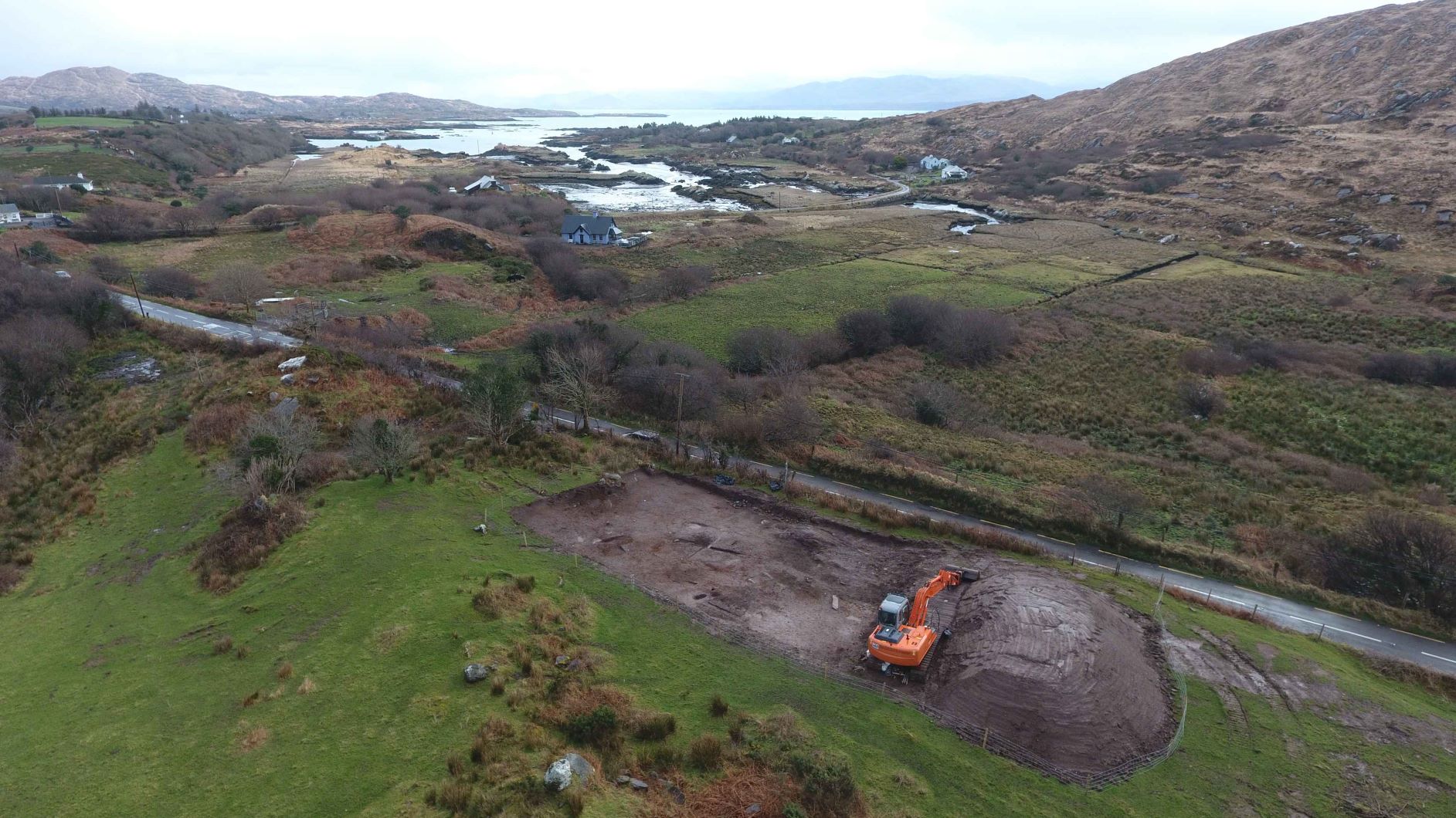
Site name: BRACKAHARAGH (1)
Sites and Monuments Record No.: N/A
Licence number: 20E0074
Author: Tony Bartlett, Archaeological Management Solutions Ltd.
Author/Organisation Address: Fahy’s Road, Kilrush, Co. Clare
Site type: Burnt spread
Period/Dating: Prehistoric (12700 BC-AD 400)
ITM: E 457063m, N 559156m
Latitude, Longitude (decimal degrees): 51.766450, -10.070983
Stage (iii) Excavation was carried out between 11 and 14 February 2020 at the site of Brackaharagh 1 in advance of construction of the N70 Brackaharagh Road Improvement Scheme, Co. Kerry. The work was carried out under Licence Numbers 20E0074 (Excavation) and 20R0021 (Metal Detection), on behalf of Kerry County Council. The site was discovered in the central section of the scheme in the townland of Brackaharagh during advance Stage (i) Test Excavations undertaken in 2019 by AMS.
The site consisted of the remains of three burnt spreads and associated features including three pits, two post-holes, a hearth and five stake-holes. A single modern agricultural field drain was also recorded at the site. Burnt Spread 1 comprised three deposits of heat-shattered stones in charcoal-enriched soil matrices. It was irregular in plan, measured 4.98m by 3.8m and had a maximum thickness of 0.2m. Burnt Spreads 2 and 3 consisted of single deposits similar to that of Burnt Spread 1. Burnt Spread 2 was irregular in plan measured 2.6m by 2.34m and had a maximum thickness of 0.12m. Burnt Spread 3 was irregular in plan, measured 3.79m by 2.53m, had a maximum thickness of 0.1m and was truncated by a modern agricultural field drain.
No other features or deposits were revealed beneath the burnt spreads.
The first of the three pits was irregular in plan, measured 1.4m by 0.42m by 0.1m in depth and contained a single fill. The second pit was oval in plan and measured 0.83m by 0.46m by 0.22m in depth and contained a single fill. The third pit was sub-ovoid in plan and measured 0.7m by 0.55m by 0.14m in depth and contained a single fill. The first of the two post-holes was associated with a hearth. This post-hole was sub-oval in plan, measured 0.27m by 0.18m by 0.2m in depth, contained a single fill and abutted the hearth at its western extent. The hearth was sub-oval in plan, measured 0.66m by 0.59m by 0.03m in depth. The second post-hole was sub-oval in plan, measured 0.25m by 0.21m by 0.22m in depth and contained a single fill.
Five stake-holes were located approximately 1.4m to the south-west of one of the pits and no definitive discernible structural pattern could be established. The cuts of the stake-holes were vertical or almost vertical, tapering onto both pointed and rounded bases and the fills were not uniform.
Three flint flakes and a grinder-pounder fragment were retrieved from the Stage (iii) excavation of Brackaharagh 1, while a flint flake and a possible quartz flake were recovered from the Stage (i) testing at the site (Licence Number 19E0721; Excavations 2019:427). In the absence of absolute dating, given the nature of the site type, it would not be unreasonable to suggest a possible Bronze Age date for the archaeology at Brackaharagh 1.
Post-excavation analysis is ongoing and it is hoped that specialist reports, including radiocarbon dating and comparative research, will further enhance our understanding of the site.