2020:611 - MOORETOWN (Castleknock By.), Dublin
County: Dublin
Site name: MOORETOWN (Castleknock By.)
Sites and Monuments Record No.: N/A
Licence number: 20E0717
Author: Siobhán Deery
Author/Organisation Address: Lynwood House, Ballinteer Road, D16
Site type: No archaeology found
Period/Dating: N/A
ITM: E 709337m, N 742250m
Latitude, Longitude (decimal degrees): 53.419025, -6.355113
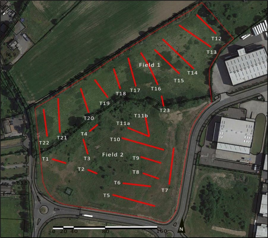
Archaeological testing was carried out in response to a desk study and a further information request from Fingal County Council. A total of 23 test trenches totalling 956 linear metres were excavated across two fields comprising the proposed development area. Field 1, to the north, was relatively undisturbed with just two areas of recent disturbance noted. Field 2 was quite disturbed, with large mounds of topsoil along its northern boundary and in the central area of the field.
Test trench 23 was opened perpendicular to the bank of the Mooretown/Mitchelstown townland boundary where a breach is proposed. It revealed a shallow ditch cut into the natural subsoil filled with loose dark brown humic soil. Nothing to indicate a date of the boundary was identified.
The natural subsoil generally comprised a firm light brown/dark yellow sandy silt with bands of dark grey weathered bedrock which was exposed in places.
No archaeological activity was encountered in any of the test trenches opened within the development area. Some very rare occurrences of 19th/20th-century pottery and a single clay pipe stem were found.