2020:510 - CLONLIFFE WEST: Clonliffe Road, Dublin
County: Dublin
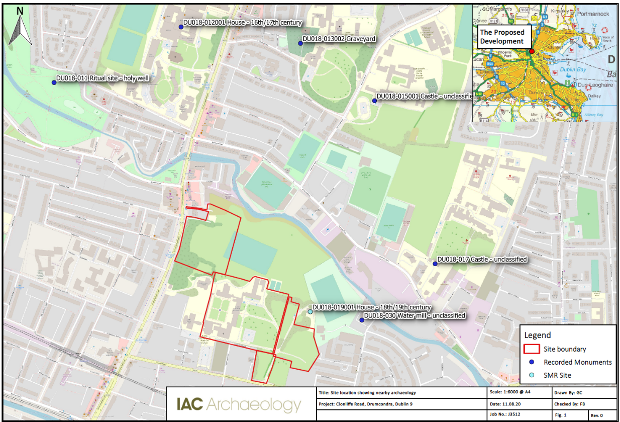
Site name: CLONLIFFE WEST: Clonliffe Road
Sites and Monuments Record No.: N/A
Licence number: 20E0286
Author: Neil O'Flanagan & Grace Corbett, c/o IAC Ltd.
Author/Organisation Address: Unit G1 Network Enterprise Park, Kilcoole, Co. Wicklow
Site type: No archaeology found
Period/Dating: N/A
ITM: E 716277m, N 736343m
Latitude, Longitude (decimal degrees): 53.364481, -6.252933
An archaeological evaluation to establish the presence or absence of archaeological remains and study the impact of proposed development on Clonliffe Rd, Drumcondra, was carried out. This assessment follows a previous geophysical report by JM Surveys (Licence: 20R0046) in March 2020.
A geophysical survey carried out at the site revealed a dataset largely dominated by modern ferrous responses and disturbance from multiple buildings, landscaping, and modern services. Several possible former field divisions were identified, some of which correlate with field boundaries depicted on historic mapping. Faint linear trends are suggestive of former agricultural activity, possibly associated with the extant field boundaries. Archaeological test trenching targeted geophysical anomalies and open green space to assess the archaeological potential of site, and included 24 test trenches.
The trenching did not reveal any features of archaeological potential, but did record a number of isolated drains, field boundaries, and some evidence of furrows within the northern part of the site. Trench 12 included the base of a large structure likely dating from the 19th or 20th century. Much of the land within the site appeared to have been disturbed and reworked for the purposes of laying out a flat lawn and playing fields associated with Holy Cross College. Whilst no sites or areas of archaeological potential were noted during the course of the investigations, it remains possible that small or isolated features of archaeological interest survive beneath the current ground level and outside of the footprint of the excavated test trenches.
The cumulative evidence of the geophysical survey, historical analysis, and the archaeological test trenching suggests that the site was largely devoid of settlement evidence, and was utilised for pasture rather than tillage in the early modern period. Field boundaries can be discerned in the historic maps of the site, and some of them were reflected in the findings of the test excavations. Disturbance, including re-grading the site to lay lawn and playing fields, may have acted to remove potential deposits and features of archaeological nature. The northern trenches demonstrated the shallow accumulation of topsoil, suggesting the lands were probably prone to flooding from the nearby Tolka River.
Previous investigations in area :
Monitoring (Licence Ref: 03E0079)
Testing (Licence Ref: 03E0615)
Geophysical survey (Licence Ref: 09E437)
Archaeological investigation (Licence Ref. 03E1067)
Arch. Investigation (Licence Ref. 06E0729)
Arch. Investigation (Licence Ref. 98E604)