2020:483 - NEWCASTLE: Newcastle South, Dublin
County: Dublin
Site name: NEWCASTLE: Newcastle South
Sites and Monuments Record No.: N/A
Licence number: 20E0024
Author: David Bayley & Fergal Murtagh, c/o IAC Ltd.
Author/Organisation Address: Unit G1 Network Enterprise Park, Kilcoole, Co. Wicklow
Site type: Excavation - miscellaneous
Period/Dating: Medieval (AD 400-AD 1600)
ITM: E 699514m, N 728601m
Latitude, Longitude (decimal degrees): 53.298348, -6.507126
Archaeological excavations were undertaken in advance of a construction compound and haul road and followed on from testing carried out in January 2020 by David Bayley of IAC Archaeology, also under licence 20E0024, and following on from a series of previous investigations including geophysical survey, site testing and desktop study.
The excavation works carried out were centred on two main areas of activity. The first of these was at the location of the proposed compound and car park for the construction works. The features here could be further sub-divided into four clusters, A–D.
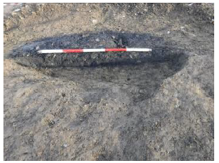
Cluster A was comprised of a curvilinear ditch and the various pits, stake-holes and spreads that were found in association with it. Three features to the south and west of the curvilinear ditch consisted of a pit with basal charcoal layers, a possible trough and a spread of materials from which some lithics were recovered (Plate 1). The remaining features in this cluster were located to the east of the curvilinear ditch and consisted of shallow pits and a stake-hole.
Cluster B was located south of Cluster A. The main features in this group were two kilns. The first kiln was disturbed by modern agricultural activity, including a modern stone drain cutting through the middle of the kiln. There were at least two phases of use of this kiln as a recut was evident immediately to the south of the modern drain. The second kiln was located to the south-east and had a charcoal-rich basal fill. Two stake-holes in close proximity to the north-west of this feature were likely associated with the use of the kiln. The exact date and function of these kilns cannot be determined at this time and post-excavation analysis is ongoing.
Cluster C consisted of a charcoal-production clamp and spread of material that were located at the eastern end of the site. Pit C34 has been interpreted as a charcoal-production clamp. These were a common feature throughout much of history and prehistory. The charcoal produced from these clamps could have had several uses but was most likely associated with metalworking activities. The spread of material comprised of fire-reddened clay. It was quite shallow and may represent the remains of a hearth that has been disturbed by modern agricultural activity such as ploughing. An east-west oriented linear ditch was also excavated in this area. Nothing to indicate a date was recovered from this ditch, but it has been interpreted as a land drainage feature.
The fourth group of features, Cluster D, were located in the western part of the compound/car park area and comprised three pits. The charcoal-rich nature of the fills of two of these features means they have been interpreted as being charcoal clamps, while the similarity of the fill of the third pit to material found in burnt mounds has led to it being interpreted as a small trough or ‘’pot boiler’’-type feature where small amounts of water could be heated quickly.
The second area of archaeological features was located in the north-west of the site area, where the proposed haul road will exit the site. This area was in close proximity to tower-house DU020-003007. The features excavated in this area could be divided into two categories (medieval and post-medieval). The medieval features comprised a deep, circular pit that contained numerous sherds of medieval pottery in its fills, and the remains of two structures. One structure was sub-rectangular in plan with a cobbled surface on the interior that was sealed by an organic deposit. The second structure comprised the remains of a wall. It was not possible to determine if this wall had been part of a larger structure.
The post-medieval features in this area appear to have functioned as land drains with one probable former field boundary. These features all produced post-medieval pottery or red brick.