2020:475 - Leixlip Transfer Pipeline, Dublin
County: Dublin
Site name: Leixlip Transfer Pipeline
Sites and Monuments Record No.: N/A
Licence number: 20E0227
Author: Tim Coughlan
Author/Organisation Address: c/o IAC Ltd, Unit G1 Network Enterprise Park, Kilcoole, Co. Wicklow
Site type: Pits associated with burnt mound activity
Period/Dating: —
ITM: E 701737m, N 737324m
Latitude, Longitude (decimal degrees): 53.376292, -6.470990
Excavations were carried out across three areas in Allenstown (1 and 2) and Hiltown (1) Co. Dublin as part of a proposed pipeline development. The excavations were carried out in response to conditions attached to the proposed pipeline development.
The majority of features recorded contained fills with inclusions of burnt/shattered stones with charcoal and are characteristic of burnt mound related activity. They were situated in 3 separate areas, along a length of wayleave measuring roughly 2.5km, located between the north of the Royal Canal and south of the Dublin Docklands – M3 Parkway railway line.
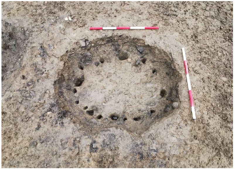
Allenstown 1 consisted of three pits (C11, C7 & C3) positioned close together in a line north-west to south-east. No structures were recorded during the excavation but the presence of multiple stake-holes within one of the pits (C3) in Allenstown 1 indicates it may have had an internal lining possibly constructed of wattle. An adjacent pit (C7) had a possible ledge or step cut into its northern side, perhaps to allow for ease of access for cleaning, removal of waste material or storage.
Allenstown 2 consisted of a cluster of six pits (C52, C50, C54, C58, C60 & C65)) and a single trough (C48) containing fills with burnt mount activity. Evidence of multi-phased activity was seen at Allenstown 2 where a large pit had been dug through a rectangular trough, which had an established stratigraphic relationship to an earlier adjacent pit (C50).
Hiltown 1 consisted of two large pits (C72 & C75) containing burnt mound material and a small spread of the same. The remains of a paleochannel (C67) traversed the site from south-east to north-west and two small burnt mounds overlay this. A modern field drain ran from north to south on the eastern side of the site.
Burnt mound activity is generally located near to a water source i.e., a river, well or in marginal land. No obvious water source was evident near to any of the sites excavated, with the exception of Hilltown 1, where the remains of a paleochannel was recorded. However, deep drains were frequent in the surrounding landscape, whose topography is generally flat. In addition to this a field drain recorded in ‘Hilltown 1’ indicates previous land management and suggests the land is prone to flooding or waterlogging.
No other prehistoric archaeological features, or indeed later, are recorded in the immediate area but additional features are likely to exist outside of the pipe’s wayleave. No finds were identified during the excavations of the three areas.
Post-excavation processing and subsequent further analysis are proposed for these archaeological features, artefacts and eco-factual samples. A programme of specialist analysis, including radiocarbon dating, is also envisaged. Samples will be analysed for environmental and economic or ritual indications.