2020:440 - CASTLEBAGGOT SUB-STATION, Dublin
County: Dublin
Site name: CASTLEBAGGOT SUB-STATION
Sites and Monuments Record No.: N/A
Licence number: 17E0394
Author: Neil O'Flanagan & Chiara Mazzanti, Reliqua
Author/Organisation Address: Dublin Business Centre, 33 Slaney Road, Glasnevin, Dublin 11
Site type: Habitation site
Period/Dating: Prehistoric (12700 BC-AD 400)
ITM: E 703309m, N 730725m
Latitude, Longitude (decimal degrees): 53.316704, -6.449526
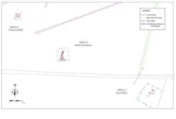
Excavations were carried out in November – December 2017 in advance of Castlebaggot 220/110 kV sub-station. Three sites were identified during monitoring of topsoil stripping in September–October 2017.
Site 1 consisted of a series of pits, post- and stake-holes in a 9 m x 7 m area. No convincing evidence for a structure was revealed or any in situ artefacts.
Site 2 consisted of a slightly curvilinear ditch running north/south and a smaller ditch just beside it, running north-west/south-east. The larger measured 9.1 m in length and the width varied from 1 m to 1,8 m, while the depth at the base varied from a minimum of 0,15 m to a maximum of 0,74 m. The smaller ditch had a total length of 5.8 m, its depth varied from 0.10 m to 0.26 m, and had a maximum width of 1.40 m. Some animal bone, and two pieces of worked flint, one possible a scraper, were recovered.
Area 3 consisted of the remains of a heavily disturbed spread of burnt stone and clay. The material was situated in a very slight hollow and the materials seems to reflect a dry cooking oven.
The archaeological material in the Castlebaggot site reflects the continued settlement of the Ballybane area, from at least the Bronze Age, and possibly earlier in the case of the ditch remains in Area 2.