2020:144 - RYLANE: Rylane Community Park, Cork
County: Cork
Site name: RYLANE: Rylane Community Park
Sites and Monuments Record No.: CO060-057
Licence number: 20E0288
Author: David Murphy, John Cronin & Associates
Author/Organisation Address: 3a Westpoint Trade Centre, Link Road, Ballincollig, Cork
Site type: Excavation - miscellaneous
Period/Dating: Modern (AD 1750-AD 2000)
ITM: E 542495m, N 581465m
Latitude, Longitude (decimal degrees): 51.982258, -8.837140
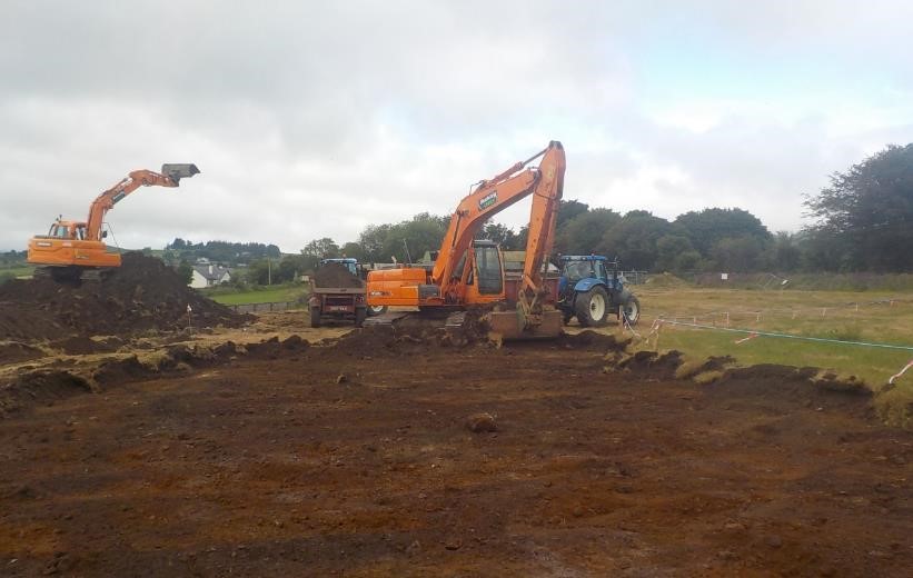
In order to comply with Condition 4 of the Cork County Council grant of planning permission (20/4172), topsoil stripping of the area which extends 10m beyond the outer perimeter of the fenced protective buffer zone which was established around ringfort CO060-057—- at the Rylane Community Park site was undertaken on 16 June 2020. The topsoil strip was undertaken by a 22-tonne 360° mechanical excavator, fitted with a toothless grading bucket, which operated under constant archaeological supervision. Stripping commenced to the north-east of the fenced protective buffer zone and immediately south of the boundary bank which separates the site from the public road to the north. Works progressed around the perimeter of the buffer zone, initially heading southwards, then westwards, before turning to the north and north-east and ceasing at the northern boundary bank on the opposing (north-west) side of the buffer zone.
The stratigraphy revealed during topsoil stripping consisted of 0.25m to 0.45m of a dark greyish brown sandy, silt topsoil which overlay a varied subsoil composed of a mix of orangish brown, purplish grey and light yellowish brown stony, clayey silt. The subsoil contained frequent inclusions of natural fragmented stone, as well as occasional natural gravel concentrations. Modern disturbance was evident within both the topsoil and upper subsoil with frequent inclusions of modern detritus such as black plastic, modern metal nails, modern ceramics etc. noted. Local information reveals that this site was subject to heavy ploughing on an annual basis for a prolonged period of time. The mixed nature of the subsoil revealed during monitoring suggests that this ploughing activity impacted significantly on the upper subsoil levels across the site and, as such, this activity likely heavily disturbed any archaeological remains which may have potentially existed within the area.
Occasional north-east to south-west aligned shallow linear features, likely associated with drainage and/or cultivation, were evident truncating the upper subsoil levels, as was evidence of field clearance in the form of burnt root channels. None of this activity was deemed to be of archaeological significance and modern cultural intrusions were retrieved from some of these features indicating that they were of recent origin. A representative amount of the upcast spoil which was removed from the area was scanned by a metal detector (Detection Device Licence No. 20R0107) and a representative amount was sieved, however, only modern items were retrieved as a result.
In summation, no artefacts, features or deposits of archaeological significance were revealed during archaeological monitoring of topsoil stripping of the area within 10m of the outer perimeter of the fenced protective buffer zone surrounding ‘Lisheenarylane’ ringfort (CO060-057—-) within the site of the Rylane Community Park, Rylane, Co. Cork.

