2019:319 - BALLYCARRIGEEN LOWER (AA1, 4), Wexford
County: Wexford
Site name: BALLYCARRIGEEN LOWER (AA1, 4)
Sites and Monuments Record No.: N/A
Licence number: E005033
Author: Liza Kavanagh, IAC Ltd
Author/Organisation Address: Unit G1 Network Enterprise Park, Kilcoole, Co. Wicklow
Site type: Burnt mound
Period/Dating: Prehistoric (12700 BC-AD 400)
ITM: E 705230m, N 647490m
Latitude, Longitude (decimal degrees): 52.568527, -6.447711
Excavation took place at Ballycarrigeen Lower 11 Areas 1 and 4, Co. Wexford. Area 1 was identified as a result of archaeological testing of Permanent Fill Area 2 in 2016 by Yvonne Whitty (Reg. No. E004781, Whitty and Coughlan 2017) during the construction phase of the M11 Gorey to Enniscorthy Scheme. Area 4 was a buffer zone established immediately west of a previously recorded burnt mound at Ballycarrigeen Lower 2 (Reg. No. E004232). The archaeology exposed and excavated within the confines of Area 4 was uncovered during the current phase of works, as part of the resolution of Area 1. The excavations were undertaken on behalf of BAM Civil Ltd-Dragados JV/PPP Co. who were awarded the contract to construct and operate the road by Transport Infrastructure Ireland (TII). Archaeological Areas 2 and 3 were excavated in April 2017 under licence E004856.
Archaeological Area 1 (ITM 705230, 647490) was noted as a horseshoe-shaped burnt mound spread (7m x 5.1m x 0.2m) with an associated sub-circular trough to the south-west. An area of in-situ burning and a shallow pit were sealed beneath the burnt mound spread. An area of root activity was sealed beneath this deposit. Two shallow burnt mound deposits were excavated to the south-west of the spread and are likely closely related to it. The burnt mound spread was cut by a modern drain and a possible agricultural furrow.
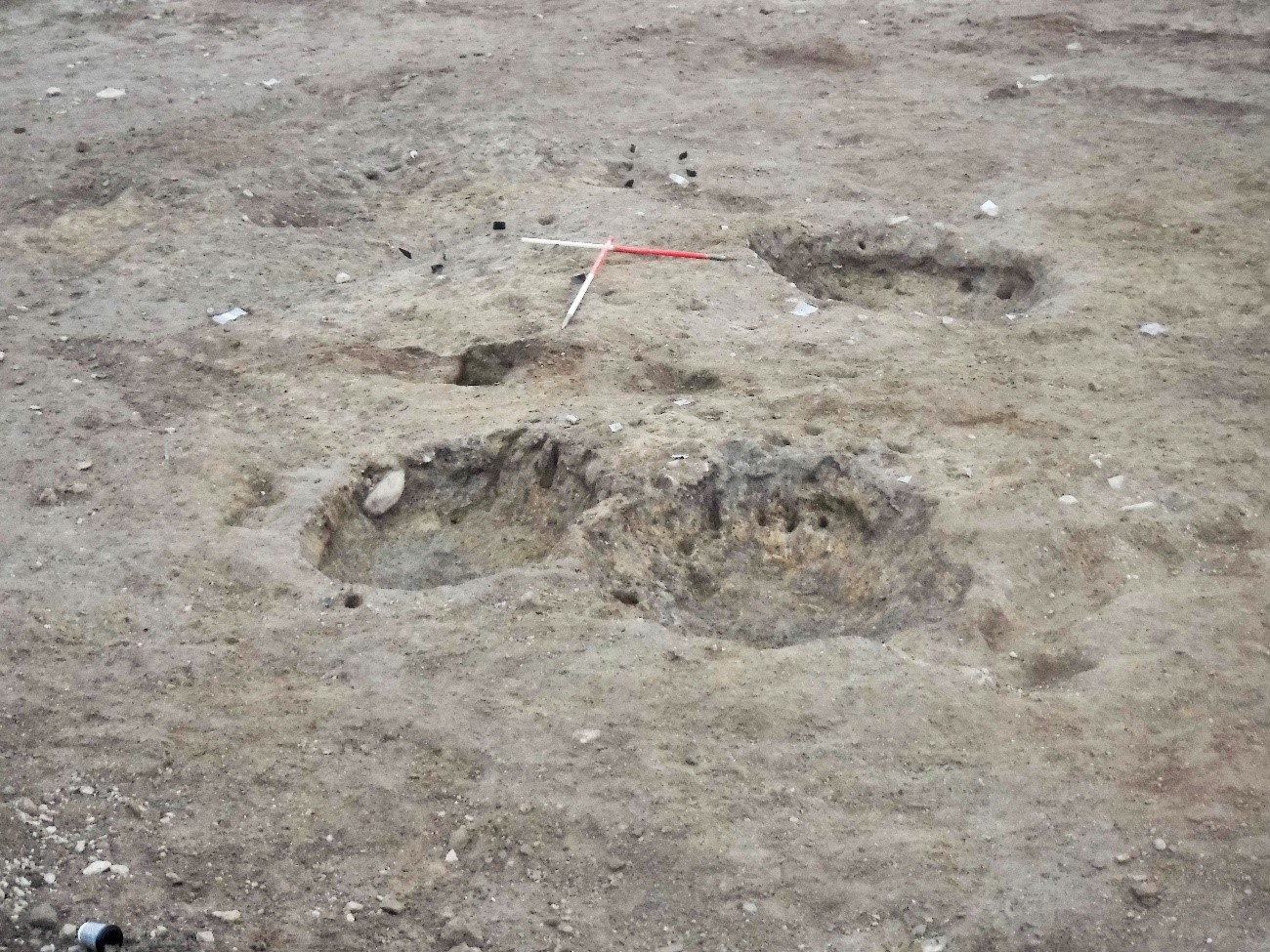
AA4 (ITM 705202, 647450) comprised an area of burnt mound activity. In addition to a burnt mound spread, a total of three troughs and 63 stake-holes were recorded on the site. A watercourse flows south-west/north-east, east of AA4, before being directed north–south along the north-east edge of AA1. This stream is evidenced on the Second Edition Ordnance Survey maps, but not the First Edition maps where the area was indicated as boggy terrain. It is likely that the area was prone to flooding events throughout history and prehistory as suggested by the layers of alluvial deposits, recorded beneath the burnt mound spread C17. Trough C19 was located centrally and to the south of the site with the main spread of burnt mound material, C17, surrounding it to the north-west, north and east. Troughs C29 and C30 were recorded adjacent to each other on the west side of AA4, 1.9m away from Trough C19. The burnt mound spread was very thin in the vicinity of these troughs partly due to disturbance by a modern drain C127, but also as they were peripheral to the central area. The stake-holes excavated in this area were cut through the base of the all three troughs and scattered beneath the burnt mound spread. Many of the stake-holes appeared as voids cut through the natural subsoil, with many showing no evidence of any fill or deposit within them.