2019:507 - INTERTIDAL FORESHORE, Tournore and Duckspool Tds., Dungarvan, Waterford
County: Waterford
Site name: INTERTIDAL FORESHORE, Tournore and Duckspool Tds., Dungarvan
Sites and Monuments Record No.: N/A
Licence number: 19E0552, 19R0193
Author: Rex Bangerter, ADCO
Author/Organisation Address: No. 2, Main Street, Bennettsbridge, Co. Kilkenny
Site type: Excavation - miscellaneous
Period/Dating: Modern (AD 1750-AD 2000)
ITM: E 627778m, N 594195m
Latitude, Longitude (decimal degrees): 52.098965, -7.594565
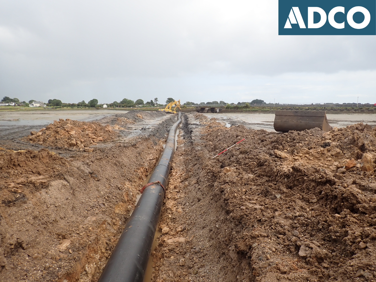
Archaeological monitoring of the installation works associated with a new stormwater outfall pipe that crosses the intertidal foreshore at Tournore/Duckspool Tds., Dungarvan, Co. Waterford was undertaken, a planned upgrade to the existing stormwater facilities that forms an integral part of the wider Dungarvan Stormwater Relief Scheme. ADCO previously carried out an intertidal inspection of the outfall location as part of the pre-planning phase of the development. This work was undertaken in January 2015; DCHG licence numbers 15D0003, 15R0002. Monitoring of the construction phase excavation works was carried out on 19 September 2019, DCHG license numbers 19E0552, 19R0193.
A c. 200m-long pipe trench was excavated to accommodate a 900mmØ HDPE outfall pipe, extending from the upper foreshore at ITM 628060E, 594195N to the subtidal zone at ITM 628232E, 594114N. The intertidal outfall will connect to the terrestrial pipework, above the foreshore, on the south side of the adjacent R675 roadway. The trench was excavated to a maximum depth of -1.6m CD. The pipe terminus is located where the intertidal foreshore meets the active channel of the Glendine River, a short distance upstream of a nearby railway bridge. Two tracked-machine excavators were employed, working in tandem, to complete the excavation work within the tidal window present, the work being undertaken on a low water spring tide cycle to maximize foreshore coverage. The completed trench was deepest on the upper foreshore, where it interfaces with the terrestrial pipework, at a depth of c. 2.5m. As the excavation progressed across the foreshore (east-south-east direction) the pipe-trench became progressively more shallow, with a depth of c. 0.5m located towards the pipe terminus. Aside from the topmost layer (c. 0.2m), where some modern debris was present, the underlying foreshore deposits were observed to be sterile in nature. The stratigraphy of the upper foreshore differed to that observed for the intertidal area; the upper foreshore included backfill material from the construction of the adjacent roadway, while much of the intertidal area comprised natural deposition, typically composed of a silty-sand with frequent rounded pebble/cobble inclusions. No archaeological significant material, deposits, or structures were encountered as part of the monitoring work.